Cycling across the Brecon Beacons National Park
Mid April promised soaring temperatures, so we're cycling across the Brecon Beacons National Park. Starting from Llandeilo in mid Wales, our route follows an old Roman Road with panoramic views of the Central Beacons to Sennybridge where we stay for the first night. The next day we head for the garrison town of Brecon, and join the pretty tow path alongside the Brecknock & Abergavenny Canal to trek to Talybont-on-Usk, then back onto lovely winding country lanes and onto the the path of the old ‘Brecon & Merythr railway’ past three massive reservoirs to Pontsticill village. The next day we ride to Rhymney, down the Rhymney valley to Hengoed, then descend the Sirhowy valley to meet up with the Crumlin arm of the Monmouth & Brecon canal back to Newport. This promises to be a very challenging route, it predominantly ascends until the end of the second day, but the views are exceptional. You will notice the mileage is down from some rides, but there’s a lot to see off the bike.
Day 1- Llandeilo to Sennybridge (26miles)
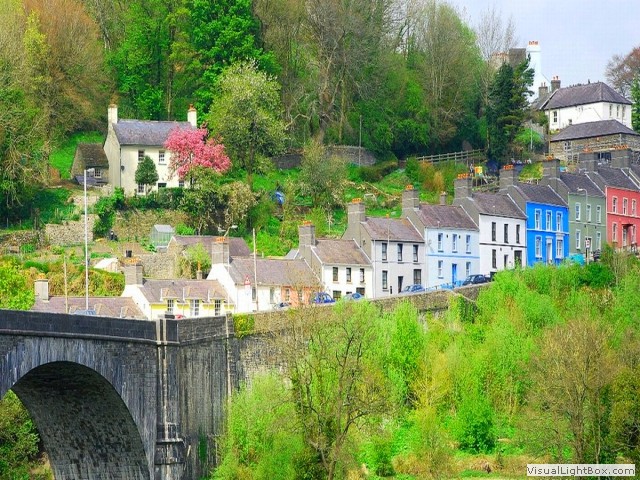 The train from Newport to Llandeilo takes two and a half hours on the 'Heart of Wales line', so
it’s an early start. The ‘Heart of Wales line’ is mostly a singular track, rural line, and it
still has the relaxing ‘clickety clack track’ sound. There can’t be many more towns in
Carmarthenshire as attractive than Llandeilo, but its double edge sword is; it’s ultra quiet.
Before leaving Llandeilo, I have a small mission which will
take about an hour, so straight from the train I headed for the National Trust-
Dinefwr, which has an 18th-century landscape with parkland walks enclosing a medieval
deer park, the historic Newton house with tea rooms and a courtyard shopping area, and not
forgeting the castle. Though the house was
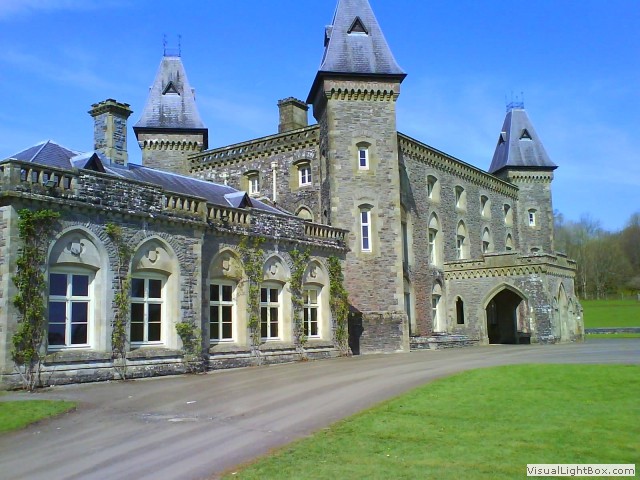
built in 1660, most of what we see of the grand building today dates back to the 1850s, when
it was given a fashionable Gothic facelift, with stone cladding and four impressive turrets. It’s
£7.60 to enter house and castle, given more time it would be a cinch to have a roam around
inside the house, but it’s on to Dinefwr Castle.
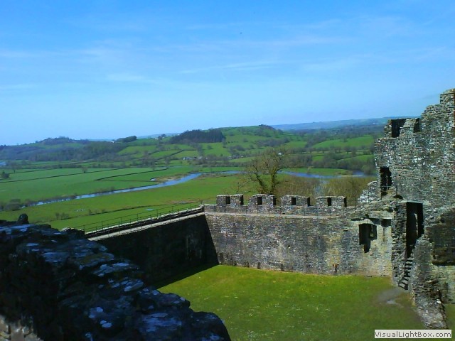 It’s not possible to cycle all the way up to the castle as the last 500 yards are up a
steep footpath, so I locked the bike up against a fence and walked up, but it’s worth
the hike. Situated in majestic hilltop location above the Tywi Valley is Dinefwr
Castle. The site is associated with the Prince of Deheubarth, in the Kingdom
of South-West Wales. Entering the castle is a must to see the wonderful panoramic views
of the Towyi river from the castle parapets. One can see why Royalty would want to build
here, the views are simply spectacular.
 Retracing my route back Llandeilo I wanted to see Llandyfeisant Church, but blink and
you’d miss the concealed little lane leading down to it. Through a four bar gate, and down
a slippery, mud speckled lane is the slightly spooky, grave-strewn church. The church looks
abandoned, but it has new graves, and I wonder how do they get the funeral procession down
the trail? Now we pass under the 'Heart of Wales' railway line at Ffairfach and climb in a southerly
direction ascending towards 'Trapp', our route turns north east. One mile from Trapp, we cycle
south on another detour to see the magnificent Carreg Cennen Castle, this iconic fortress
is glued to sheer cliff-faces on all sides. Back on the main road and climbing steadily at
first, we reach higher ground offering great views of the Cefn y Cylchau, and Garreg Lwyd
mountains, this was the hilliest section of the route, undulating all the way to Llangadog. We
descend past Gwynfe, then back up to Twynllanan, from here it's a steady climb until we reach
todays peak near 'Llanddeusant Red Kite feeding centre' where we were hoping for a coffee,
but we were two hours too early for opening times. We cross over a cattle grid and onto moorland,
over one thousand feet above sea level, on the right was a Roman camp. The monument
comprises of remains of a Roman marching camp, dating from the first century AD, but there's not
much to see unless you know what you’re looking for (and I don't). You could turn left and cycle around Usk reservoir
on good forest tracks, but we continued downhill all the way to Trecastle, onto the A40 and
again downhill to Sennybridge to the 'Usk & Railway Inn', our stop for tonight. After food, I went
for a small walk and came across twenty to thirty yellow-billed kites, gliding then diving.
Occasionally a pair would interlock talons in mid-air, during their aerial courtship
displays, it was an incredible sight.
Today wasn’t an easy ride, the predicted heat came, and wow; it was bloody hot! It took six hours to ride from Llandeilo to Sennybridge (including trips to the castles) at an average speed of 5mph. True, you don’t get the views without climbing, but I don’t climb very well (and I never did), so for me, today was hard work using over 3000kcal. I really did suffer on this one.
Day 2- Sennybridge to Pontsticill (28.5 miles)
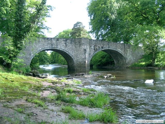 Sennybridge is a small town situated on the banks of the River Usk, it did have a small
station fed from the Neath & Brecon railway, but today, it’s most fascinating feature
is the military training camp (SENTA) which is the third largest in the UK. It's still sunny when we leave
Sennybridge and cross over the River Usk on the 18th century Llwyn-Cyntefin bridge and skirt the
‘SENTA‘ camp, then loosely follow the River Usk through Trallong to Aberbran. In Aberbran
Caravan & Motorhome Site there is a tribute to Aberbran station, but nothing remains of
the original structure. We go through Aberyscir to Cradoc which lies two miles northwest
of Brecon. You could spend the whole day sightseeing at Brecon, however, I’m going to
have a swift coffee in the ‘Castle Hotel’, then move on.
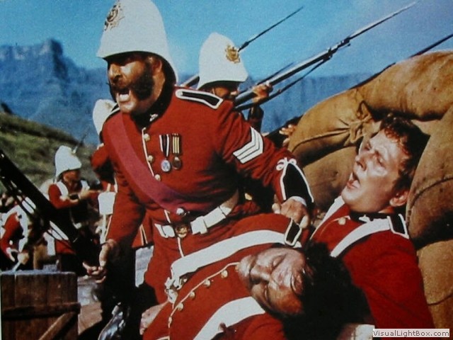 Brecon has long since been a garrison
town and still has many connections to the military, and for me, it’s worth a visit to the
Regimental Museum of the Royal Welsh (£5 entry). The exploits of the 24th Regiment during the
1879 Anglo-Zulu War are legendary, and developed worldwide interest with the 1964
movie ‘Zulu’. After a fleeting visit to the Regimental Museum, we leave the town of Brecon
and follow the traffic free towpath alongside the Brecknock & Abergavenny
canal. This section is also shared with the Taff Trail and the NCR8.
We cross the Brynich aqueduct and head towards Pencelli on a flat, but a bumpy
towpath to Talybont-on-Usk where we leave the canal. It’s a gradual climb now up
through Aberclydach village to ‘Talybont reservoir’ where we cross the grass covered
dam, on the other side we climb again on the old Brecon & Merthyr Railway path
through densely populated coniferous fir trees losing sight of the lake until
about mid-way. It can’t be any easier cycling uphill than on an old railway line
path, but it’s still uphill and after a while the gradient bites your legs. Virtually,
near the top of the route, the path rises sharply, which exposes the need for a tunnel,
and there it was just down to the left with a stream running out of it. Now, it’s a short
steep ascent back on the main road to get to the top, and then finally downhill. I picked up so much speed, my brake
pads began to smell trying to stop to see the ‘Brecon mountain railway’ terminus at
Torpantau, the heritage narrow gauge railway continues from here to its base in
Pant. Now, I have to make a decision; continue progress
alongside the next two reservoirs on the road or take a ride on the Brecon
 mountain railway to Pant. It’s such a rare (in the sense- we don’t seem to
have many anymore) beautiful day, I decided to continue on the cycle route,
but first it’s tea at the ‘Old Barn Tea Room’. I know I’m near the northern
edge of the Pentwyn reservoir, but I can’t see it through the trees,
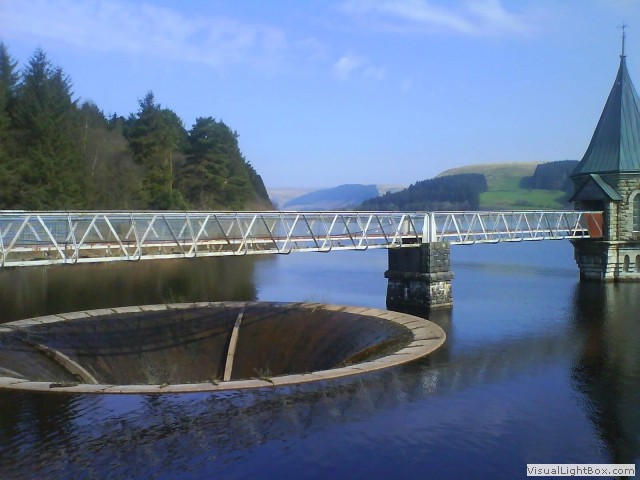
seconds later it appears to my left. Now, we sail along a flat road next to
Pontsticill Reservoir until we reach Penrhadw Farm, our stop for the second night. Penrhadw
Farm is exactly what it says, but has excellent accommodation, with the ‘Butchers
Arms’ nearby for food.
Day 3- Pontsticill to Newport- via Ryhmney (30 miles)
 The sun was shining for the third day running when I set off from Pontsticill village
and at first it’s downhill over the Pontsticill dam, then back up on a steady climb past the Brecon Mountain Railway
at Pant. We turn left onto an unbelievably steep cycle path which flattens out past a small
lake near Dowlais Top, and then parallel the heads of the valleys road to finaly cross over
it to enter the Rhymney Valley. Several ironworks sprang up here in the early 19th century, the first
was ‘Upper Furnace’ built on the east site of the River Rhymney in 1801 (soon after called the ‘Union
Ironworks’). Later the ‘Bute Ironworks Company’ was established on the western side of the
River. In the 1830’s, all the ironworks were amalgamated into ‘The Rhymney Iron Company’.
In 2010 a sculpture was unveiled shaped like a ‘twisted chimney’ to commemorate all of the iron
industries based here. In the 1830's and not far from the sculpture, the model village of 'Bute Town'
was created to house the workers. To keep the men watered, the 'Rhymney Brewery' began operating in
1839 and expanded to become the largest brewery in the Wales, it was taken over by Whitbread &
Co Ltd in 1960, the Rhymney site was finally closed in 1978. We tried to find the
old brewery clock so synonymous with the town, and from research I knew it was
re-located to the rear of the 'Whitebread' building just two hundred yards away, such
a dishonour for what was an apogee of the Rhymney Brewery.
 It’s down the B4257 (Wellington way) to Pontlottyn viaduct where we join the Brecon
& Merthyr Railway path (only for a short distance), through Abertysswg to circumnavigate
'New Tredegar' and past some ugly quarry fines and tailings, which came from the White Rose
Colliery quarry. It’s impossible to erase the scars left behind from the blasting of rock, but
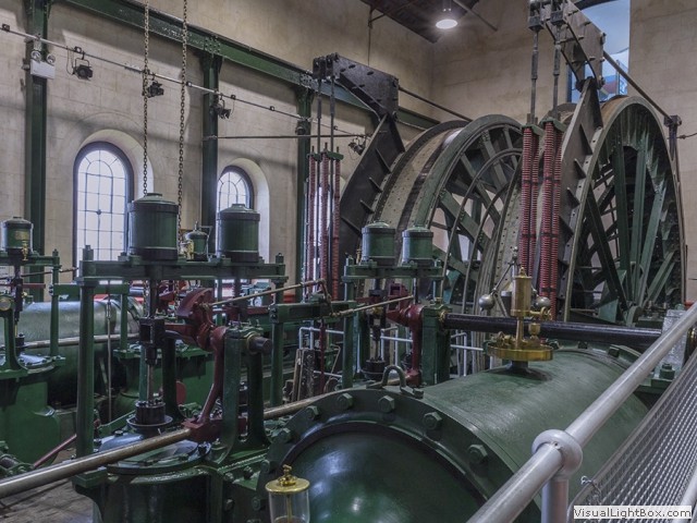
on a positive note; the cliff face almost looks natural. At Elliots Town there was a museum
encompassing a working Victorian winding engine; ‘the winding house’, from the original site
of the Elliot Town colliery . The museum was open so it would’ve been rude not visit it.
Now, the route follows the Rhymney River and is surrounded by trees on both sides through Cwmsyfiog
to Aberbargoed. On the other side of the river was the Rhymney railway (now part of the current
mainline), this railway continues north up the Darren valley which supposedly has a nice cycle
path too. Our cycle route now hugs the east side of the river, finishing at Pengam. From
here we join the road through Fleur-De-Lis on the B4252 to the Hengoed viaduct. Our course
now repeats a previous ride through the Sirhowy valley, click
here to
continue reading where the route goes.
Who would’ve thought we’d have three days of sunny weather? There were three castles, stupendous views across the Brecon Beacons, and I wanted to re-ride the Monmouthshire & Brecon canal in good weather, so now that’s achieved too, but the highlight of the last leg had to be the ‘Winding house’ museum at Elliots Town, I never even knew was there. The sacrifice for these visual pleasures was enduring the torture of climbing up and down 1600 feet for two days and of course; sunburn. Though, it couldn’t be that bad as I want to do it again, but on an electric bike this time.
-
Gallery
 Why not have a look at the gallery relating to this ride. Click the image or the title.
 -
Newton house at Dinefwr Llandeilo
 "If you take a handful of the soil of Dinefwr and squeeze it in your hand, the juice that will flow
from your hands is the essence of Wales." -Wynford Vaughan Thomas.
 -
Glanrhyd Bridge collapse
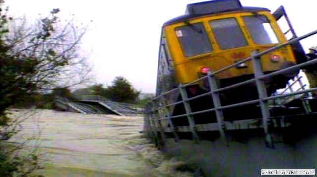 In 1987, floods were so severe that the River Tywi (Towy) overwhelmed the railway
bridge crossing the river near Llandeilo. Four people, one of them a boy, were
drowned when the 05:27 train from Swansea to Shrewsbury plunged off the damaged
Glanrhyd Bridge into the river.
 -
Carreg Cennen Castle
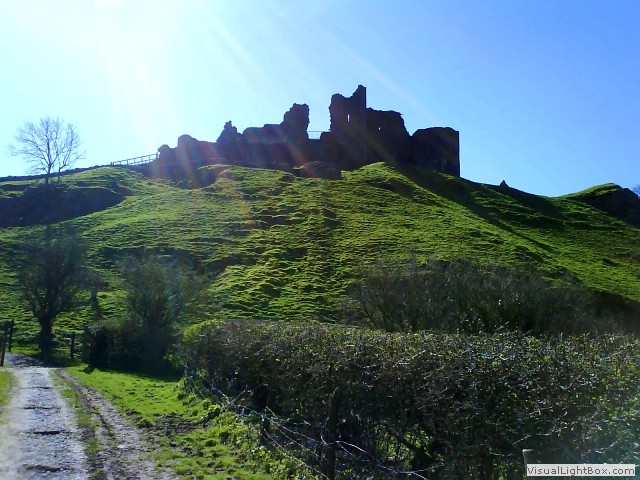 Attackers scaling the steep cliffs might as well have signed their own death
warrants, but the end of the castle came in 1462 during the 'War of the Roses'. 500
Yorkist men brandishing not swords, but picks and crowbars were paid to vandalize the
then abandoned castle. If you’ve time, take trek down a steep set of steps past a
postern gate into the bowels of the castle, into a damp limestone cave. Several
theories have been offered to explain the use of the cave, with the most rational
argument being the supply of water. The café below the castle will hire you a
torch if you forget to bring one.
 -
Sennybridge junction
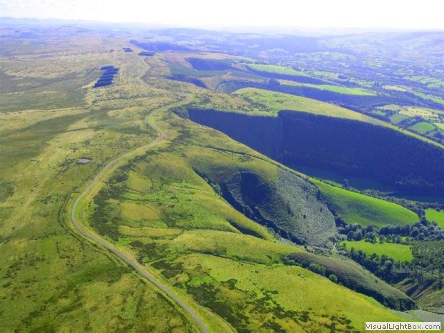 There was a proposal to make Sennybridge a prominent rail junction. An ambitious
plan was put forward to construct a line from Sennybridge to Llangammarch Wells
across the mighty Epynt mountain range (where the army training area is now). A
few earthworks were begun before the contractors went bankrupt, then the LNWR later
attempted to resurrect the scheme, but it too abandoned the plan as the terrain was
too tough.
 -
The South Wales Borderers Museum
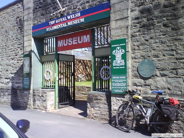 At the time of the Anglo-Zulu War, the 24th Regiment was known as the 'Warwickshires'
(the area where they originated from), but by 1879 their home base was at Brecon
and within a few years the regiment changed its name to ‘The South Wales Borderers’.
The truth is; there was a mixture of Welsh and English soldiers present at the 'Battle
of Isandlwana', despite what was depicted in the film.
 -
Torpantau tunnel
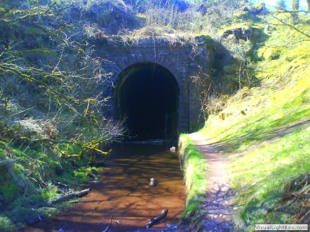 The tunnel at Torpantau claims the record for the highest railway tunnel in the UK.
The Brecon & Merthyr Junction Railway (whose line it was) gained the unfortunate nickname
of the ‘Breakneck and Murder Railway’ due to the number of fatal accidents it suffered
thanks to the steep inclines leading to the tunnel. Torpantau tunnel closed to passengers
in December 1962 and was left open for two more years to carry freight to Brecon.
 -
Under the Pontsticill Reservoir
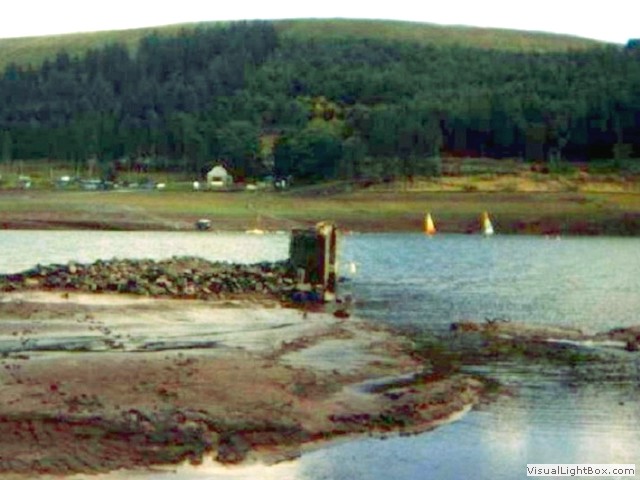 The Pontsticill Reservoir was completed in 1927 by merging two lakes to create a
stretch of water over two miles long. Scattered under the flooded reservoir were; eight farms, some
cottages, and small holdings, the vicarage and Church of Taf Fechan (the 15th century
Dolygaer church and a Congregational chapel). The graveyard of Capel Bethlehem was
moved; its memorials were recorded and are held in the Merthyr Library.
 -
Bute Town
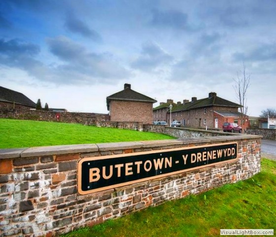 Large swaths of south Wales land became part of the Bute Estate (named after the Marquis
of Bute) in the 18th century. Bute Town (Rhymney) was built in the 1830’s as a ‘model
village’ to house local iron workers. There were 48 houses arranged in three rows with
foundations for a forth row, which wasn't needed. It even had a pub; 'The Windsor
Arms', although it appears that it was originally built as a house.
 -
The Rhymney Brewery
 The Rhymney Brewery has its origins in the days of the South Wales iron industry.
Working in heavy industry specifically the hot iron furnaces certainly gave the
men a terrible thirst, and in the mid nineteenth century in industrial Wales, it
was far safer to drink the beer than to touch the water (due to cholera). The
Rhymney Brewery began operating in 1839 with Andrew Buchan as its manager, the
works clock retained Buchan’s name. Currently, the clock is at the rear of the
‘Whitebread building’ 200 yards from the station.
 -
Fleur-De-Lis Whit Monday festival
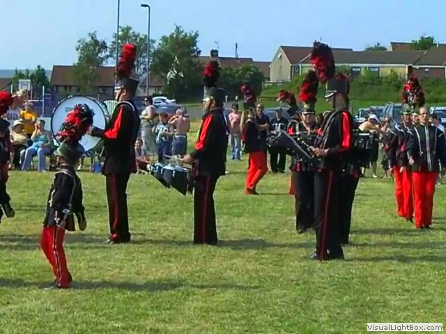 On Whit Mondays, the community held a competition for the loudest singer. After the tea
and 'tramline' cake (plain cake sandwiched with jam and cream - only seen on
Whit Monday) everyone joined in the fun on the Ynys field.

 "If you take a handful of the soil of Dinefwr and squeeze it in your hand, the juice that will flow
from your hands is the essence of Wales." -Wynford Vaughan Thomas.
 In 1987, floods were so severe that the River Tywi (Towy) overwhelmed the railway
bridge crossing the river near Llandeilo. Four people, one of them a boy, were
drowned when the 05:27 train from Swansea to Shrewsbury plunged off the damaged
Glanrhyd Bridge into the river.
 Attackers scaling the steep cliffs might as well have signed their own death
warrants, but the end of the castle came in 1462 during the 'War of the Roses'. 500
Yorkist men brandishing not swords, but picks and crowbars were paid to vandalize the
then abandoned castle. If you’ve time, take trek down a steep set of steps past a
postern gate into the bowels of the castle, into a damp limestone cave. Several
theories have been offered to explain the use of the cave, with the most rational
argument being the supply of water. The café below the castle will hire you a
torch if you forget to bring one.
 There was a proposal to make Sennybridge a prominent rail junction. An ambitious
plan was put forward to construct a line from Sennybridge to Llangammarch Wells
across the mighty Epynt mountain range (where the army training area is now). A
few earthworks were begun before the contractors went bankrupt, then the LNWR later
attempted to resurrect the scheme, but it too abandoned the plan as the terrain was
too tough.
 At the time of the Anglo-Zulu War, the 24th Regiment was known as the 'Warwickshires'
(the area where they originated from), but by 1879 their home base was at Brecon
and within a few years the regiment changed its name to ‘The South Wales Borderers’.
The truth is; there was a mixture of Welsh and English soldiers present at the 'Battle
of Isandlwana', despite what was depicted in the film.
 The tunnel at Torpantau claims the record for the highest railway tunnel in the UK.
The Brecon & Merthyr Junction Railway (whose line it was) gained the unfortunate nickname
of the ‘Breakneck and Murder Railway’ due to the number of fatal accidents it suffered
thanks to the steep inclines leading to the tunnel. Torpantau tunnel closed to passengers
in December 1962 and was left open for two more years to carry freight to Brecon.
 The Pontsticill Reservoir was completed in 1927 by merging two lakes to create a
stretch of water over two miles long. Scattered under the flooded reservoir were; eight farms, some
cottages, and small holdings, the vicarage and Church of Taf Fechan (the 15th century
Dolygaer church and a Congregational chapel). The graveyard of Capel Bethlehem was
moved; its memorials were recorded and are held in the Merthyr Library.
 Large swaths of south Wales land became part of the Bute Estate (named after the Marquis
of Bute) in the 18th century. Bute Town (Rhymney) was built in the 1830’s as a ‘model
village’ to house local iron workers. There were 48 houses arranged in three rows with
foundations for a forth row, which wasn't needed. It even had a pub; 'The Windsor
Arms', although it appears that it was originally built as a house.
 The Rhymney Brewery has its origins in the days of the South Wales iron industry.
Working in heavy industry specifically the hot iron furnaces certainly gave the
men a terrible thirst, and in the mid nineteenth century in industrial Wales, it
was far safer to drink the beer than to touch the water (due to cholera). The
Rhymney Brewery began operating in 1839 with Andrew Buchan as its manager, the
works clock retained Buchan’s name. Currently, the clock is at the rear of the
‘Whitebread building’ 200 yards from the station.
 On Whit Mondays, the community held a competition for the loudest singer. After the tea
and 'tramline' cake (plain cake sandwiched with jam and cream - only seen on
Whit Monday) everyone joined in the fun on the Ynys field.