Edinburgh to Carlisle on the Waverley line (supposed to be 66 miles cycling)
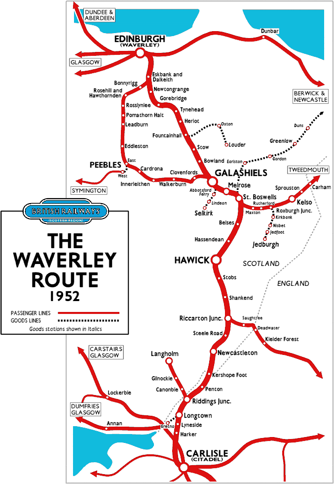 I found a fantastic website that overlaid the pre-Beeching 1960 railway routes onto Google
maps and though I'd prefer to ride on old railway lines converted into cycling paths, I felt I
was missing so many interesting routes. It was clear I needed a different bike to ride them, my
hybrid wasn't man enough. I put the word out and one of my friends gave me a mountain bike. In fairness and
no disrespect meant, it was a retro bike in need of a lot of tender loving care, if this was to be
the bike to carry me and my kit over fields, moors, and mountains; it had to be up to the job. £250
later, it was ready, ready to take me on the 60 mile trek through central Scotland, heading south west on
the old Waverley line.
I was going to cycle or walk as much of the old dissused railway line that was as physically possible. I planned the course on my Garmin and only had the benefit of Google earth to see if it was ridable, in short this whole ride was a bit of a gamble. Taking the story back one month prior to the Waverley ride; I rode the Trans-Cambrian route with my mate and was totally unprepared for off road riding, so I expected the Scottish ride to be difficult as a lot of the route was to be off road. That said, I've done some stupid things in my life, and part of this ride rates in the top five dopey things I've done of all time.
Day 1- Edinburgh to Tweedbank (30 miles train- 2 miles cycling)
I considered flying to Scotland and sending the bike via a courier, but in the end I opted for the train. Past Carlisle, the scenery of the Scottish southern mountain uplands parted to let the track run through as if a celestial being had cut a passage through it. I arrived at Edinburgh Waveley station, the only station in the World to be named after a book; the Waverley Novels by Sir Walter Scott. Like any major city station Waverley is full of hustle and bustle, at the centre of the station, the light floods in from a glass dome illuminating a small square surrounded by shops. I headed for platform 20 to travel on a route that had only been recently been reinstated after lying dormant since Beeching's axe slashed the line in the late sixties. It took an hour to travel the thirty miles to Tweekbank. The journey was unremarkable; the first five stations were in a deep cutting preventing any countryside views.
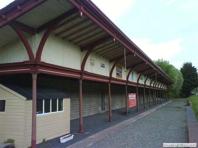 Leaving Tweedbank the cycle path continues on, but only for one mile. My first nights
stop was in Melrose, 2 miles from the terminus of the current Waverley line. I stayed
at Gibson Park Caravan site, but it was too early in the year to go into the tent field, so they
put me on a tiny patch of grass next to the toilet block. I walked to the old Melrose station now
converted into an Italian restaurant; I had a meal in this renowned eatery and wasn't impressed.
The town is notable with its own famous abbey a short walk away.
Day 2- Melrose to Newcastleton (47 miles)
The first part of the cycle ride was straight forward; it took six and a half miles on roads before I could
feasibly join the original Waverley route, but straight forward didn't mean flat. It was a nice
day with the sun bursting through the clouds, nice enough for shorts. I passed through the lovely
village of St Boswells where the Waverley line split into a branch line to Kelso and Jedburgh. With a
strange excitement I arrived at my Waverley start point, not far from Charlesfield. The track bed was
compressed by farm vehicles and was ridable. After a mile, I crossed a field and through a gate, then
it was walking. The route became impassable blocked by trees, no problem, I looked at a static OS map
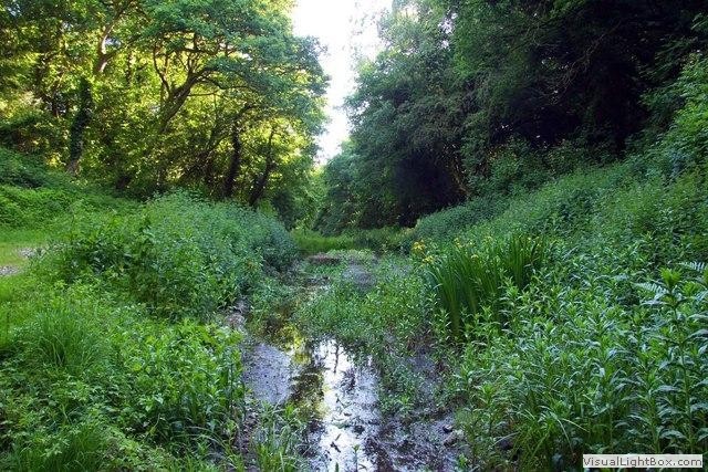 image on my Ipad and circumnavigated around the blockage via a farmer's field. Back on the track
I continued, brambles didn't stop me, the track went into a cutting and began to become boggy. This
got deeper and deeper, but I was obstinate and continued. The water was black and stank of years of
rotting vegetation. Now the murky water was touching the underside of my panniers, ahead was a road
bridge, when I got there, the underside of the bridge had been backfilled, I couldn't go forward.
I had two choices; retrace my route about five miles, or climb up to the road. I chose the latter; the bike was too heavy to drag up the steep embankment, so I stripped off the tent, sleeping bag, and anything to make the bike lighter and threw them onto the steep bank. At this point the Garmin GPS fell off the bike into the gloop. With one hand holding the bike upright, I reached into the turbid water. No amount of prodding or foot tapping could find it, it was gone.
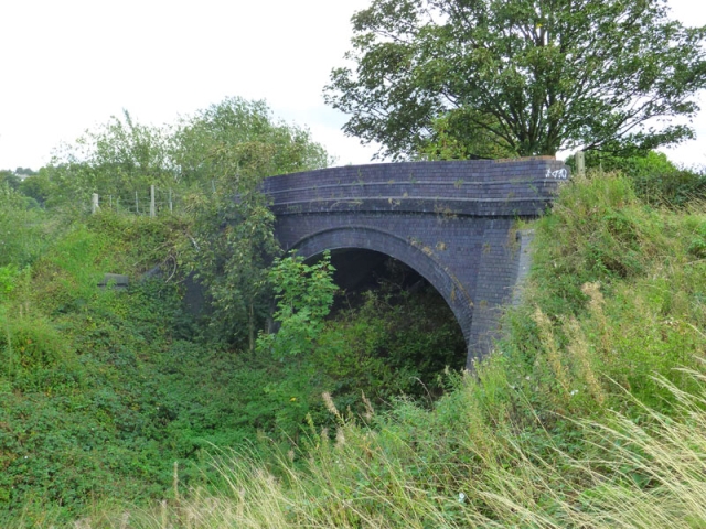 I dragged the laden bike up the slope riddled with stingy nettles; it took at least
twenty minutes to drag the bike up thirty feet, at the top was a six foot wall. I'm so
grateful to the house owner who threw years of plant cuttings over the wall making a
platform for me to throw the bike over the wall. Now I had to go back down the bank to get the
rest of the stuff. I sat on the side of the road, and realised what I had done; my legs
looked like they'd had a sustained attack from a vicious cat, blood was pouring from every
scratch and the nettles had left the rest of my legs inflamed, glowing like the embers of a dying fire.
I spoke to a farmer and asked where the Waverley line could be ridden on again, he recommended the next bridge. Two miles down the road I got back onto the old railway line. After a few miles I crossed Ale water on a small bridge and disappointedly had to rejoin a road (this was to be par for the course). I passed Belses station, now a private residence and turned back on to the trackbed, crossing fields, and jumped back on the road at Standstill. We go passed Hassendean station (on a private lane) and over a raised embankment towards Hawick. I limped into Hawick (pronounced ‘Hoyk') and rode into Morrisons supermarket and washed my cuts and bruises in the toilet (sorry about the mess), then had tea and toast in the restaurant. Even with a wash I still smelt of swamp mud. I sat there debating with myself ‘should I continue, stay here, get a taxi?' I was dejected, but decided to continue. This was the last town on-route for today, so I bought some pasta for tonights stop, before rejoining the track if only for half a mile.
Time was ticking and I wasn't making much headway. I decided to go on the B6399 to get a few miles under the belt, and reached Stobs camp memorial. Over a hundred years ago, hundreds of thousands of young men used the facilities at Stobs Camp to prepare for war. Now the bleak, windswept hills lie silent, and nothing is left of this First World War training camp.
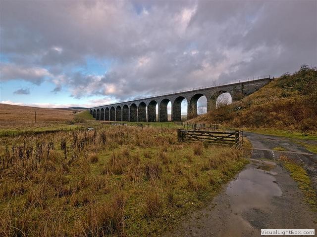 I began to climb, very subtle at first, but then steeper, it was hard work, but the views were
imense. The Penchrise peel mountain and the Maidens mountain seemed to increase in size as I drew nearer,
and then Shankend viaduct appeared to the right, I went in for a closer look, it's a quarter of a mile long, 15 arch,
bridge. The line now ran parallel to the road I was on, through fields and over a few fences, I
rejoined the trackbed south of Shankend viaduct which raised the
elevation to 1000 feet. After about a mile rejoin the B6399, on the descent I slam the
brakes on to view the Whitrope railway heritage centre. I stopped
for a little bit hoping it was open as this was the last opportunity to have a coffee and cake before the penultimate
few miles of this trek, it was closed.
I turned off the road on a forestry track heading for Riccarton junction, which was to be today's stop. I arrived at Riccarton at 5 o'clock, cut, sweaty, and stinking like a muddy dog, but I wasn't alone, there were a few Volkswagon camper vans around, and Will's Bothy was full of people. There was obviously going to be some kind of party, and inevitably they'd become inebriated. Someone was bound to bring a guitar, the chances are they'd only know three chords and less than half the lyrics, but this will not stop them working their way through the collected works of Coldplay. Every time I stopped the nettle rash buzzed on my legs with a feeling of a thousand ants running over me. I was in no mood for a party, I needed a shower, and the next civilization was Newcastleton a mere seven miles away downhill. I went back onto the main road and motored downhill. I reached Newcastleton and headed for Lidalia Caravan Park (on the original Newcastleton station), I fully expected my clothes to be fetid as the panniers actually dipped into the mire, but to my surprise everything was clean. I erected the tent and ran for the showers. Sudocrem didn't stop the itching even on clean legs. I ate at the Grapes hotel, it was a nice meal, but I had a horrendous night with very little sleep; courtesy of the nettle rash.
Day 3- Newcastleton to Carlisle (28 miles- on Google)
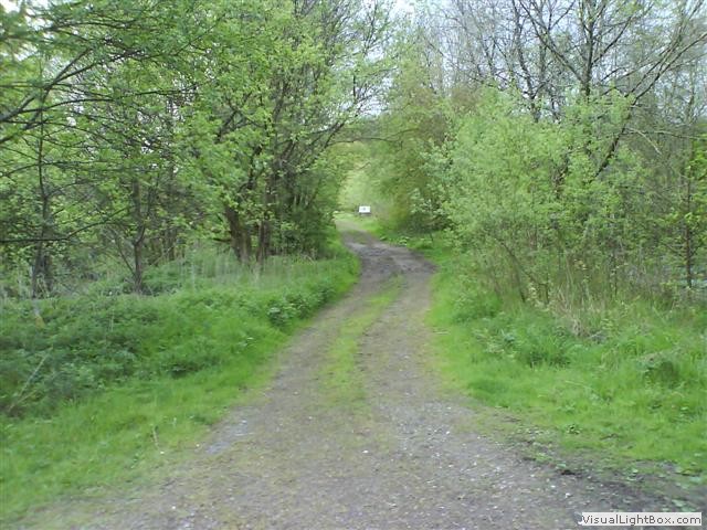 First thing in the morning I headed for the medical centre where they kindly gave me some
antihistamine tablets. After breakfast I discussed with the site owner about the Waverley line,
she suggested there was a cycle track that went along side the river. I plodded on and got as far
as Kershopefoot and crossed the road, I was merrily bobbing along at seven mile an hour, until the
trail ended again. It turned left up hill; I followed it thinking it might rejoin the line, no such
luck. I'd done six miles in a complete circle back to Newcastleton. That was it, I'd had enough, and I rejoined
the B6357 just as the heavens opened up. Passing through Caulside, Harelaw, and Canonbie to later join the A7 main
road, a fast dangerous road, but without the benefit of the sat-nav I was relying upon my Ipad for directions, and
that isn't waterproof.
I reached Longtown and locked the bike on railings outside a cafe to have a well deserved break. During my coffee and toast a man paid closer attention to my bike than I would like, but he moved off just as I stood up. I still had about eight miles to ride to Carlisle, and I could see the staff getting the 'cillet bang' and air freshener ready to clean my chair, so I prised myself from the seat. As I approached the bike I could see the Polar computer had gone. The thieving bathplug had nicked my computer, I whinged at myself for leaving it on the bike then set off in the pouring rain. I reached Carlisle like a drowned rat, but I couldn't remember my hotel name, or where it was (as the GPS would have taken me straight there). I knew it was near the station so I headed there hoping it would jog my memory. I sat in a coffee shop and accessed my email; it was the Crown and Mitre hotel, just around the corner.
It was a great hotel to finish the ride, grandiose with a superb room. My legs were still itching like a flee bitten dog, so I popped to 'Boots' to get an antihistamine cream. I had a hot bath and applied the cream, finally it did the job. I couldn't be bothered to walk anywhere so had a meal in the hotel restaurant, pricey but excellent, I even had a malt whiskey and actually slept well.
Day 3- Carlisle to Newport (train)
 I had a swim before a hearty buffet breakfast. Then went for a walk, I had time
to kill and it was a short distance to Carlisle Castle, so off I went. The castle is really
interesting to walk through, and like many English castles, Carlisle Castle was first
a Roman garrison. The upper levels require climbing a steep circular stairwell (a bit
dodgy). The keep was a powerful central stronghold and the views over the city from the outer
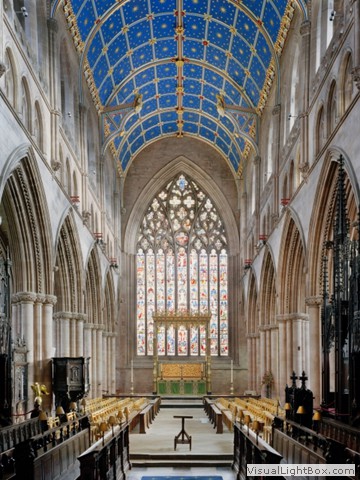
walls are embracing. Next was the cathedral which was in close proximity to the castle. Carlisle
cathedral has a tranquil, and peaceful atmosphere, above me was a tremendous painted ceiling.
It's only a small cathedral, but makes up for it with its salubrious ambience.
It was time to go; I went back to the hotel and packed the panniers. My train was at 1230 and the station was minutes away. On the train I had time to reflect on the whole journey. I needed a slap across the back of my head (something my junior school teacher used to do) for being so stupid; going through a frog infested swamp and worse still up an embankment where I could have broken an ankle, losing the Garmin and the Polar. And I needed a pat across the back for perseverance. The bike was brilliant; downhill with full weight on, it was steady as a rock.
In summary the old Waverly railway line is primarily not navigable by bike, I cycled on the road from bridge to bridge, each place I looked at was either bog or overgrown, only near villages was there small sections of ridable track where the villagers walked their dogs, or farmers tracks used to navigate from field to field. You have to like your own company on these trips, and I do, but this trip became a mission to follow the Waverley line at the expense of enjoying the ride, the ride was tortuous and I can't say all of it was pleasant, but the highlights had to be the mountain ranges and the Crown and Mitre hotel in Carlisle.
-
Gallery
 Why not have a look at the gallery relating to this ride. Click the image or the title.
 -
Melrose Abbey
 It was founded in 1136 by Cistercian monks. The abbey is known for its many carved
decorative details, including likenesses of saints, dragons, gargoyles, and plants.
 -
Melrose station
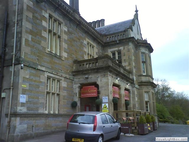 The Grade A listed building has been externally fully restored. Internally the building was
gutted leaving just a shell. It was then rebuilt and now incorporates a restaurant, gallery,
model railway centre, museum, craft shop, and craft workshops.
 -
Foot warmers
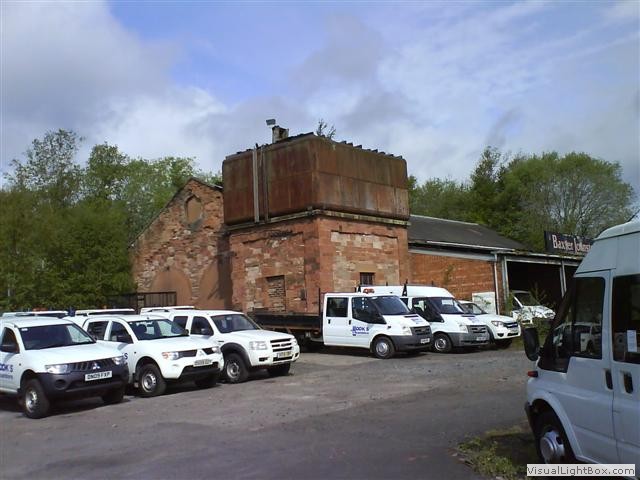 In the middle of St Boswells (at Cooks vehicle hire) there is a stone-built two-road
engine shed with a pitched roof which used to back onto line. This had a stone water
tower in one corner with a large cast iron water tank on top, and there was a stove in
the room below to stop the water freezing in the winter and to provide hot water for foot
warmers for first class passengers.
 -
The Waverley line
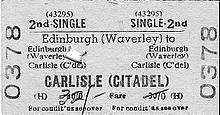 The line was built by the North British Railway; the stretch from Edinburgh to Hawick opened
in 1849 and the remainder to Carlisle opened in 1862. It's tough topography gave rise to the
line's reputation as being the toughest main line in Britain due to its constant curves and
continuous steep gradients.
 -
The last train to Hawick
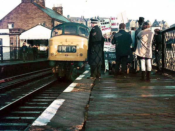 Hawick is the largest of the Border towns. With the axing of the 98-mile Waverley Route,
it was reputed to be the worst of all the Beeching cuts. The closure left the Scottish
Borders town as the the furthest town in Britain without a train service. Leaving Hawick
56 miles from Edinburgh and 42 miles from Carlisle. Though, the new Borders Railway has closed some of
the gap and Hawick may not hold that record anymore.
 -
Stobs Camp
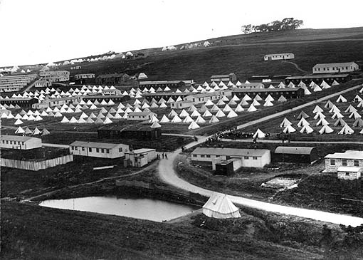 In 1914, in answer to Kitchener's call, men from all over the British Empire came to Stobs
Camp to train as soldiers. So great were the numbers that men had to be accommodated in the
town's church and public halls. The usage changed late 1914, when it was announced that Stobs
Camp would house German prisoners of war.
 -
Riccarton Junction village
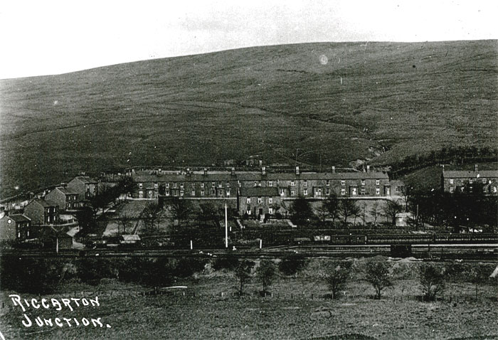 Riccarton Junction was a railway village and station on the former “Waverley Route”. There
was no road access until 1963 when a forest track road was constructed from the B6399 road
at Whitrope Summit, some three miles away. In its heyday there were as many as 118 residents
in the village which had its own school, post office, and retail grocery. Very few buildings still exsist.
 -
7stanes mountain-biking centre
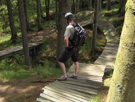 Only a few miles from the Scotland-England border, in the scenic Liddesdale Valley, is home
to one of Scotland's world class 7stanes mountain-biking centres, Newcastleton offers a
range of trails for all abilities from family groups to experienced thrill seekers.
 -
Battle of Solway Moss
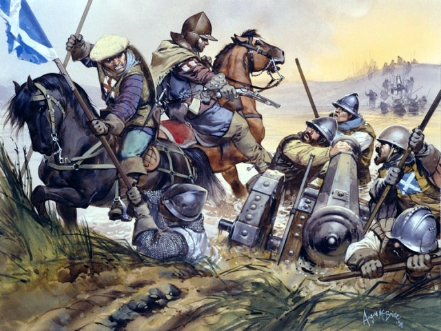 Longtown is on the Anglo-Scottish boarder and is close to the site where the Battle of
Solway Moss was fought in 1542. When Henry VIII of England broke from the Roman Catholic
Church, he asked James V of Scotland, his nephew, to do the same. James ignored his uncle's
request and further insulted him by refusing to meet with Henry at York. Furious, Henry VIII
sent troops against Scotland, the troops fought near the River Esk.
 -
Crown and Mitre hotel
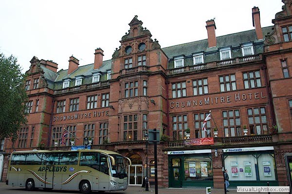 The hotel was rebuilt in the 1920's and no expense was spared during the construction, all the
best materials available were used throughout, and when it first opened, it was rated as being
one of the finest hotels in the north of England. The most noteworthy visitor to the hotel
was Woodrow Wilson, then President of the United States.
 -
Carlisle Castle
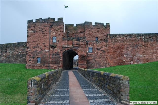 Carlisle Castle is over 900 years old and has been the scene of many historical episodes in
British history. Due to its location, it has a long and violent history with ownership by the
English and Scottish changing numerous times throughout the years.
The castle was used as a prison. Its most famous prisoner, Mary, Queen of Scots was incarcerated within the castle in 1568.

 It was founded in 1136 by Cistercian monks. The abbey is known for its many carved
decorative details, including likenesses of saints, dragons, gargoyles, and plants.
 The Grade A listed building has been externally fully restored. Internally the building was
gutted leaving just a shell. It was then rebuilt and now incorporates a restaurant, gallery,
model railway centre, museum, craft shop, and craft workshops.
 In the middle of St Boswells (at Cooks vehicle hire) there is a stone-built two-road
engine shed with a pitched roof which used to back onto line. This had a stone water
tower in one corner with a large cast iron water tank on top, and there was a stove in
the room below to stop the water freezing in the winter and to provide hot water for foot
warmers for first class passengers.
 The line was built by the North British Railway; the stretch from Edinburgh to Hawick opened
in 1849 and the remainder to Carlisle opened in 1862. It's tough topography gave rise to the
line's reputation as being the toughest main line in Britain due to its constant curves and
continuous steep gradients.
  Hawick is the largest of the Border towns. With the axing of the 98-mile Waverley Route,
it was reputed to be the worst of all the Beeching cuts. The closure left the Scottish
Borders town as the the furthest town in Britain without a train service. Leaving Hawick
56 miles from Edinburgh and 42 miles from Carlisle. Though, the new Borders Railway has closed some of
the gap and Hawick may not hold that record anymore.
 In 1914, in answer to Kitchener's call, men from all over the British Empire came to Stobs
Camp to train as soldiers. So great were the numbers that men had to be accommodated in the
town's church and public halls. The usage changed late 1914, when it was announced that Stobs
Camp would house German prisoners of war.
 Riccarton Junction was a railway village and station on the former “Waverley Route”. There
was no road access until 1963 when a forest track road was constructed from the B6399 road
at Whitrope Summit, some three miles away. In its heyday there were as many as 118 residents
in the village which had its own school, post office, and retail grocery. Very few buildings still exsist.
 Only a few miles from the Scotland-England border, in the scenic Liddesdale Valley, is home
to one of Scotland's world class 7stanes mountain-biking centres, Newcastleton offers a
range of trails for all abilities from family groups to experienced thrill seekers.
 Longtown is on the Anglo-Scottish boarder and is close to the site where the Battle of
Solway Moss was fought in 1542. When Henry VIII of England broke from the Roman Catholic
Church, he asked James V of Scotland, his nephew, to do the same. James ignored his uncle's
request and further insulted him by refusing to meet with Henry at York. Furious, Henry VIII
sent troops against Scotland, the troops fought near the River Esk.
 The hotel was rebuilt in the 1920's and no expense was spared during the construction, all the
best materials available were used throughout, and when it first opened, it was rated as being
one of the finest hotels in the north of England. The most noteworthy visitor to the hotel
was Woodrow Wilson, then President of the United States.
 Carlisle Castle is over 900 years old and has been the scene of many historical episodes in
British history. Due to its location, it has a long and violent history with ownership by the
English and Scottish changing numerous times throughout the years.