Madeira, a vertical island!
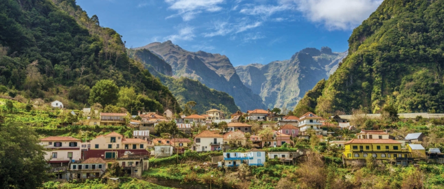 Madeira dropped into my inbox from one of those cut price holiday websites, the price was right; so I
was set to go. Not a typical cycling destination, Madeira is essentially a big rock. This small island is the remnant of a
massive volcano rising 6km from the Atlantic Ocean floor. Over eons of time, intense
erosion from the sea and the weather have carved valleys and gorges into the landscape, creating
an uneven terrain that’s so harsh, it’s either up or down, and not suited to cycling. I researched the
island for routes, and very few were recommended, so I took my folding bike as a half way house.
Day 1- Caminho Alagoas to Pico das Pedras (20km)
 It was late when I arrived at my hotel, I began chatting to a waiter about potential cycling
routes. He didn’t appear optimistic and just kept shaking his head. Twenty minutes later another
waiter came back and suggested one route; drive most of the way up the second highest mountain on
the island and ride the last 10km through the forest. The next day I parked the car in a remote area of 'Faial'
and unfolded the bike, eager to set off. The weather was a little cloudy but warm at 23°C.
The first thing that hits you is the smell of the pine trees together with the silence, absolute
stillness. No birds tweeting, just the sound of the car creaking as it cooled. I stood there
trying not to breath too loud to hear something, anything. The ‘Garmin’ was clicked on the
bars, but didn’t show any route, all I had was a hand drawn map on a Madeira road atlas, given
to me by the waiter.
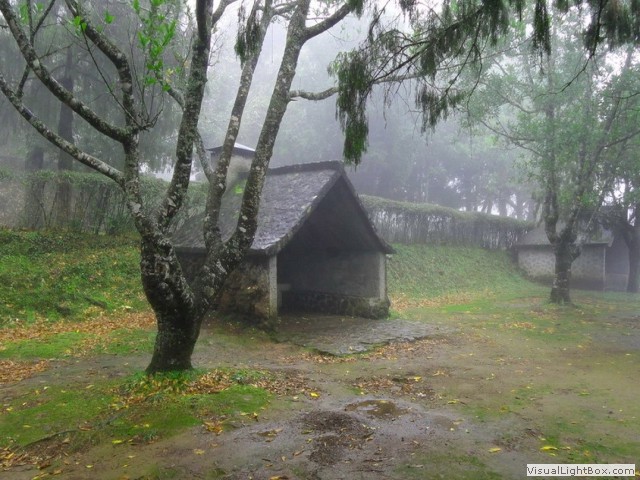 I was already over 2000ft up from sea level and climbing up on a mud track through the forest. Suddenly a
jeep descended out of the murk, with two elderly people sat in the back, which I presume were on a 4x4
tour. With a welcome excuse for a breather I hurriedly hopped off the track until the jeep
passed. The route wasn’t straight forward, and there
were many ‘Y’ junctions, so I decided to follow the jeep tracks cut into the soft ground, after all,
it’s a distinct possibility the jeep came from Pico das Pedras. There was only one junction with a wooden
sign on it, pointing me to the right. When I reached the place, the picnic area was suffocated
with fog, with some steep roofed picnic shacks similar to the
traditional 'palheiros' built to shelter from the unpredictable rain at this altitude. I rode back down a road
section and then reversed the woodland route. All the rough, bumpy tracks had caused a casualty; the
head stock on my bike had come loose. Back at the car, there was an immense view of 'Sao Roque
does Faial'. Never in my travels have I seen such a spectacle of rock formations on such a colossal
scale, all covered in green foliage, with distant farms cut into the acute landscape so steep, how could
anyone even walk up them, let alone tender the soil?
Day 3- Santo Antonio da Serra- Levada da Serra do Faial- Santo Antonio da Serra (20km)
 I didn’t have the right tools to fix the Dahon folding bike, putting it out of action, and I didn’t
trust it down the steep hills anyway, so I hired a mountain bike in Fuchal on day 2. Today, I was
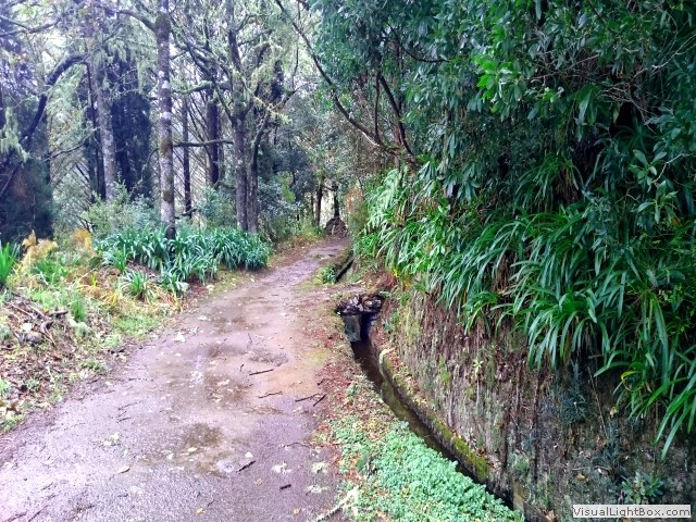
going to ride something as iconic and quintessential as Madeira fortified wine – a Lavada. ‘Levada’
in Portuguese is roughly translated as ‘carriageway’, but more correctly defined as a mini-canal,
carrying water from the mountains down to plantations on the steep sided lower hills. There are
many organised guided tours of the Levarda’s, but only a few are cycle friendly. The reason for this
is most Levarda’s start high in the mountains with sometimes only a foot wide path alongside
them and with massive drops on the other side. Many deaths occur every year from walkers falling
from the Levarda’s, so cycling along most of them is out of the question.
I was going to ride the Levada da Serra do Faial starting from Santo da Serra, and just the drive there was an extraordinary challenging journey. Most Madeira roads are cut into the mountainside, winding like serpents they twist and ‘U’ turn back on themselves as they progress up the mountains. You have to be a confidant driver and have a leap of faith maintaining speed around each blind hairpin bend, even though there were rock falls spilt across the road around some bends, and if you’re not near the cliff wall (with a water gulley near the wall), you’re feet away from tumbling down several hundred feet to certain death. I still can’t believe at one stage driving to the Levada, the road was so steep; I spent over twenty minutes in 1st gear climbing. All this before I sat on the bike.
 With the absence of a guide and the fact I was riding this alone, I used a fantastic app created
just for the Levada’s to steer strangers safely along with mapped offline ‘gps’ routes loaded to your
phone. It was great and I can safely
recommend the app; you can get ‘Walkme’ from the ‘Play store’ for about £3. The ride starts
with a few mile climb up a tarmac forest road. Then we turn straight onto the Levada, it was
muddy, and it seemed there was more water on the trail path than in the Levada. It began to rain
heavily allowing a dense fog to drop, but from time to time and when the prevailing wind
allowed the fog to disperse, it opened up the landscape to reveal the grandeur of the
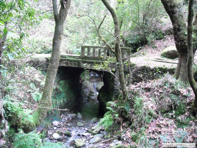
terrain below. I crossed a bridge over a dry ravine and continued on the path, the proximity
to nature; gives away forest aromas of pine and eucalyptus, truly making the air so fresh, you
could bottle it. The reason for the dry levarda became apparent; there was a breach in the
wall, allowing the water to cascade down the hill. On the other side of the breach, the Levada
was full. The Levada ended after passing some small buildings, then the path turned downhill, down
a slippery mud road past a trout fishing park to head back to Santo da Serra for a cold ‘Fanta’ in
one of the local sleepy bars. Maybe it was the wrong time of year, but it felt like I could’ve been on
any canal in the UK with the views hemmed in by winter fog, but it was flat and it put a tick on the
Madeira bucket list.
Day 4- Sao Vicente to Porto Moniz (15km round trip)
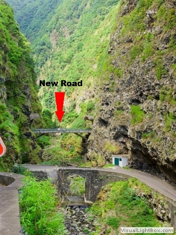 The aim today was to ride along the remaining old parts of the north ER101 road.
I started the ride at São Vicente, an area characterized by its beautiful volcanic green slopes
leading onto pebble beach’s battered by the Atlantic, a haven for surfers. I parked near the
main restaurant in São Vicente; 'Restaurante Quebramar' and began the ride on the ER101/VE2 which is a new
road following the coast, after around a kilometre the VE2 veers off underground into a new tunnel, however
I continue on the old ER101. The old road now goes up and around a steep ravine through two small
tunnels to appear where there is a most peculiar sight; the new road pops out of the rock for
100 meters, cross’s a small bridge, and then disappears back into the mountain again. I continued
on a slippery downhill stretch and back along the coast to a
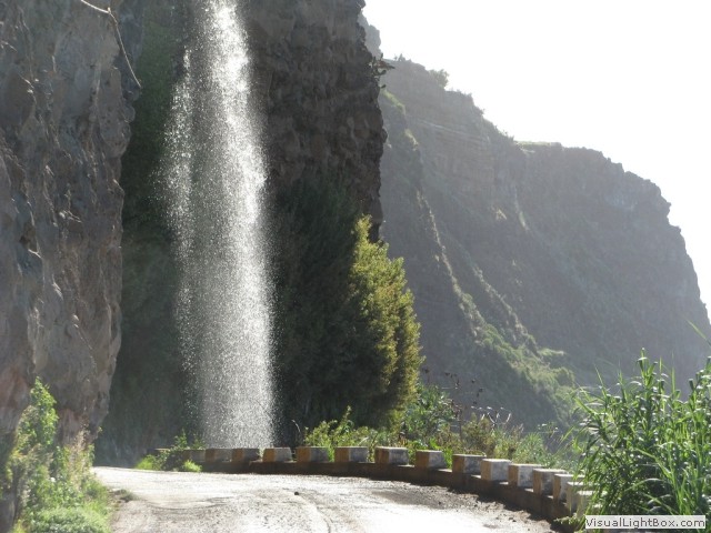 waterfall, the 'Miradouro do Véu da' waterfall falls directly onto the road, recalled by the locals
as a free car wash. Sadly beyond the waterfall, the road had collapsed and I had to retrace my steps
and take the main road through the ‘Tunel de Joao Delgado’. It was a cycling journey not for the faint
hearted; some Madeirian drivers think they're the next Mario Andretti but misjudge their overtaking distance,
other motorists have forgotten that pushing the right foot down makes the car go faster, so the
moral of the story is; avoid cycling through the main road tunnels. On the
other side of Miradouro do Véu da Noiva is a viewing platform where tourists drive
their minibus’s too and park up to take photos and then move on to the next attraction. Somehow riding there, I feel I
deserve the view more than the diesel head tourists.
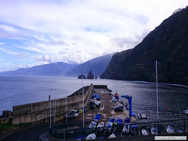 Now the ER101 road winds and twists to Seixal where I have a swift coffee at the 'Lounge Bar
Clube Naval do Seixal'. It’s possible to get
the other side of the Seixal peninsular down a narrow lane and back onto the coast road ‘R. do
Porto da laje’. Now it’s onto the ‘Antigo tracado da ER101’ and through a creepy old damp one kilometre
gloomy tunnel, after emerging into the light the beach is taken up by a sewage
farm. Through one more tunnel and into a small outlet, then it’s into ‘Porto Moniz’ where I stock
up on caffeine and retrace my steps. The views were awe inspiring interspersed with dodging rock
falls, or waterfalls that drip (or pour) onto the roads, sometimes with green moss everywhere making
it treacherous, pretty blue hydrangeas line the roadsides. Where the old and new roads separate there
is either some kind of barricade or chicane, but most were easily overcome. It’s a shame people are
discouraged from exploring these beautiful roads, if opened up properly to the public, they
could be such a fantastic attraction, and yes, they're dangerous, but surely, that’s part of the appeal.
The rest of the island
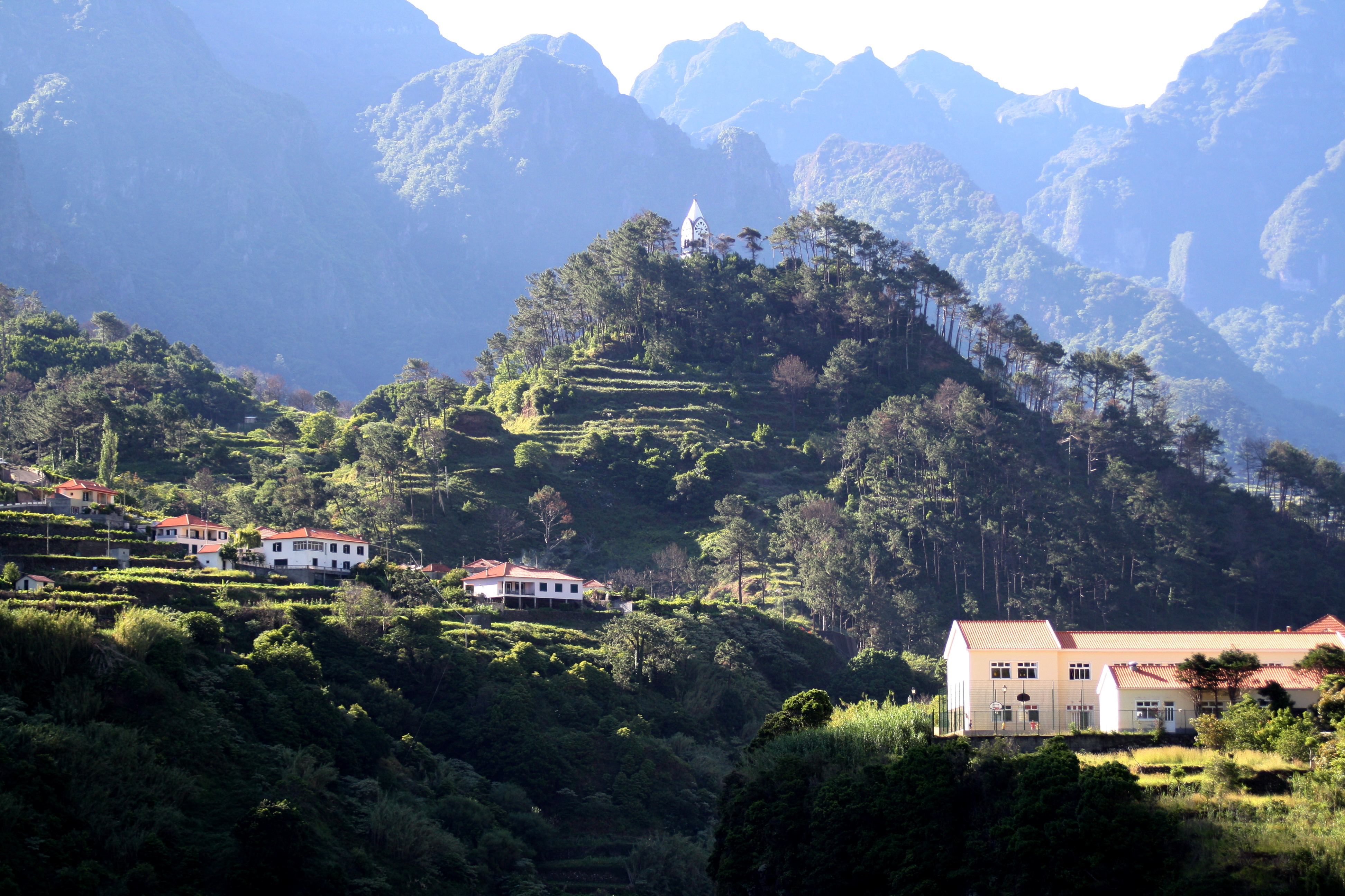 I did drive around the east of the island starting at Achadas Da Cruz, the roads are really quiet, I
mean really quiet. They’re still either up or down which wouldn’t be such as issue except the area was
really damp. Big fern leafs were strewn over the road making the surface exceptionally greasy, I can’t
tell if this was normal or preceding a storm. The views were nice, but I feel safer to be on four wheels
rather than two. Simply put, Madeira island isn't a cycling destination. The island might well be thirty five miles
long and thirteen miles wide and boast of almost one hundred miles of coastline, but the shore is
all rock and cliffs; it's a mountainous island. During my week there, I probably didn’t scratch the
surface of things to do. Would I go back? Well, I wouldn’t abandon the idea of returning one day, but
I might leave the bike at home.
-
Gallery
 Why not have a look at the gallery relating to this ride. Click the image or the title.
 -
Cristiano Ronaldo International Airport
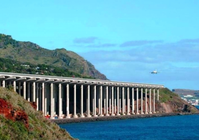 Cristiano Ronaldo International Airport (also known as Madeira Airport or Funchal Airport) brings
in the eager tourists to this special island, but I wonder how many know it’s ranked as the ninth
most dangerous airport in the world, and the third most dangerous in Europe. The airport was once
infamous for its short runway which, surrounded by high mountains and the ocean, gave it extreme
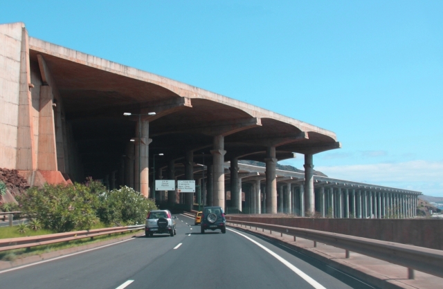 gusty winds, making tricky landings for even the most experienced of pilots. Over the years the
airport has been extended a few times. The last time landfill was not a realistic option, so the
extension was built on a platform, partly over the ocean, supported by 180 columns, each about 70m tall.
 -
Cristiano Ronaldo
 Born and raised on the Portuguese island of Madeira, Ronaldo is a professional
footballer who plays as a forward for Spanish club Real Madrid and the Portugal national team.
Often considered the best player in the world and widely regarded as one of the greatest of all time.
 -
The Dangers of the Lavada
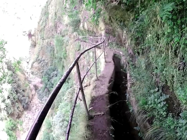 Following the meandering course of a levada is probably one of the best ways to experience the beauty of
inland Madeira and there are a few easy ones for us pedestrians, but for expert walkers, the guide books
advise- 'they should be able to manage all of the mountainous Lavada's easily, provided that they are used to
very sheer unprotected drops'. It’s all there
in black and white, the subliminal message being said is- “stay away”. Except... the concept of danger
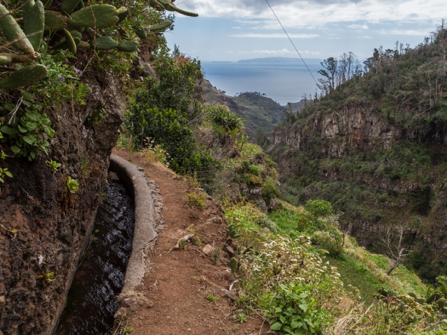 is cultural, and coming from a safety-conscious country like the UK, it is impossible to conceive a
dangerous path being accessible to the public, but in some parts of the World- danger is a subjective. Walking
the treacherous lavadas isn’t for me, I really do feel safer on two wheels than two feet.
 -
Santo Antonio da Serra
This modest, bland little village is much the same as many on the island consisting of a single street with a few bars and a few hotels, though I couldn’t understand why anyone would want to stay here. True the beautiful fog topped mountains are near, but the small village also hides a few secrets. The ‘Blandy estate’ was the former summer residence of an English wine merchant family. Today the newly named public ‘Parque de Santo
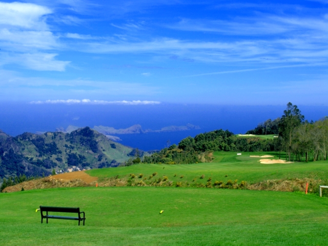 da Serra’ boasts of lush parkland and is lined with a large variety of endemic plants, flowers, and
camellia trees. There’s also the Santo da Serra golf course; ranked among the world’s finest courses
with one of the most spectacular panoramas in all of the PGA European Tour Schedule.
 -
World’s most dangerous roads
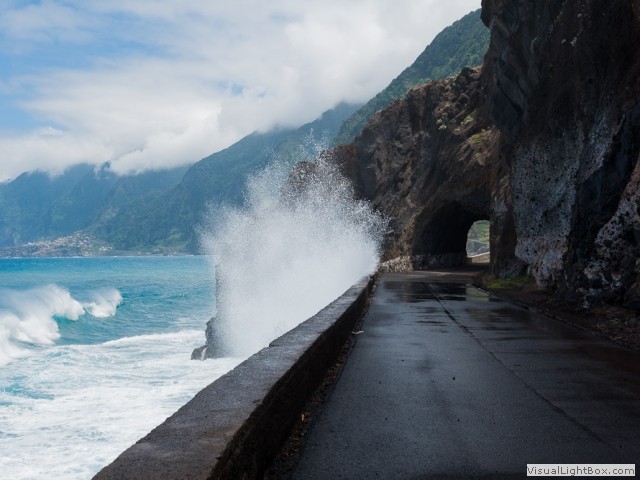 The ER101 surrounds the island and is the oldest and most beautiful road of Madeira, but it
also has a well-deserved reputation for being dangerous as avalanches and landslides can occur
anytime, unpredictable sea blizzards invade the shores with ferocity. Today the dangerous sections have
been replaced by tunnels carved through the mountain, but Madeirains rarely see a cyclist, so riding
through the new road tunnels isn’t recommended.
 -
Seixal is best for swimming
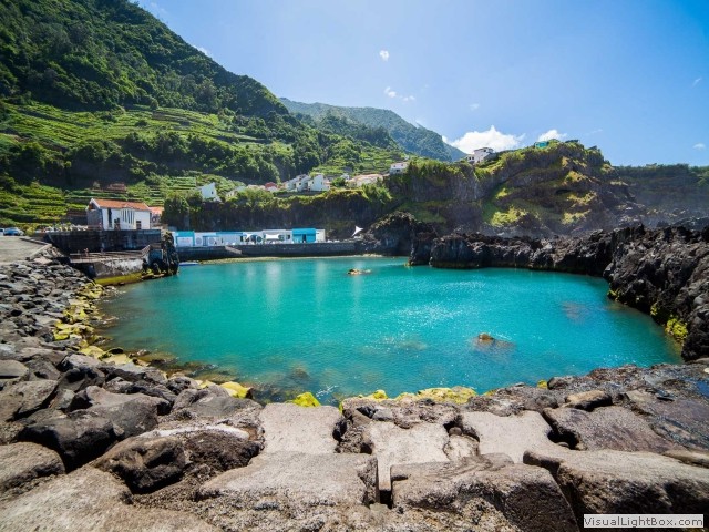 Seixal is a small, unspoilt Madeiran village with no tourist shops, but it has two fantastic, stunning
sea pools at the base of the cliffs, access is either from the pebbled beach or from a 20ft rung ladder
built into the wall which overlooks the pools. The water is unusually warm and the pools are filled with
small fish, the place is unnaturally quiet. Seixal is also reputed to have the best beach
in Madeira; Laje Beach has black sand and is hidden between rocks with a natural contrast of beauty of the
green mountains in the background and the crystal clear blue sea.
 -
Madeira slaves
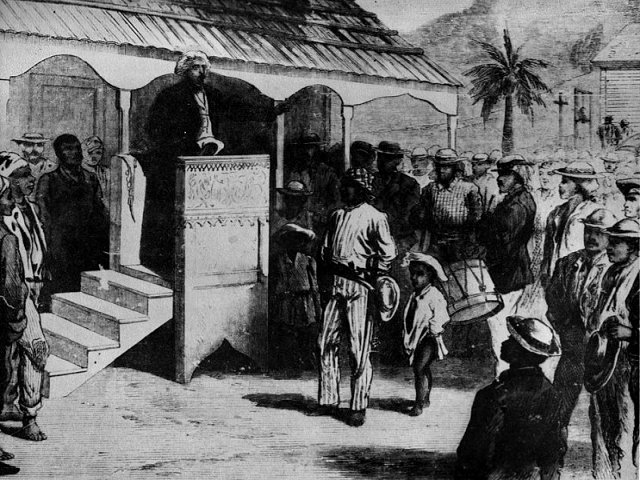 Madeira was colonised in the early 1400’s by the Portuguese, and like many European countries- slaves were
used to build and work the land. Imported slaves reached 10% of the total population of Madeira by
the 16th century. African slaves were used to cultivate sugar cane, and even the first levadas were
constructed by Arabic and African slaves.

 Cristiano Ronaldo International Airport (also known as Madeira Airport or Funchal Airport) brings
in the eager tourists to this special island, but I wonder how many know it’s ranked as the ninth
most dangerous airport in the world, and the third most dangerous in Europe. The airport was once
infamous for its short runway which, surrounded by high mountains and the ocean, gave it extreme
 gusty winds, making tricky landings for even the most experienced of pilots. Over the years the
airport has been extended a few times. The last time landfill was not a realistic option, so the
extension was built on a platform, partly over the ocean, supported by 180 columns, each about 70m tall.
 Born and raised on the Portuguese island of Madeira, Ronaldo is a professional
footballer who plays as a forward for Spanish club Real Madrid and the Portugal national team.
Often considered the best player in the world and widely regarded as one of the greatest of all time.
 Following the meandering course of a levada is probably one of the best ways to experience the beauty of
inland Madeira and there are a few easy ones for us pedestrians, but for expert walkers, the guide books
advise- 'they should be able to manage all of the mountainous Lavada's easily, provided that they are used to
very sheer unprotected drops'. It’s all there
in black and white, the subliminal message being said is- “stay away”. Except... the concept of danger
 is cultural, and coming from a safety-conscious country like the UK, it is impossible to conceive a
dangerous path being accessible to the public, but in some parts of the World- danger is a subjective. Walking
the treacherous lavadas isn’t for me, I really do feel safer on two wheels than two feet.
 da Serra’ boasts of lush parkland and is lined with a large variety of endemic plants, flowers, and
camellia trees. There’s also the Santo da Serra golf course; ranked among the world’s finest courses
with one of the most spectacular panoramas in all of the PGA European Tour Schedule.
 The ER101 surrounds the island and is the oldest and most beautiful road of Madeira, but it
also has a well-deserved reputation for being dangerous as avalanches and landslides can occur
anytime, unpredictable sea blizzards invade the shores with ferocity. Today the dangerous sections have
been replaced by tunnels carved through the mountain, but Madeirains rarely see a cyclist, so riding
through the new road tunnels isn’t recommended.
 Seixal is a small, unspoilt Madeiran village with no tourist shops, but it has two fantastic, stunning
sea pools at the base of the cliffs, access is either from the pebbled beach or from a 20ft rung ladder
built into the wall which overlooks the pools. The water is unusually warm and the pools are filled with
small fish, the place is unnaturally quiet. Seixal is also reputed to have the best beach
in Madeira; Laje Beach has black sand and is hidden between rocks with a natural contrast of beauty of the
green mountains in the background and the crystal clear blue sea.
 Madeira was colonised in the early 1400’s by the Portuguese, and like many European countries- slaves were
used to build and work the land. Imported slaves reached 10% of the total population of Madeira by
the 16th century. African slaves were used to cultivate sugar cane, and even the first levadas were
constructed by Arabic and African slaves.