Four days cycling around the South Wales Valleys
It’s nice to do a unidirectional ride rather than replicate the trip in the opposite direction, and I love old railway paths and there’s loads of them in Wales, after all South Wales once had one of the most densely populated rail networks in the world: a product of competition between a multitude of private companies serving the coalfields, hauling coal from the collieries to the ports. Though, most railway paths in the Welsh valleys finish at the top of the valley, so this summer we’re going to attach several cul-de-sac routes together, and I’ll be honest, I’m excited about this ride; we travel along more than half a dozen old railway paths, three canals, along loads of rivers and their tributaries, through the breathtaking Millennium Coastal Park at Llanelli, and the Gower Peninsula an 'Area of Outstanding Natural Beauty' (AONB). We start by driving to Swansea, dropping off our panniers at the Ibis hotel (first nights stop) on the way, then we continue in the car to Swansea, and park up (I found a great new parking app- JustPark, this enabled me to park at a third of the cost of NCP car parks). Once parked, we catch the train back to Port Talbot to begin the ride.
Day 1- Port Talbot to Port Tennant (via the Afan valley, 33 miles)
 When we left the railway station, the weather was leaden and overcast, we gradually headed uphill northbound through
the gorgeous Afan valley (we did this route southbound in 2014 ‘Ogmore Vale’). The area is
a haven for all sorts of wonderful wildlife and has world-class mountain bike trails. At
Pontrhydyfen the trail splits; to the left is the ‘Richard Burton trail’ (I don’t think he had anything
to do with cycling, but he was born here) which crosses the Pontrhydyfen viaduct, however we go right
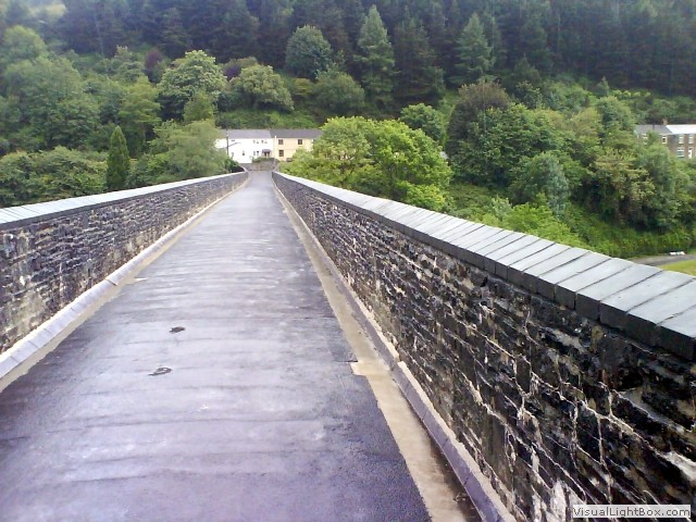
through the village of Pontrhydyfen, then up and over the old Pontrhydyfen aqueduct (built in 1825 to
supply the water to power the waterwheels of the nearby Cwmavon blast furnaces), now part of the
NCN887 towering above the valley floor. It began to rain heavily and we sheltered in a nearby log shed,
just until it subsided. At Rhyslyn there’s another split, we go left, leaving the
NCN887 to parallel the River Afan on a small gravel forest road on the north side of the river. The river
meanders right and we follow it high above the water, joining up with the Afan valley cycleway
(on the old South Wales Mineral Junction Branch), a route less crowded than the south side path.
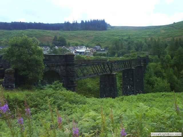 We pass the fantastic disused Cymmer viaduct on our right side, which used to join the north and south railway lines
together, now we turn north passed the Cymmer (Corrwg) station following the Afan Corrwg river. When
we pass Glyncorrwg ponds, it's time to drop down to the Glyncorrwg Visitor Centre for a cuppa. After a wonderful
brew we rejoin the Afan valley cycleway. The railway trail now
finishes here and terminates at the old station of Glyncorrwg (now just a car park). From here, we
have 2 miles of climbing over the Mynydd Resolfen (mountain) on forestry tracks, to reach our highest
point of the day at 1500 feet above sea level. It began to rain heavily again as we were climbing
(and walking) through the massive pine forest, with each tree one hundred feet high, until we heard a
loud whooshing- when closer, we can see gigantic wind turbines slicing the air. At last we stop climbing
and make our descent into Resolven on a teeth rattling service road. Cold and soaked through we had a
coffee in a small supermarket and moved on, crossing the River Neath. We had intended to jump onto
the Neath canal, but it was unridable until we reached Abergarwed.
 Riding across the B4434 road bridge we notice a great sight to our right; a railway viaduct
and the Tennant canal aqueduct behind within spitting distance of each other, making a great photo. The
‘Garmin’ alerted us to the Aberdulais Tin Works, worth a little diversion. Now
there's a series of left and right turns to get onto the canal basin at Aberdrdulis, where we
eventually ride between the river Neath and the Tennant canal on a small path. Just after the Tennant
canal crosses the river Clydach we cross over the canal on to Monastery road to see Neath Abbey. These
ruins were once part of the biggest Cistercian Abbey in Wales. Walking around the remnants, there’s
a lot of work going on, but one can still appreciate the sheer scale of how the Abbey was in its prime.
We stay off the Tennant canal for a mile and make a small detour on the road, rejoining it when it
goes under the M4. We pass through Jersey marine famous for its four storey octagonal tower, built
in the Victorian era. The Tennant canal terminates at Port Tennant and so does our ride for
today. The canal used to end in a basin now occupied by Ashlands playing fields, from here the
goods would have been craned off the barges and taken straight to the King’s dock (which is
still in use today) for distribution around the World. We booked in at the hotel Ibis and had
the well deserved pint.
Day 2- Port Tennant to Crosshands (33 miles)
 We knew it was going to be a tough day today, uphill for most of the route following the river Tawe and
then the river Glan-Yr-Avon on former railway routes. We start around ten and leave the hotel on a glorious day,
traveling on the old route of the Swansea Vale Railway (which eventually transfered to the Midland Railway
in 1876), keeping the river Tawe on our left. We shortly arrived at the ‘Copper quarter’; the
Hafod Morfa copperworks was once the crucible of the global copper industry and vital to Swansea’s
development. By 1850 eleven major copperworks had been established on the banks of the River
Tawe, and for a time they produced over half of the World’s total output of smelted copper. Such
was the importance of this industry that Swansea became known as ‘Copperopolis’.
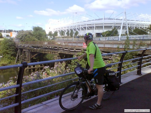 Before we cross the river Tawe to the Liberty stadium (home of both the Swans football team
and the Ospreys rugby team), we stopped for a photo of the Bascule railway bridge which
cantilevered up for tall ships. The old railway
now follows the current Nantong Way, but we follow the cycle path besides the
river, crossing it to the west side, before crossing back again in a short distance to circumnavigate
Fendrod Lake. The whole area is riddled with old railway paths and it’s difficult to choose which
one to travel on. We arrive at Morriston, constructed as ‘Wales' earliest planned industrial
village’, laid out on a grid pattern, and named after its founder- Sir John Morris. There were
two stations here, the Midland railway ran the station east of the river and GWR ran the west
side. The path goes underneath the M4 and we cross the river Tawe on park road, then going
through Ynystawe Park. At Clydach we jump onto the Swansea canal and come across the Clydach
Heritage Centre; a pocket sized museum, depicting a fascinating insight into the historical life
of the Clydach people. It was closed today, so we continued on the
Swansea canal, through Pontardawe where we rejoin the route along the river Tawe again. The path gradually
drifted uphill on a good surface, then we reached a strange distraction; a memorial to Gleision mine where
four men died as recent as 2011. A very poignant tribute to these men, with many personal possessions and
hand written messages from friends as part of the shrine. At Ystalyfera
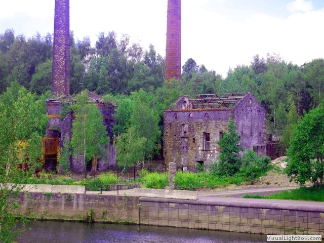
 we cross a bridge, then take a short diversion to see the Ynyscedwyn Iron Works. The
remains of the building on the Ynyscedwyn site are not part of the original ironworks, but were
built in 1872 as part of a planned steel mill, which was not completed. The site then housed the
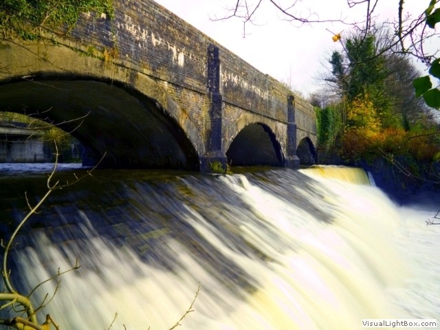
Ynyscedwyn Tinplate Works. We have to backtrack to Gurnos and it’s a must to cross the aqueduct
over the Afon Twrch, but the image looking ahead doesn’t prepare you for the view over the side.
There’s colossal weir roaring even in the summer.
 The Swansea vale railway path now follows the river Afon Twrch and we stay on its route for a short distance.
From here, unfortunately we now have to ride on a main road for about 3 miles to Ystradowen, but at least it's quiet
crossing the Lower Brynmorgan Bridge and then the Upper Brynmorgan Bridge. Now we turn right on to the NCN437
cycle path at Cwmllynfell. Between Cwmllynfell and Brynamman is East Pit (named after
the old colliery here), a massive blot on the landscape, an opencast coal mine producing anthracite from
twelve individual coal seams lying up to one hundred and fifty metres below the surface. At Brynamman
there’s an example of just how ludicrous the
many railway companies were at the time; when the Midland railway crossed the A4069 road, the
ownership of the line changed to the Great Western Railway (originally part of the original Llanelly Railway and Dock
Company route), not that usual you say, but the Midland Company had a station on the east side of the
road and GWR had their station on the west side of the road, 100 metres apart from each other. Crazy. The GWR route
now follows the river Amman skirting the Parc Golwg Yr Amman (on the former Amman Tinplate works site).
We criss cross the river Amman a few times before arriving at Glanaman, where the railway used to be a
spiders web supporting various local collieries and galvanising works, from Ammanford to
Cross Hands the railway was purely commercial transporting coal from all the collieries back to Swansea. We now
have only 6 miles to go to tonight’s stop at Cross Hands, but this last bit is uphill again and it was a
mother of a climb. We arrived at the © Travelodge around 1630, there isn’t much here so we just
chilled in the room.
Day 3- Cross Hands to Port Eynon (37 miles)
Who would expect two nice days on the trot in the British summertime, but here it is; proof we do sometimes have nice weather. Anyway I digress, we left the Cross Hands © Travelodge in the morning, a short distance from here is one end of route 47; The Swiss Valley Cycle Route, to Llanelli. The route is on the former Llanelly & Mynydd Mawr Railway (which later transfered to GWR)- it was the main artery for coal distribution from the Gwendraeth Valley, but never had a passenger sevice (except for worker trains). After a mile the route starts proper after we cross Carmarthen road, from here its largely car free. We pass through Tumble, a village developed in the 19th century to house the anthracite miners who were employed at the nearby Dynant Fach and Great Mountain collieries. To honor the workers there's a giant miner's lamp sculpture at the entrance to Mynydd Mawr Woodland Park just up the road.
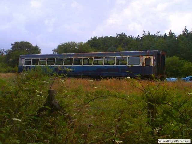 It’s a pleasant downhill ride, but the views are a bit too restricted by trees for me, until we reach Cynheidre. Here
there’s a new heritage railway site set up in 1999 on the old Cynheidre colliery site. Their initial phase has a
half a mile running line, and for a relatively new heritage railway, they have a respectable
amount of rolling stock including; a little saddle tank steam engine, two DMU’s and some coaches and a few goods
wagons. Also, at Cynheidre was one of the few stations on the line. There isn’t a café here yet, and I reckon they make a
mint when there is. The cycle path follows the course of the Afon Lleidi and now we can see the first
reservoir with the same namesake as its feeder situated in the stunning Gwendraeth Valley. The route
we're on today takes its name from the second reservoir down the valley; the Swiss Valley reservoir. At
the bottom of the reservoir, the cycle path goes near to the dam, and with a little leap over a fence, and a path downhill
one can get right onto the dam itself, where you can get up close and personal with the water inlet
tower. At Felinfoel (an Irish sounding name, you think?) the houses and roads begin to build up
signifying that we're near Llanelli. A short diversion from the cycle track is the Felinfoel Brewery,
home of Double Dragon Ale, and is the oldest Brewery in Wales.
We pass a lake on our left, known by local people as Old Castle Pond or in welsh Pont Tym meaning
‘Warm Pond’. There is a large island roughly in the middle of the lake, which has foundations of a
 castle, but there isn't much to see from the cycle path. We turn right and pass another lake called 'Sandy
Water Park' (a rather idealistic and drippy name, in the true sense), but when I researched the
area, I was absolutely gobsmacked by what I found, please read the side panel titled 'Duport works'. So the
water of the very park we’re now riding around was filled with millions of tears from the devastated lives
of the people that used to work here, still it was worth it wasn’t it? The path now follows the coast on
the Millennium coastal path, and in fairness it is nice (if a little crowded). Time for a brew, we stopped
at Flanagan's; a café housed in a strange building with great views of the estuary and a good selection of
continental coffees. The path directs us on to a road for a while and then back onto the coastal path
with goes around in a horseshoe around the peninsular. On our right is mudflats looking like veracious
veins in the sludge, we now go back inland before crossing the river Loughor. Adjacent to the road bridge
is Loughor railway viaduct. There is evidence of
an older bridge which can still be seen from the right side of the new bridge, in the river bed at low tide the
foundations of the old bridge popup from the mire. We turn into Parc William on the Swansea side of
the bridge, here, are the remnants of Loughor castle; built around 1106 during the Norman invasion of Wales.
We turn right and onto Penclawdd Road for a short while before going back onto a dedicated cycle path into Penclawdd. The area is well known for its cockle industry going back to Roman times. It had the penultimate station on the Gowerton South to Llanmorlais branch line closing to passengers in the 1930’s, a little of the platform remains in someones garden. It’s right onto Beach road (there’s no beach, just mud) and onto Llanrhidian Marsh road, famous for its salt marsh lamb. We climb into Llanrhidian village and had a schooner of ‘Gower cider’ in the 'Welcome to Town pub'. There are many tales of ships carrying cargos of gold, which were wrecked on the marshes below. Some of the wrecks still remain in the mud below and there are stories of the ghosts of the drowned sailors still haunting the Welcome to Town pub. There's about 7 miles to go (uphill) to the end of todays ride and our stop for the night at Port Eynon. Port Eynon is the most southerly point on Gower and is thought to be named after an Eleventh Century Welsh Prince (the Eynon bit, not the port). We’re staying at the Youth Hostel, South Gower’s former lifeboat station, where tragedy struck in 1916. The crew responded to a distress signal from the S.S. Dunvegan and while making her way to the vessel the lifeboat capsized several times, two crewmembers were lost overboard. Due to this tragedy, the lifeboat station closed, now the hostel enjoys unparalleled sea views from the large lounge windows which was the boat house doors.
Day 4- Port Eynon to Swansea (18 miles)
 It’s back to Swansea today, but we spotted a ruin which had to be inspected before setting off
for the City, the ruin is the remains of a salt house. After a quick gander we headed for ‘Horton’,
a local village a short distance from Port Eynon. Then it’s onto some B roads which thankfully aren’t
too busy, the Gower Peninsular is the type of place ‘if you didn’t have business there, you
wouldn’t be there’ as it’s out of the way. We turned down a bridle path towards Oxwich, which was
very muddy and headed for Oxwich castle. Then back up onto the A4118 where we stumble across the Gower Heritage
Centre, based around a working 12th century water-mill, but after 6 miles it’s too early to have another
coffee, so we stuck our noses in (as there isn’t much to see from the outside) and sauntered off. It’s right
now off the main road and through Kittle and Bishopston down to Caswell bay for an ice cream and coffee.
Just before we join the Mumbles coastal path, we pass Oystermouth castle on our left and Mumbles pier in
the distance. Riding along the coastal path there's miles and miles of golden sand, we come across
‘The Junction’ café which once served as a railway station and power station for the Swansea and Mumbles
Railway. The land between Mumbles road and Blackpill beach now houses Blackpill Lido, today full of
little kids playing in the water. We cross a little bridge and pass the inevitable golf club. We are one
mile from the car now, decisions, decisions. We put the bikes in the car and walk across the car park to
the leisure centre for a shower, then visit the National Waterfront Museum and then the Swansea Museum.
I don’t know why I didn’t do this route before; the area is packed with industrial remnants of a bygone age, and wow! What an emotional journey it was, not specifically with us, but with the people and communities we rode through. Without intensions the theme of this ride has to be based on the now extinct coal industry. We have seen firsthand how the destruction of coal and steel industries affected the whole region, leaving villages and neighbourhoods in a void of unemployment and conflict. I must stress this was never intended to be a political blog, but it’s difficult not to report on the stories we hear going through the settlements. As I said; the wounds run deep and contrarily to popular belief, the anger isn’t healed by time, it’s passed on to each generation in turn.
-
Gallery
 Why not have a look at the gallery relating to this ride. Click the image or the title.
 -
The Richard Burton trails
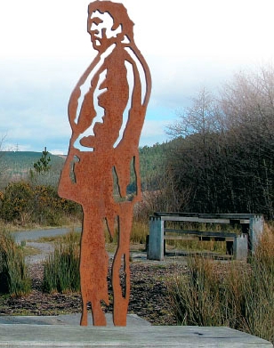 There are two walking trails associated with Richard Burton, entitled ‘The Birthplace trail’ and
‘Childhood Trail’. Each will take you in Richard’s footsteps around Pontrhydyfen and Taibach. Both
trails include a children’s play area and a scenic picnic spot. The most striking feature is the
two 19th-century viaducts that zigzag Escher-like across the confluence of the Pelenna and Afan
rivers, two vantage points offer dreamy views of wooded valleys and tumbling streams.
 -
The Cymmer viaduct
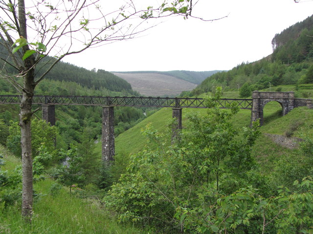 The Cymmer viaduct ran across the deep Afan valley and was built by the Llynfi & Ogmore
Railway Co, it came into use in 1878. The design was supposed to have nine masonry arches, but a
shortage of skilled masons prompted a redesign in favour a wrought iron viaduct.
 -
Polluting Neath Abbey
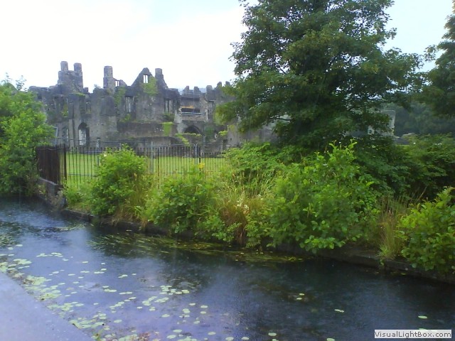 Though the ruins of Neath Abbey had long been abandoned by the Cistercian order before the Industrial
age, it was recognised even then how much damage the polluting atmosphere was doing. One traveller
commented, “neglected Neath, once the ornament of a lovely vale, looms up through its dense veil of
smoke, like the skeleton of a stranded ship crumbling piecemeal to decay”. By 1730, some of the
Abbey buildings were being used for copper smelting, and the rest were abandoned.
 -
Copperopolis- what was in the air?
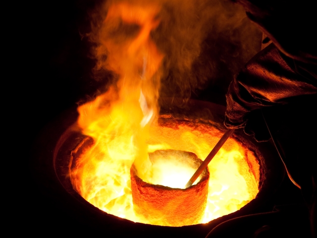 There was a price to pay for the development of Copperopolis; it spawned an area so industrialised in the
late 1800’s, it poisoned the very environment around it, separating copper from its base copper ore
produced mountains of furnace ash and slag, with clouds of smoke laced with arsenic and sulphur. Nothing
could grow around the area and it was the causation of a shortened lifespan for the locals.
 -
Liberty stadium
 During its construction, a variety of names were suggested; most commonly used was ‘White Rock’
stadium (after the copper works of the same name which existed on the site historically). However
‘White Rock’ was only used as a temporary name during its construction and when work was finished,
the name was dropped.
 -
Ynyscedwyn Iron Works.
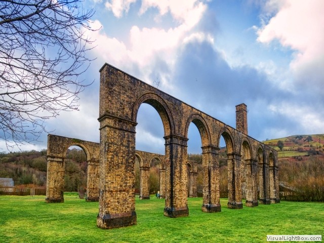 The ironworks began with a single charcoal furnace that was believed to have been built in 1612.
The site later used the hot-blast method which allowed the local anthracite to be used successfully for
iron smelting for the first time, resulting in no fewer than thirty six extra iron furnaces being
built in the area. In 1866 the furnaces were largely demolished and a new charging-bank
was constructed to feed two new circular metal-clad furnaces.
 -
The Anglo-Celtic Watch Co. Ltd
 Though the area is synonymous with coal mining Gurnos had a special talent. The Anglo-Celtic
Watch Co. Ltd based at Gurnos, near Swansea, was the largest watch manufacturing factory in
Britain and one of the largest in Europe and manufactured watches under the ‘Smith’s’ brand. They
manufactured station clocks, pocket watches and even aircraft clocks. In fact Edmund Hillary wore
a Smiths De Luxe to the top of Mt Everest.
 -
Garnant Colliery disaster
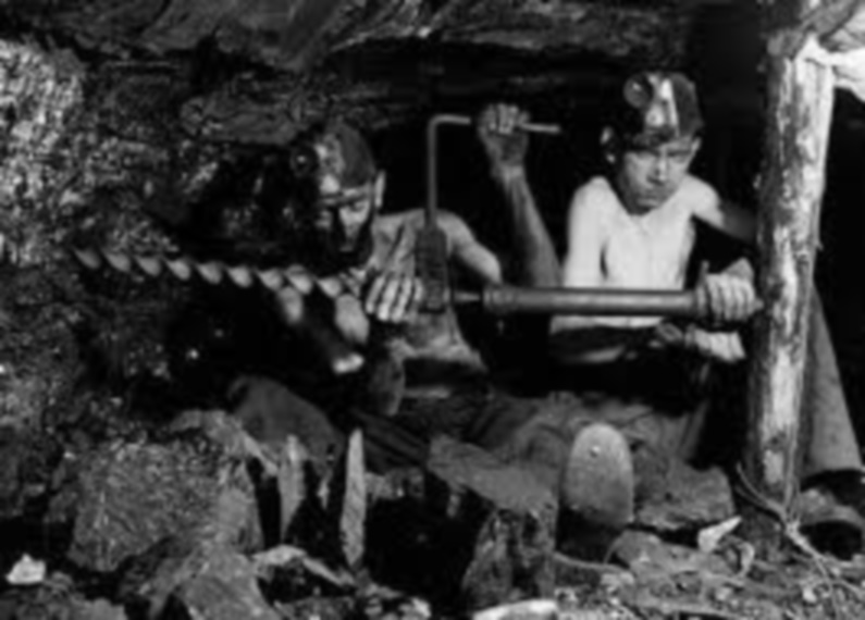 The worse pit disaster in the Amman Valley occured in 1884 at the Garnant Colliery, known locally
as 'Pwll Perkins'. A cage carrying ten miners plunged 220 feet down the shaft when the rope
snaped. Three of the ten miners killed were only 14 years old.
 -
The National coal strike
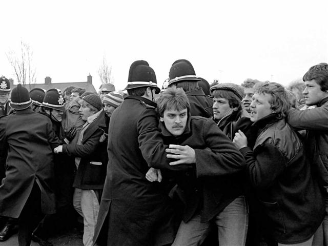 In 1984, the National Coal Board (NCB) announced that four million tonnes of capacity was to be
taken out of the industry, leading to a loss of 20,000 jobs, causing one of the bitterest industrial
disputes in UK history. The National Union of Mineworkers (NUM) president Arthur Scargill called for
miners in all coal fields to down tools. Within a week, most of the country’s 183,000 miners had
walked out and miners began picketing outside collieries. The strike dragged on for more than a
year until workers desperate for money drifted back to work. Cynheidre miners ended their strike
in March, 1985 (alleged to be the first miners in Wales to go back to work), a decision that
divided both the Country, and Community, causing massive civil disturbances.
 -
Duport works
When Margret Thatcher (Prime Minister of the UK from 1979 to 1990) passed away in 2013, she received a ceremonial state funeral (prior to this the last state funeral was for the Queen Mother), half the Country wanted to canonize her (make her a saint), but the other half of the country believed she was their nemesis, and a destroyer of the very communities they were brought up in, for sure, three generations since; the wounds still run deep. Make your own mind up; was she a saint or sinner?
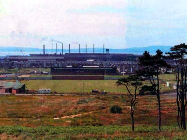 During the nineteenth and early twentieth centuries, Llanelli burst into industrial life. The town prospered,
and its economic wealth was undeniably from the tall chimneys of the steel, copper, and tin works which
overshadowed the north Loughor estuary. Llanelli supplied fifty percent of the world's tinplate, but
with high energy costs and cheap subsidised overseas products, the decline of heavy industry in the
area took a nose dive in the nineteen eighties, and the last of the giant steel mills closed.
 The honourable member of Parliament for Llanelli Mr. Denzil Davies (served between 1970 to 2005),
pleaded with the House of Commons about the Duport works, here’s the transcript; “They will lose their
jobs not because of any failings in themselves, but because of the Government's policies and high energy
costs. The energy costs of Duport in Llanelli now exceed the wage costs of that plant, because of high
interest rates, and because of the high value of the pound”. In its heyday there was around 2,000 people
employed at Duport works (a little steel plant I’d never heard of before this ride), in 1986 the factory
was demolished, and the area was landscaped, it’s known now as the Sandy Water Park.
 -
The Salt House
 At the Salt House, over 35,000 gallons of salt water filled a main tank at high tide, the
water was then pumped to shallow iron tanks which were heated to allow the water to evaporate, at this point
in the process ox-blood or eggs would have been added to allow any impurities to congeal on the surface,
this could then be skimmed off, as the water evaporated salt crystals formed, with the water gone the
salt would be scraped off the bottom of the tanks and taken to market to sell.
 -
The Mumbles Railway slip bridge
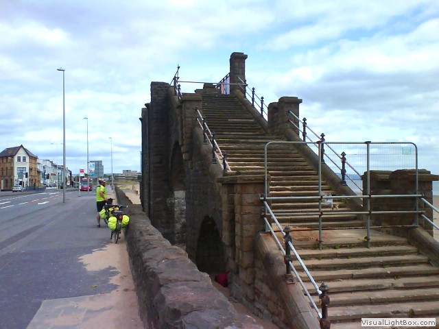 The bridge was built 95 years ago in the Edwardian age to allow people to cross over the Mumbles
Railway and Oystermouth Road, it was taken down in 2005 for maintenance, leaving the only the arched
steps. There are moves to reinstate the steel bridge across the road.

 There are two walking trails associated with Richard Burton, entitled ‘The Birthplace trail’ and
‘Childhood Trail’. Each will take you in Richard’s footsteps around Pontrhydyfen and Taibach. Both
trails include a children’s play area and a scenic picnic spot. The most striking feature is the
two 19th-century viaducts that zigzag Escher-like across the confluence of the Pelenna and Afan
rivers, two vantage points offer dreamy views of wooded valleys and tumbling streams.
 The Cymmer viaduct ran across the deep Afan valley and was built by the Llynfi & Ogmore
Railway Co, it came into use in 1878. The design was supposed to have nine masonry arches, but a
shortage of skilled masons prompted a redesign in favour a wrought iron viaduct.
 Though the ruins of Neath Abbey had long been abandoned by the Cistercian order before the Industrial
age, it was recognised even then how much damage the polluting atmosphere was doing. One traveller
commented, “neglected Neath, once the ornament of a lovely vale, looms up through its dense veil of
smoke, like the skeleton of a stranded ship crumbling piecemeal to decay”. By 1730, some of the
Abbey buildings were being used for copper smelting, and the rest were abandoned.
  There was a price to pay for the development of Copperopolis; it spawned an area so industrialised in the
late 1800’s, it poisoned the very environment around it, separating copper from its base copper ore
produced mountains of furnace ash and slag, with clouds of smoke laced with arsenic and sulphur. Nothing
could grow around the area and it was the causation of a shortened lifespan for the locals.
  During its construction, a variety of names were suggested; most commonly used was ‘White Rock’
stadium (after the copper works of the same name which existed on the site historically). However
‘White Rock’ was only used as a temporary name during its construction and when work was finished,
the name was dropped.
 The ironworks began with a single charcoal furnace that was believed to have been built in 1612.
The site later used the hot-blast method which allowed the local anthracite to be used successfully for
iron smelting for the first time, resulting in no fewer than thirty six extra iron furnaces being
built in the area. In 1866 the furnaces were largely demolished and a new charging-bank
was constructed to feed two new circular metal-clad furnaces.
 Though the area is synonymous with coal mining Gurnos had a special talent. The Anglo-Celtic
Watch Co. Ltd based at Gurnos, near Swansea, was the largest watch manufacturing factory in
Britain and one of the largest in Europe and manufactured watches under the ‘Smith’s’ brand. They
manufactured station clocks, pocket watches and even aircraft clocks. In fact Edmund Hillary wore
a Smiths De Luxe to the top of Mt Everest.
 In 1984, the National Coal Board (NCB) announced that four million tonnes of capacity was to be
taken out of the industry, leading to a loss of 20,000 jobs, causing one of the bitterest industrial
disputes in UK history. The National Union of Mineworkers (NUM) president Arthur Scargill called for
miners in all coal fields to down tools. Within a week, most of the country’s 183,000 miners had
walked out and miners began picketing outside collieries. The strike dragged on for more than a
year until workers desperate for money drifted back to work. Cynheidre miners ended their strike
in March, 1985 (alleged to be the first miners in Wales to go back to work), a decision that
divided both the Country, and Community, causing massive civil disturbances.
 During the nineteenth and early twentieth centuries, Llanelli burst into industrial life. The town prospered,
and its economic wealth was undeniably from the tall chimneys of the steel, copper, and tin works which
overshadowed the north Loughor estuary. Llanelli supplied fifty percent of the world's tinplate, but
with high energy costs and cheap subsidised overseas products, the decline of heavy industry in the
area took a nose dive in the nineteen eighties, and the last of the giant steel mills closed.
  The honourable member of Parliament for Llanelli Mr. Denzil Davies (served between 1970 to 2005),
pleaded with the House of Commons about the Duport works, here’s the transcript; “They will lose their
jobs not because of any failings in themselves, but because of the Government's policies and high energy
costs. The energy costs of Duport in Llanelli now exceed the wage costs of that plant, because of high
interest rates, and because of the high value of the pound”. In its heyday there was around 2,000 people
employed at Duport works (a little steel plant I’d never heard of before this ride), in 1986 the factory
was demolished, and the area was landscaped, it’s known now as the Sandy Water Park.
 At the Salt House, over 35,000 gallons of salt water filled a main tank at high tide, the
water was then pumped to shallow iron tanks which were heated to allow the water to evaporate, at this point
in the process ox-blood or eggs would have been added to allow any impurities to congeal on the surface,
this could then be skimmed off, as the water evaporated salt crystals formed, with the water gone the
salt would be scraped off the bottom of the tanks and taken to market to sell.
 The bridge was built 95 years ago in the Edwardian age to allow people to cross over the Mumbles
Railway and Oystermouth Road, it was taken down in 2005 for maintenance, leaving the only the arched
steps. There are moves to reinstate the steel bridge across the road.