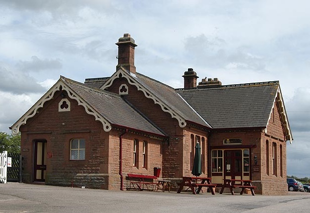
Cycling the route of the Settle- Carlisle railway
 The Settle to Carlisle railway line is one of the most impressive scenic railways in the country. It runs
between the market town of Settle in North Yorkshire and the city of Carlisle in Cumbria. It goes through
remote, scenic regions of the Yorkshire Dales, the North Pennines and the lush green Eden valley, passing
through loads of small charming communities. Threatened with closure in the early eighties, it survived
through National and local pressure groups, saving; twenty one tunnels, fourteen viaducts, 380 bridges,
twenty stations (eleven are still open), twelve signal boxes (10 are still operational), and 150 Railways
workers houses (all are now privately owned). I intend to cycle from one end to the other then ride the
train back. The ride is spread over four days and isn’t actually many miles per day, but I’m under no
illusions it’s going to easy, there are mountains to cross. Let’s hope it’s going to be worth it!
Day 1- Newport to Settle (car)
I considered going by train to get to Settle, but this involved three changes and significant expense. Driving up was the other option, then leave the car in Settle, leaving the car at the station (£9) was cheaper than on the ‘JustPark’ app. Settle is a wonderful, bustling, historic Yorkshire Dales market town at the gateway to Upper Ribblesdale and in sight of the wild and lovely Forest of Bowland. The town is full of quality independent shops, cafés, inns and restaurants. The surrounding limestone landscape abounds with dry stone walls, meadows, scars, peaks, field barns, waterfalls, becks, and sheep! There are some nice hotels here (though their prices are a little overinflated), so to keep the costs down I’m staying at an AirB&B tonight, ready for the expedition tomorrow.
Day 2- Settle to Cowgill (23 miles)
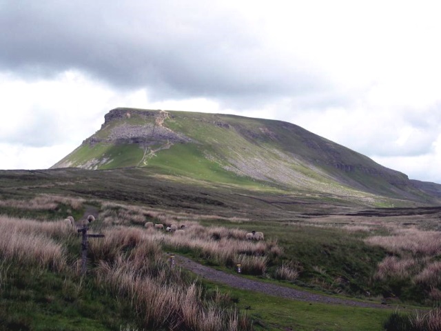 Starting at 600 feet above sea level, we left Settle gradually climbing and pass two tiny viaducts 'Little
Sheriff Brow Viaduct', and 'Sheriff Brow Viaducts'. I had to have a little peak at Helwith Bridge and the
pub just below with same name sake. After six miles we reach ‘Horton in Ribblesdale’ with a cracking view
of Pen-y-ghent mountain. Crossing the railway, and loosely following it to Selside, forever climbing. The
road was teaming with heavy quarry lorry's and at 9°C with a ferocious headwind, it wasn’t a pleasant
ride, but at the road junction with the B6255 I stood in awe, directly in front was the ‘Ribblehead
viaduct’ the very structure that started this quest off. In the background was the astonishing Whernside
mountain, highest of the Yorkshire Three Peaks.
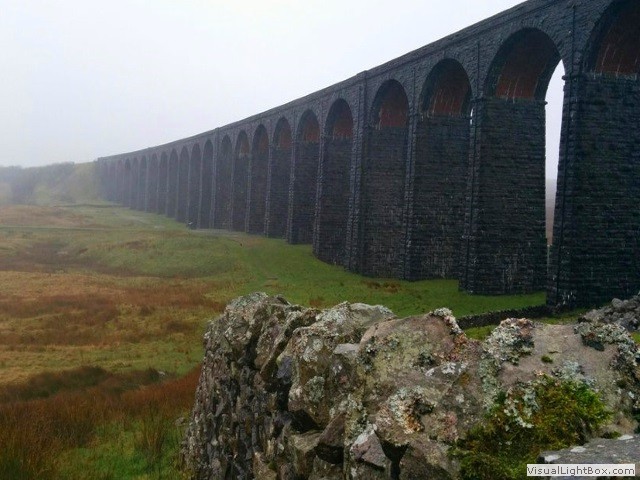 I took the customary photo’s of the most iconic site in the Dales, both visually and for its historical
interest, and rode a few miles to St Leonard's Church at Chapel-Le-Dale. It’s back uphill at first to
get back to the viaduct, where I popped into Ribblehead station and had a coffee there, this is no
ordinary café. Over 150 years have passed since it was opened, and in 2000 it’s original condition
was restored. Now heading north east on the B6255, the wind spat fine droplets of rain at me, and
after twenty miles since I left this morning, I was finally at the peak altitude of the day at 1388
feet above sea level. Two miles after turning into 'Newby Head Gate', we start to descend on a patchwork
of tarmac and Dent head Viaduct appears on the brow in the distance, free wheeling under a bridge the
viaduct opens up it's full magnitude. We’re now on a single track road following the tiny juvenile River
Dee and we’ve dropped down enough height to be
  surrounded by tree canopies. One can think we’re at the edge of a forest, but the fact is the river Dee
has created an oasis along its banks, and amazingly the temperature increased to 13°C. Just by a
white farmhouse placed next to a long derelict building, the vista opens up between the two buildings
to the site of Arten Gill viaduct. We're only ½ mile from our stop for the night, we're staying
in a 200 year old drovers Inn; The Sportsman's Inn. Today was truly an incredible (leg aching) experience,
the weather was horrible, and it’s predicted to get worse the rest of the week.
Day 3- Cowgill to Kirkby Stephen (19 miles + 6 extra miles)
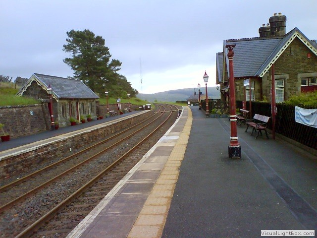 We set off early and crossed the minnow River Dee, almost immediately climbing up ‘Coal Road’, in
the first mile it's walking with trainers up a 19% incline. There's a small rest-bite just
to have a look at Dent station, the highest railway station in England. There’s a sign outside the
station- 'winter conditions can be dangerous' and they aren't kidding. It's nearly four miles since
we started this morning and we’re now 1726 feet high, it’s pretty desolate except for Dodderham moss
woods and some sheep. We’re climbing up over the top of the World, and the temperature fell below
9°C again, but it felt much colder with the howling side wind, and if this is summer, what's it like
in the winter? Baugh Fell looms in front as we descend into Garsdale and now shivering I have a peak
at the station. If you want to get away from the rat race, there’s a row of cottages near Garsdale
station, seriously I bet these houses are completely cut off in the winter. Turning right onto the
A684 it’s not long before Dandry Mire/Moorcock Viaduct appears on the right, just after is ‘James
Junction Methodist Chapel’, opened in 1876, the same year passenger traffic began on the railway, it
served the local community of railway employees and farmers.
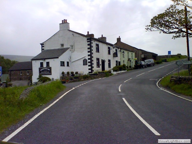 We came across the ‘Moorcock Inn’, it's absolutely in the middle of no-where, we’re talking the
‘Slaughtered Lamb’ isolation. With nothing else around its a no-brainer for coffee where I stripped
off (not completely) and thawed out by a log fire. We found out this ancient Inn dates back to the
1740’s, well before the railway was even considered. We continue on the B6259 and as outstandingly
rugged, beautiful and peaceful as this landscape is, I’m glad I’ve got my music. We are paralleling
the Settle Carlisle railway and I’m almost wishing for a train, something to look at besides sheep
and self-perpetuating stone walls. Some say; be careful what you wish for, but on this occasion I’m
happy with the result as Pendragon Castle appears on the left, reputed to have been founded by Uther
Pendragon, the father of King Arthur. Generally heading downhill, we still proceed up and over
undulating green hills, passing loads of medieval barns alongside the trickling River Eden heading
for Nateby.
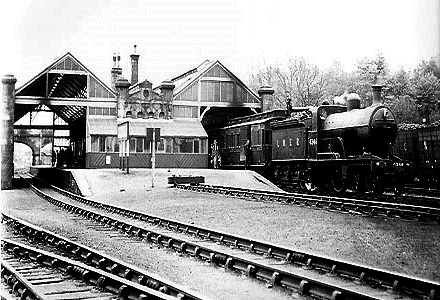 Less than a mile from Nateby is Kirkby Stephen, for me perhaps the most interesting village
on-route. Kirkby Stephens has a secret, not only did the Settle to Carlisle railway (owned by
the Midland railway) pass through the town, so did the North Eastern railway route (formerly
the South Durham & Lancashire Union Railway). The Beaching axe shut the latter in the sixties
leaving behind railway routes which spider away from the town in all directions of the compass,
another legacy of the closures are some epic disused viaducts within striking distance of the town,
it would be a travesty to miss them. So, ½ mile from the hotel, we turn off Nateby Road onto
a little path that leads down to the North Eastern railway route, now heading east in a huge circle
passing over Pod Gill viaduct and then Merry Gill viaduct. The route takes us back onto a road where
we finally head back into Kirkby Stephen crossing the River Eden on ‘Franks Bridge’, arriving at our
destination hotel; the Kings Arms. Most of Kirkby Stephens village is a conservation area predominately
with 18th and 19th century buildings that are situated on older foundations, the high street has half
a dozen or so antiques and oddity shops, it looks like an old coaching town, now very drab and
depressing. Today’s distance was in-excess of twenty five miles, and the majority of the miles
have been uphill, I’m really tired, so it’s (in the following order) shower, food and bed.
Day 4- Kirkby Stephen to Langwathby (34 miles)
 It was a long day yesterday, not miles just hours and the cold, my legs are still aching. Today has
the most mileage and is possibly the hardest day, again not because of the miles, but because of the
terrain, it has a sharks teeth profile and of course it's the worst day for weather. We start climbing
straight away, and pass Kirkby Stephen station (on the live Settle Carlisle route), it’s a beautiful
relic of an age where they made a building look pretty as well as functional. Heading for Smaresdale
and too good an opportunity to miss is probably the most impressive viaduct in the area, worth a little
diversion. Jumping onto the North Eastern railway path again heading for Scandal Beck, first we go under
Smardale viaduct, the highest viaduct on the very much still active Settle to Carlisle line. Now we pass
through a steep valley and through Demesme Wood where the light diminishes such is the depth, and
steepness of the valley. Now into the environs of Smardale Gill, I can see the clouds again, opening
up to the architectonic Smardale Gill Viaduct, an exceptional piece of Victorian engineering. This
viaduct diagonally cross’s the acute sides of the
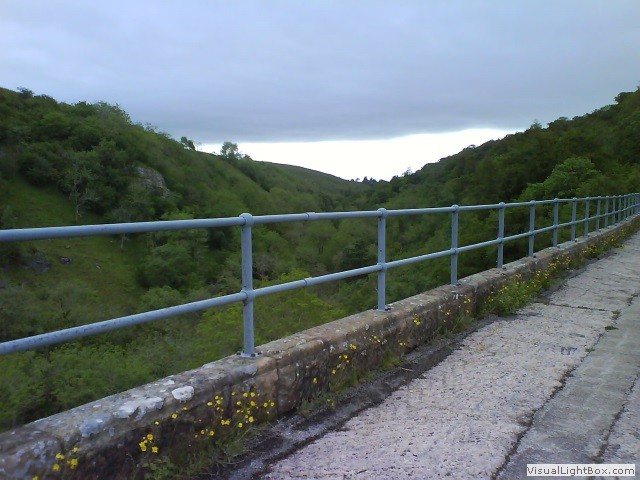 valley and then runs longitudinally along it, is there any canyon the Victorians couldn’t cross? Retracing
my route a mile back to Beck Lane the Smaresdale viaduct is visible again, into Tarn Lane the dry stone
walls have been replaced with hedges bilateral to the road. It leads us to Crosby Garrett and turning left
at the end of Tarn Lane opens up the view Crosby Garrett viaduct, it did have an extensive marshalling yard
sadly thats gone and there's no station here any more.
We leave the little hamlet on Gallansay Lane eventually finding Mask Road and Appleby-in-Westmorland.
Appleby castle is placed on a mount in the centre of Appleby-in-Westmorland, but though it is now a hotel,
visits are by appointment only, so I plodded on over Bridge Street. We had a small diversion to Appleby
station before setting off again on Battlebarrow Road to Long Marton. Long Marton station closed in the
sixties, but it still has a station building which is now private. The scenery glides through meadows
with actual cows in them (instead of sheep), it's a stark contrast to the moors over the top of the
mountains.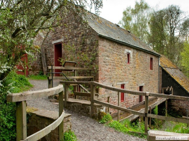 We pass through New Biggin and over the railway to Acorn Bank Garden and Watermill, it’s a must
to visit this place. Once refreshed it’s time to crack on and we cross the line at Culgaith Signal
Box, the adorable station (now a private residence); a red brick cottage would fit into any village
as a residential house, closed in 1970, and is the only station on the Settle-Carlisle Railway with
non-standard buildings, possibly because it was opened four years after the other stations in 1880.
Leaving the village on a straight road you can clearly see Cumbrian mountains far away situated in
the ‘Lake District’. We cross under the line again on the B6412 heading for Langwathby our stop for
tonight at the ‘Shepherds Inn’.
Day 5- Langwathby to Carlisle (22 miles)
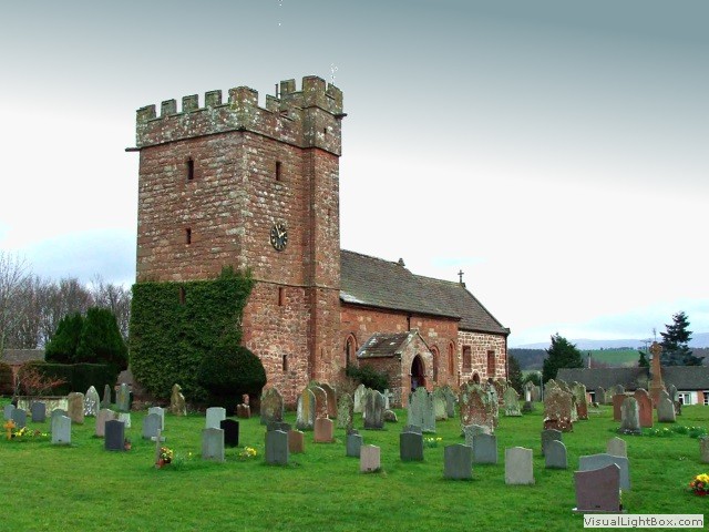 It’s lovely riding along green fields to Great Salkeld, we pass St Cuthbert’s Church, the current
building was rebuilt in 1080, but like most churches there was an earlier building here. There’s a
horse drinking trough at Scatter Beck which believe it or not is grade II listed. The Cumbrian mountains
are now in front of us as we plod into Lazonby which holds the last but one station on the railway before
Carlisle. We cross the tracks and turn left into Fiddler’s Lane after a few miles we turn right onto a
road that is so straight, it has to be an old Roman road, which has provenance considering how close we
are to Carlisle. Turning right onto Armathwaite Road we roll under Armathwaite viaduct. Out of Armathwaite
on Front Road it gently rolls up and down and continue on an unclassified road still with the Settle
Carlisle track by our side. We turn left towards Cumwhinton and crossed the line again with a good view
of the old station, now a private residence. The platforms are still there but covered in grass, and
there’s a waiting room on the south platform. After eighteen miles we turn right into Cumwhinton road,
the car free lanes are over as we jump onto the A6 into Carlisle. My hotel (one of the cheapest in Carlisle)
for tonight is the Milton Hilltop Hotel.
Day 6- Carlisle to Settle (Train)
 Today I’m travelling back to Settle on the very track I’ve shadowed for the last four days and
I’m quite excited. The 72 mile route (click the image for larger version) of the Settle to Carlisle
Railway (as it’s known) is one of the most scenic and impressive railways in the UK. The train journey
is recommended to anyone who would love to see two of Yorkshire's celebrated ‘Three Peaks’ (without
walking them), but I’ve ridden the route and somehow, I feel I deserve the best seats in house on the
train back. Northern rail’s DMU’s that go from Carlisle to Settle don’t have first class seats, though
some steam train excursions do this route regularity and they do have premiere seats, but they’re
usually one way from Settle to Carlisle. Researching the dates; ‘Statesman Rail’ have a steam excursion
on the day I’m travelling back to Settle, the organisers never give a timetable because they only pick
up at certain stations (hours before the Settle Carlisle route), but I do know that that train will stop
at Appleby this afternoon for water, and I know they will be there for an hour or so. Therefore, the best
I can do is get off at Appleby before twelve and wait until the steam train comes in, stare through the
first class carriage windows, ogle at the engine, take some photo’s and get back on another train to
Settle, then at least I’ve had my nostalgic fix of Victorian opulence.
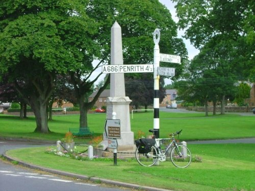 For someone fitter than me, this trek could be done in two days, but they would have to be racing
snake fit. I suffered many times on this ride, safety wise I never ride without my polar heart meter
and ride accordingly to it and if that means getting off and resting, then so be it. The mileage has
been kept short on purpose, for the ascents have been significant, but the main barrier was the
weather, it was horrendous, it was so cold and the wind was relentless. Visiting all the old and
current stations on-route (something it would be difficult to do on the train!) I'm so glad I did it!
-
Gallery
 Why not have a look at the gallery relating to this ride. Click the image or the title.
 -
Helwith Bridge Inn
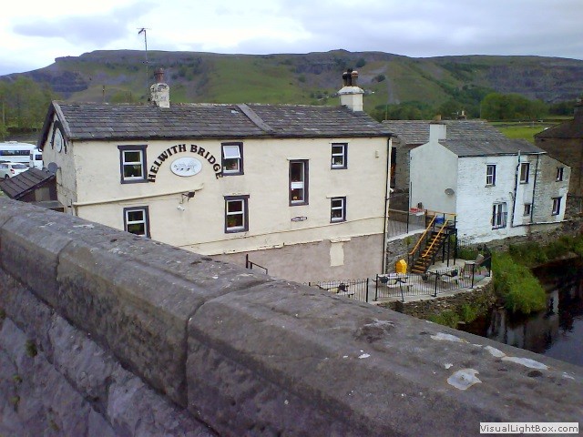 The building of the Helwith Bridge Inn dates back to the 1820’s when it was built as a canteen
for the local quarry workers. It then became a public house in 1870 when the adjacent railway line was built.
 -
Three Peaks of Yorkshire Club
 The three peaks walking challenge began in 1887 and took ten hours to complete. Now those that can
manage the task in 12 hours or less are able to join the exclusive Three Peaks of Yorkshire
Club that is operated by the Pen-y-Ghent Café in Horton.
 -
St Leonard's Church
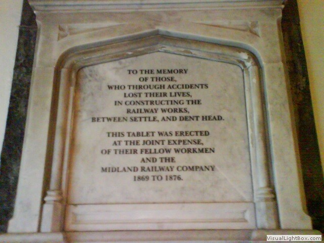 The church is a grade II listed building, built in the late 17th century, but I was here to
pay respect to some of the construction workers of the Settle Carlisle line who were buried
there. I couldn’t find the graves as the cemetery was unkempt and overgrown, but in contrast,
inside, the church was in good condition. On the wall was a memorial giving a poignant reminder
of the 200 railway folk; men, women, and children who died in the 1870s during the construction
of the Settle-Carlisle railway.
 -
The Sportsmans Inn
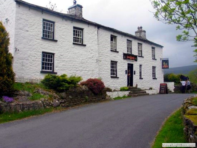 There used to be 4 pubs in Cowgill, now only The Sportsmans Inn is left.
 -
Coal road
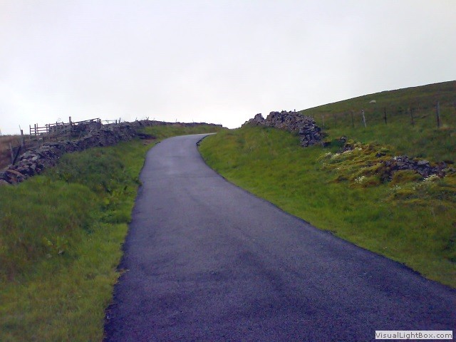 Coal Road connects Garsdale Head with Dentdale, and while the mines above Dentdale were abandoned
after the railway brought cheap coal from farther afield, the traditional name remains and is a
testing and beloved climb for Northern road cyclists.
 -
Hawes Junction rail crash
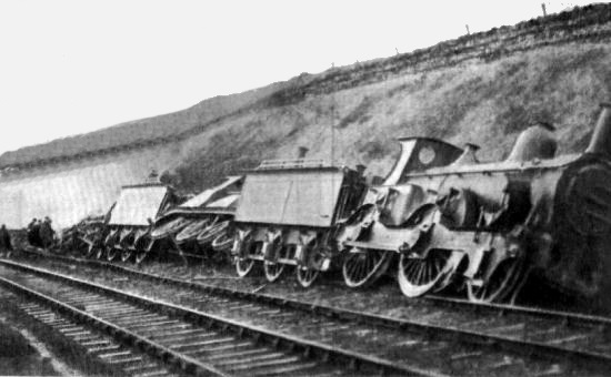 When the St Pancras to Glasgow express collided with a pair of light engines on Christmas
Eve 1910 near the Lunds viaduct just behind the Moorcock Inn, the bodies of the 12 victims were
stored in the pub's cellar. The dead were later buried in the small churchyard at Hawes.
 -
Pendragon Castle
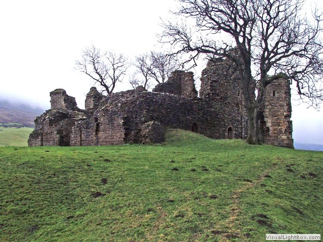 Pendragon Castle is now a ruin in the Mallerstang valley. It occupies a site close to a young
River Eden with the peaks of Wild Boar Fell and Mallerstang Edge towering over it.
 -
Stainmore Railway Company
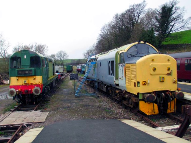 In 1997, Kirkby Stephen East was derelict after closure of the line to passengers in 1962 and
freight in 1974. The site was purchased by Stainmore Properties Ltd and Stainmore Railway Company
volunteers have worked over the years to develop a Heritage Centre and an operational railway which
welcomes visitors at weekends.
 -
Franks Bridge
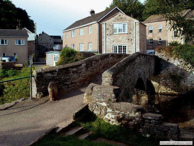 The bridge is a 17th century corpse lane bridge and there are stones at the far end where the coffins
could be rested on their way from Hartley or Winton. There are reports of a ghost referred to as Jangling
Annas who haunts the bridge jangling her chains. She is said to have been a prisoner at Hartley Castle and
after escaping in her chains, drowned in the river.
 -
Smardale Gill Viaduct
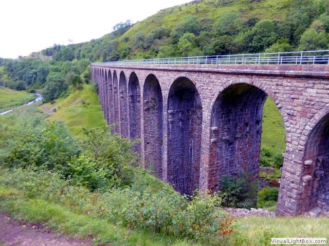 The desire of British Rail Property Board to demolish it drove the formation of the
Northern Viaduct Trust in 1989. Grants were secured which helped towards the cost of
renovation, approaching £400.000. The work was completed in 1992, enabling a permissive
path to the opened across the deck.
 -
Appleby castle
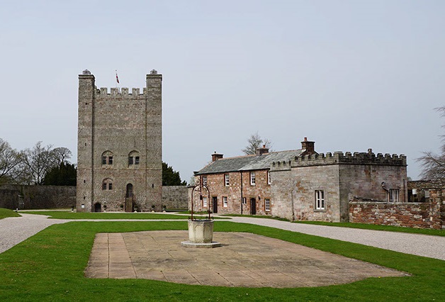 During the twelfth century the castle alternated between English and Scottish ownership as the
two nations vied for control of Westmorland. In the mid thirteenth century it passed into the
hands of the powerful Clifford family.
 -
Acorn Bank Garden and Watermill
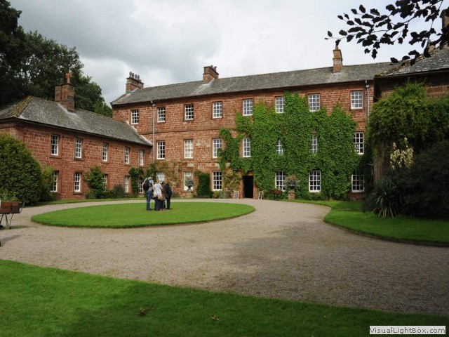 The manor passed to the Knights of the Hospital of St John, who held it from 1323 until the Dissolution
of the monasteries by Henry VIII, since then it was a family home, nursing home and now owned by the
National Trust, and they have a nice tearoom in a courtyard.
 -
Langwathby station
-
Armathwaite signal box
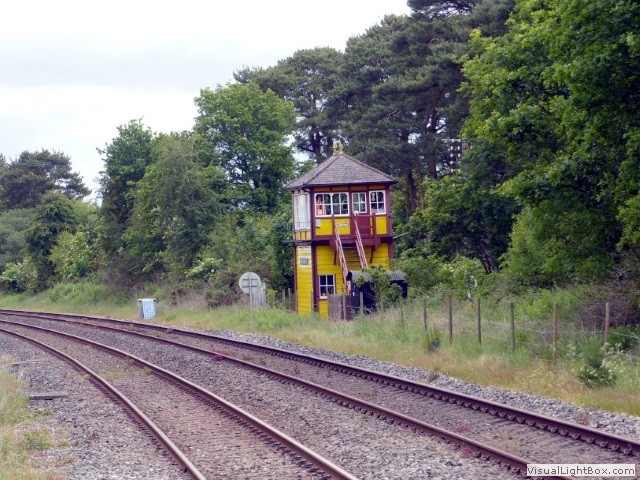 Opened in 1899 it only closed in 1983. The signal box is still owned by Network Rail, but it
is classed as a 'non-operational heritage asset' and opens for pre-planned tours organised
by the Friends of the Settle Carlisle Line. The original lever-frame is still in position
and the signal box has been furnished with a number of interesting exhibits.
 -
Appleby-in-Westmorland
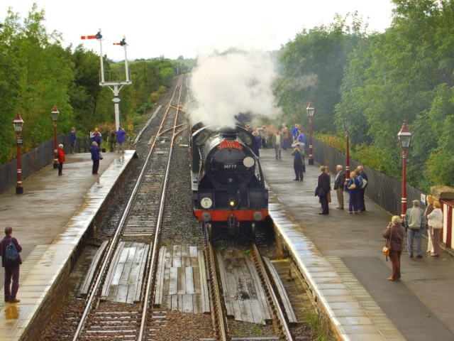 After waiting for the train (which I thought was the only one that week) I discovered
there was one steam train a day. Steam trains stop at Appleby because of the the water
tower, which was only installed by the local Round Table in 1991 specifically to service
steam specials. Click the image for more.
 -
Victorian Engineering
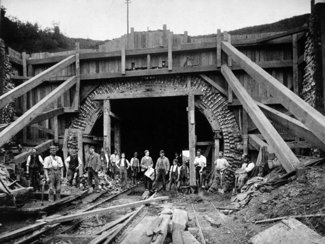 The Settle Carlisle line was constructed by men who lived a harsh life in shanty towns along the
route (click image), with little to supplement their manpower except dynamite. Hordes of 'navies'
worked on the route in appalling conditions often in a quagmire of a landscape. There they lived,
drank, fought, worked, were born – and died. Smallpox was rampant, as was malnutrition, men died
at such a rapid rate that they were buried, unmarked, on the moors. The structures, however, are a
testament to their willingness to persist against all the odds. What an incredible railway!

