Portsmouth- Bideford- Lundy- Ilfracombe- Barnstable
(7 days- 88 miles)
This is a magical ride, it starts at Plymouth and follows the old Plym Valley railway line, then we pursue Drake's Leat (a watercourse constructed in the late 16th century), onto the Granite way railway line (an old quarry branch line), next onto the Tarka trail (made famous by Tarka the otter) to Bideford. Then something I’ve wanted to do for years; Stay on Lundy- an island in the Bristol channel (so secluded there’s no mobile phone coverage) and finally after two days on the island sail back to Ilfracombe and ride back to Barnstable. It is 90% off road.
Day 1- Plymouth to Marsh mills (6 miles).
When I put Newport to Plymouth into National train website, it came up with an extortionate price, but from experience, if the journey is split up into single bite size chunks, it’s usually cheaper. There was a saving of £30 buying a single to Bristol Temple Meads and then catch the train to Taunton and finally onto on to Plymouth.
However, I cocked the times up we were due to meet, and by luck, we caught the 1115 from Newport to Taunton. Well, the bottom line is, we caught the wrong train at the wrong time, which ended up being the right train all the way to Taunton. At Taunton we changed for Plymouth. As mentioned on a previous trip, the journey from Taunton to Plymouth is worth doing on its own. The line after Exeter goes southbound following the river Exe, opening up into some extraordinary views of the estuary, passing oyster farms, winkle pickers and rusty relics of long abandoned boats, on the right; Powderham castle flash’s past. At Dawlish Warren the line follows the sea heading south west, with beautiful sandy bays lapped by turquoise water. At Teignmouth the line follows the river Teign. After Newton Abbot, the line turns inland and we speed past Totnes where there is a heritage railway, finally entering Plymouth 15 minutes later.
 We disembarked at Plymouth with our bikes heavily clad with a week’s supply of clothing (including
walking gear), so the lifts were the best option. It’s extraordinary how many able bodied people use the
lifts; we changed into our cycling gear on the station platform and let the queues die away. It was six
miles to the hotel, through the town and over the river Plym, where they’re constructing a new cycle
path/pedestrian bridge, to link the town to the start of the Plym valley trail. We cycled through Saltram
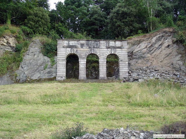
park and past a large folly with three arches, the path was fairly bumpy and not suitable for road bikes. We
stayed at the Premier Inn at Marsh mills, but ate at Sainsbury’s hypermarket just opposite to keep costs down.
Day 2- Marsh mills to Okehampton (36 miles).
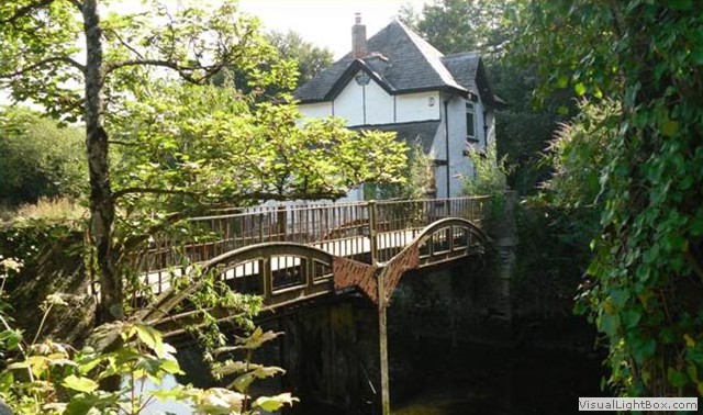 The next day we set off for the Plym valley trail on a glorious sunny day, crossing the river Plym (now a small
tributary) on the Lee Moor Tramway Bridge, constructed in 1823 to transport English China Clay to Plymouth from
the quarries at Lee Moor. We came across the base of the Plym valley heritage railway, sadly it was closed. The
surface is asphalt and was good going following the river Plym down to our left and the old canal on our right. Once
you reach Plym Bridge, you will need to cross the little road that feeds the car park, then up an incline to get
back onto the old railway bed. We come across the remains of Rumple Quarry engine house. Built in the late
1860’s, it housed a powerful steam engine which hauled the stone up from Rumple Quarry, ready to transfer onto
the waiting wagons.
There were more ruins further on, after cycling under the first stone road bridge, on the right you'll see the ruins of cottages, built to house quarry workers. The first viaduct we cross has some free viewing telescopes to view Peregrine falcons nesting at Cann quarry below, after this we cross the Riverford Viaduct, and the Bickleigh Viaduct. We ride past the old Shaugh Bridge halt with the platform still intact, not long after the old station, we arrive at the Shaugh tunnel built by Brunel, now dimly lit (the diffused lighting is so not to disturb any bats that live in the tunnel) and cold. The tunnel curves to the left, so you can’t see right through it. Soon after the tunnel we start veering slightly to the left, and climbing, along the ramp that was built to replace a old nasty off-road section. We follow the tarred track until we reach the village of Clearbrook, where we turn left and cycle up the hill. The views are superb back across the hills and the weather was perfect and even at this height, it was short sleeves and shorts.
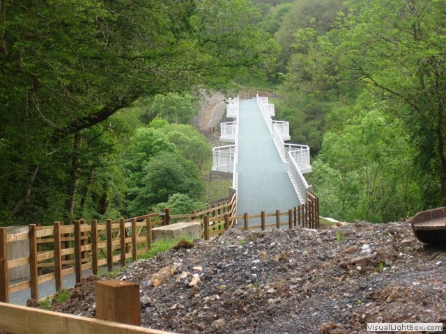 We turn right across Drakes Leat and follow it to Yelverton passing some old concrete tram tracks. We cross the
busy A386 and continue along Drakes trail, after a short while at last we are heading down hill and are motoring
along. The path is gravelly in places and therefore not very accommodating should you need to brake quickly. The
course now follows the old railway track that linked Yelverton with Tavistock, we cross the Ham Green Viaduct before
descending to Gem Bridge, a viaduct that spans the Walkham valley. Soon we are travelling through Grenofen tunnel, so
called as it passes right underneath the hamlet of Grenofen. Shortly after we reach the outskirts of Tavistock an
ancient stannary and market town, a little way in we crossed the river Tavy on a small footbridge and rode around
Tavistock college. After twenty miles without tea, it was time for a brew. We left the planned route and headed
along the canal to Tavistock leisure centre, where we had tea and a cake.
Now refreshed, it was only a mile back to NCR 27, up a hill and back onto another disused railway. Then we cross the iconic Tavistock viaduct, the Viaduct spans several streets in the town below. There are five spans of 50 feet and three spans of 32 feet. At the far end of the viaduct was the station, Tavistock (North) Station was the second largest on the line, covering about five acres, now sadly only the station masters house remains. The station grounds were bought by the west Devon borough council. After a mile we leave the track and jump on a small road which feels like going up a vertical ascent. Two miles later we turn off the road and back onto the railway track, but this only lasts a few miles before we go back onto the road again and go up into the heavens. We turned right off the recommended cycle route 27 and headed toward Mary Tavy.
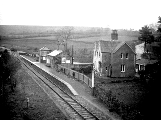 Just before a little bridge, if you look across the right fields, there were obviously two railway levels. A
station was opened here in 1865 and was originally known as Mary Tavy station but was changed to Mary Tavy and
Blackdown station. When first built, it had up and down platforms on either side of the track for the London
and South Western trains travelling on the line between Lydford and Tavistock, and on to Plymouth. To the left
the station building still remains complete with a single platform, now converted into a residential home. We
continued on route 27 towards Brentor, now we were climbing up into Dartmoor National park where we stopped to
ask a lady in her garden if we could have some bottle refills. The wind picked up and whisked us up the hill in
scorching conditions. Then we dropped down and the NCR27 signs showed two different directions to proceed (one
being a winter route). My Garmin chose straight on and I knew we were nearing Brentor station. Just off the route
is this magnificent refurbished station, it has since been a B&B and is now a residential home.
 We climbed on a main road towards Lydford and dropped down where the station was, nothing is now left of the
station. This was the main junction where the GWR and LSWR lines from Plymouth diverged, the station was very
popular with Victorian tourists visiting the healing waters of the ‘white lady’, a waterfall in the Lydford
gorge. The gorge is an amazing place for wildlife, plants and trees. Continuing on, we cross under the old railway
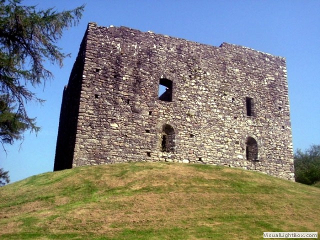
line to Lydford village. The pretty village of Lydford is home to Lydford castle placed right next to the main road,
built in the 13th century.
Just outside the village we turn off onto the Granite way trail, it’s now downhill on a smooth tarmac track. Before long we were passing over Lake Viaduct with views of Sourton Tors, and an invite to go and see the lake. A little way on we come to gates across the path, on closer inspection the tarmac stops and the path becomes permissive; with the sign ‘please respect the owners rights on the path, if the gate is open proceed, if shut do not proceed’. Well, what strikes me is, unless he locks the gate, each user is going to leave it open. The permissive path is only about two hundred yards long and quite muddy before going back on the full tarmac trail. Now slightly uphill we come to Meldon viaduct, which seems to be really high. Meldon Viaduct was built in 1871 to carry the London and South Western Railway (LSWR) across the West Okement River. It was constructed of wrought iron and cast iron. On the other side of the viaduct, tracks remain as up until recently the route was used for the quarry.
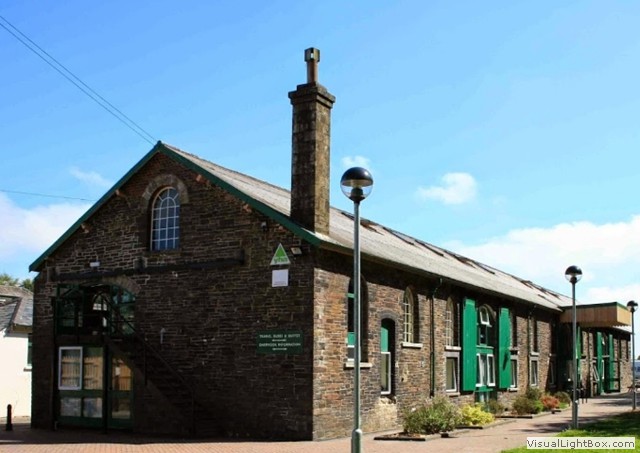 Before long we reached the end of the Granite way (and the end of our day) at Okehampton station. We dropped
down into Okehampton and bought some wine (even though our accommodation has a bar), we wearily rode back up
the hill and after several photos of the deserted station, we crossed the tracks and entered
the Youth hostel. It’s not cheap at £56 for a twin, but what better place to stay? The hostel is inside
a converted Victorian goods shed next to Okehampton rail station. It has a café, a self-catering kitchen, games
room with table tennis and pool tables, and a lounge with a flat-screen TV, there’s also free Wi-Fi in public
areas.
Day 3- Okehampton to Bideford (30 miles).
It was a beautiful day when we left the YH and proceeded through the town crossing the river Okement and climbed up and up and up. At Jacobstowe we zigzagged through the pretty village with thatched cottages and past the church of St James, originating in the 12th century and largely rebuilt in the 15th century. Once through the village we turned right and after a few miles we came across a herd of deer. The road now opens up and climbs, a very subtle climb but long, at the top we stopped and had a drink on an aptly placed picnic bench. From here, the views were commanding, we could see back to the heights of Dartmoor. We passed an obelisk monument pointing high into the sky, commemorating Colonel William Morris from 1854.
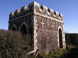
The Garmin turned us off the road onto a farm track, it was a toss up to carry on, on the main road or continue on the mud track. The farm track won, leading us to a strange folly we now know as the Belvedere Tower built to celebrate the shooting prowess of Colonel Pearse who at the age of 22 in 1875 won the Queen's Prize for rifle shooting (there seems to be a lot of Colonel’s in the area). After ore inspiring views from the tower we continued on and found tarmac again leading us into the top of Hatherleigh. We dropped down into this one street town and had a brew in a small cafe, the Cornucopia.
The down side to this was we had to climb back up the steep climb we’d just rolled down. The NCR 27 will have you cross the A386, but having plotted the route on the sat nav, I knew the Tarka trail was just 2 miles from here, along the main road. We crossed the river Torridge and passed a railway abutment and climbed a steep hill. After the miles off road and many more on the tiny country roads, this was the first major road we’d been on, and true to ‘A’ road dangers, a stupid motorist passed within inches of me whilst climbing the hill. This had me ranting and a little scared.
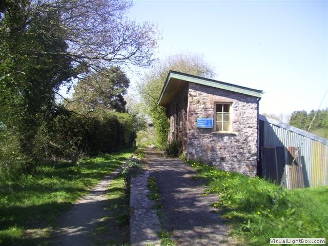 After one more mile we turned off the main road and immediately stopped to view the remains of Meeth
Halt station, the iconic start of the Tarka trail. The surface was stone chips, but at least we were away
from the maniacs on the main roads. It took us into woodland with the sun now casting shadows through the
trees. There was a small platform before we crossed Bury Cross road and onto a good surface. We pass Yarde
Orchard where there is a small cafe and a tepee camp site. From here the track goes up hill ever so slightly,
but enough to feel it, when we cross the B3227 the trail becomes asphalt. We cross the river Torridge again,
and this time it’s much wider, before going under a road bridge to expose the old Torrington station. Here
the old station has been restored and converted into a restaurant, opposite is the old goods building, now
with cycle hire and a cafe. We plonked ourselves down and tasted the coffee and chocolate ice-cream. Moving
on, we cross the river Torridge three more times before crossing it as an estuary. The trail begins to climb
ever so slightly into Bideford, until we enter Bideford station. Bideford station has had many attempts to
convert it back to a heritage railway and is well restored ready for the next attempt.
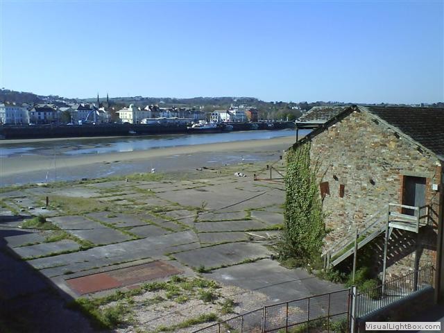 Through the trail continues to Barnstaple, we are staying here at the Royal hotel as the ship to Lundy
leaves in the morning. The hotel were very accommodating with the bikes, allowing us to put them inside in
a hallway, obviously being so close to the Tarka trail, they must be used to Bikeys. I believe our room was
the best in the house overlooking the estuary and the MS Oldenburg; our transport to Lundy. The sun was still
bright shining into our room, just below us there was evidence of Bideford’s former glory as a port with dock
buildings below us. We showered and changed, then crossed the bridge. We needed food and wine for the stay on
Lundy, Lundy has its own shop, but we believed they wouldn’t have the selection we required. After a few drinks
at the bar in the hotel, we retired to bed. Before snoozing, I had a quick peek at my Polar heart monitor;
it revealed we had used 30% less calories today than our first day of riding, not surprising really as the
first day was very hilly.
Want to continue reading an account of the journey around Lundy and sailing back to Ilfracombe then the ride back to Barnstaple? Click here.
-
Gallery
 Why not have a look at the gallery relating to this ride. Click the image or the title.
 -
Powderham Castle
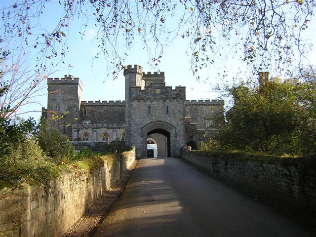 Powderham Castle is located in a unique, picturesque setting beside the Exe estuary. Six hundred years of
history are contained within the walls of one of England's oldest family homes. Sir Philip Courtenay began
building it in 1391 and it has remained in the same family to this day, currently home to the 18th Earl &
Countess of Devon.
 -
Saltram park
The Amphitheatre folly overlooking the Plym Estuary is one of several follies in Saltram park. The stone arches are simply a sham, with no building behind them. The park is set in a rolling landscape that provides precious green space on the outskirts of Plymouth. Strolling along the riverside or through the woodland, you can almost forget that the city lies so close.
-
Plym valley line gauges
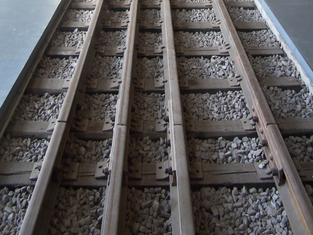 The original line had Brunel’s broad gauge of seven foot and one quarter inches, so to accommodate
L.S.W.R trains a third rail had to be introduced. To complicate matters, at Lee Moor Crossing, the
Lee Moor Tramway had a four foot six inch gauge, this crossed the railway line and so gave rise to a
very rare three gauge crossing. The remains of this crossing can still be seen at the Plym Valley
Railway today.
 -
Shaugh Tunnel ghosts
 There are supposed to five separate ghosts in the Shaugh Tunnel, but the one that sends a shudder through
me, is that of a bullish, broad man, accompanied by a big nasty looking dog. This man is supposed to be a
former foreman during the building works of the tunnel. He appears near the bend of the tunnel, and seems
to have a reputation to physically push people. There have been several reports of people being pushed, some
that hard they fell off their bikes. I did not find the tunnel oppressive and it’s a pity he didn’t push
us up the hill on the other side of the tunnel.
 -
Will Tavistock viaduct see another train?
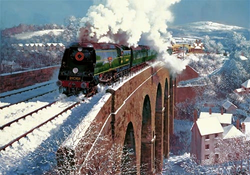 One thing the murderer of railways didn’t like; was duplicate or alternative railway routes to the same
place, now over 50 years on Dr. Beeching must be turning in his grave. The main line through Dawlish took
a battering in early 2014, costing over 35 million pounds to repair, cutting off west Devon and Cornwall
for two months. During the repairs alternative routes were discussed, one such route was Okehampton to Plymouth
(via Tavistock). Now the route is being discussed again, with early plans to be submitted in 2016.
 -
Old beam engine house
 The small village of Mary Tavy was once home to the world's largest copper and arsenic mines and there are
many old mines in the area around the village. On the main road out of the village, you can see an old mine
works building which once housed a beam engine.
 -
Lydford castle
 The pretty village of Lydford is home to Lydford castle placed right next to the main road, built in
the 13th century, it later became a prison well known for its harsh punishment and cruel regime. During
the reign of Henry VIII it was described unflatteringly as "one of the most heinous, contagious and
detestable places within the realm."
 -
Meldon Quarry
 There may be a piece of Meldon near you. Meldon Quarry’s granite stone was extensively used as rail
ballast. Rail Ballast is employed to underpin the rails and sleepers of railways for support. The quarry
was the main reason the line to Exeter didn’t fall under Beechings axe, but due to falling demand, the
quarry shut mid 2011.
 -
Okehampton Castle
 Okehampton Castle is a medieval motte and bailey castle in. It was built between 1068 and 1086 by Baldwin
FitzGilbert following a revolt in Devon against Norman rule, and formed the centre of the Honour of
Okehampton, guarding a crossing point across the West Okement River. It continued in use as a fortification
until the late 13th century.
 -
The Belvedere Tower
.
-
Hatherleigh fire festival
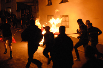 Hatherleigh, is the setting of an ancient fire custom: every year in early November, they
roll barrels of flaming tar down the long, steep main street of the village, and onto a bonfire in the
square at the bottom of the hill.
 -
The Tarka trail
 The Tarka trail was named after the famous novel; Tarka the Otter: His Joyful Water-Life and Death
in the Country of the Two Rivers by Henry Williamson, first published in 1927 with an introduction by
the Hon. Sir John Fortescue. It won the Hawthornden Prize in 1928 and remains Willamson's best-known and
most popular work, having never been out of print since first publication.
 -
Bideford
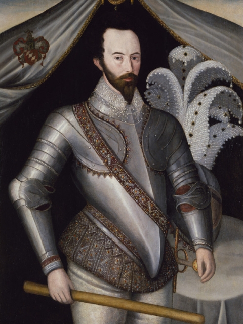 By the 16th century Bideford had become Britain's third largest port. Sir Walter Raleigh landed his
first shipment of tobacco here, although, contrary to popular belief, he was not the first to import
tobacco to England. There were two prominent shipbuilders in Bideford; George Crocker and Richard Chapman,
they built a large amount of ships including HMS Acorn an 18-gun sloop launched in 1807.

 Powderham Castle is located in a unique, picturesque setting beside the Exe estuary. Six hundred years of
history are contained within the walls of one of England's oldest family homes. Sir Philip Courtenay began
building it in 1391 and it has remained in the same family to this day, currently home to the 18th Earl &
Countess of Devon.
 The original line had Brunel’s broad gauge of seven foot and one quarter inches, so to accommodate
L.S.W.R trains a third rail had to be introduced. To complicate matters, at Lee Moor Crossing, the
Lee Moor Tramway had a four foot six inch gauge, this crossed the railway line and so gave rise to a
very rare three gauge crossing. The remains of this crossing can still be seen at the Plym Valley
Railway today.
 There are supposed to five separate ghosts in the Shaugh Tunnel, but the one that sends a shudder through
me, is that of a bullish, broad man, accompanied by a big nasty looking dog. This man is supposed to be a
former foreman during the building works of the tunnel. He appears near the bend of the tunnel, and seems
to have a reputation to physically push people. There have been several reports of people being pushed, some
that hard they fell off their bikes. I did not find the tunnel oppressive and it’s a pity he didn’t push
us up the hill on the other side of the tunnel.
 One thing the murderer of railways didn’t like; was duplicate or alternative railway routes to the same
place, now over 50 years on Dr. Beeching must be turning in his grave. The main line through Dawlish took
a battering in early 2014, costing over 35 million pounds to repair, cutting off west Devon and Cornwall
for two months. During the repairs alternative routes were discussed, one such route was Okehampton to Plymouth
(via Tavistock). Now the route is being discussed again, with early plans to be submitted in 2016.
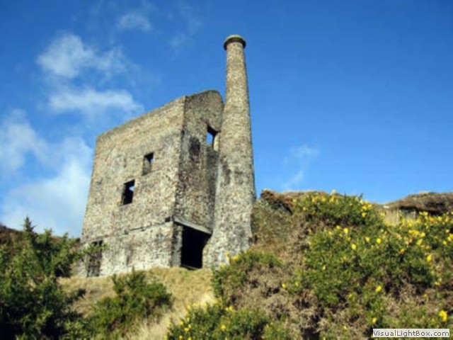
 The small village of Mary Tavy was once home to the world's largest copper and arsenic mines and there are
many old mines in the area around the village. On the main road out of the village, you can see an old mine
works building which once housed a beam engine.
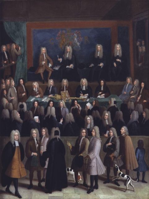
 The pretty village of Lydford is home to Lydford castle placed right next to the main road, built in
the 13th century, it later became a prison well known for its harsh punishment and cruel regime. During
the reign of Henry VIII it was described unflatteringly as "one of the most heinous, contagious and
detestable places within the realm."
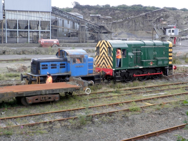
 There may be a piece of Meldon near you. Meldon Quarry’s granite stone was extensively used as rail
ballast. Rail Ballast is employed to underpin the rails and sleepers of railways for support. The quarry
was the main reason the line to Exeter didn’t fall under Beechings axe, but due to falling demand, the
quarry shut mid 2011.
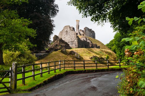
 Okehampton Castle is a medieval motte and bailey castle in. It was built between 1068 and 1086 by Baldwin
FitzGilbert following a revolt in Devon against Norman rule, and formed the centre of the Honour of
Okehampton, guarding a crossing point across the West Okement River. It continued in use as a fortification
until the late 13th century.
 Hatherleigh, is the setting of an ancient fire custom: every year in early November, they
roll barrels of flaming tar down the long, steep main street of the village, and onto a bonfire in the
square at the bottom of the hill.
 The Tarka trail was named after the famous novel; Tarka the Otter: His Joyful Water-Life and Death
in the Country of the Two Rivers by Henry Williamson, first published in 1927 with an introduction by
the Hon. Sir John Fortescue. It won the Hawthornden Prize in 1928 and remains Willamson's best-known and
most popular work, having never been out of print since first publication.
 By the 16th century Bideford had become Britain's third largest port. Sir Walter Raleigh landed his
first shipment of tobacco here, although, contrary to popular belief, he was not the first to import
tobacco to England. There were two prominent shipbuilders in Bideford; George Crocker and Richard Chapman,
they built a large amount of ships including HMS Acorn an 18-gun sloop launched in 1807.