West Wales coast to coast
A three day ride through Pembrokeshire, a beautiful overlooked part of Wales.
 What an incredible part of Wales this is, it has the tint of Cornwall, but without the hoards of tourists (though it can get busy in the school holidays). Small rocky coves accompany secluded picture-postcard sandy beaches. Not even the rain can dampen the spirits along the Pembroke coast, as surging Atlantic waves crash against the cliffs bringing in sea mists that engulf the coastline. The area has fond memories for me, every winter there was a huge one hundred and twenty mile (and some) training ride to Stackpole. The ride was ball breaking hard work, and like every training ride; it turns into race in the last quarter, but the evening was fun and I'm happy we're going back there. This time instead of chewing the handle-bars for most of the day, we will be sedately riding along some of the beautiful coastal footpaths, through rustic sleepy villages, exploring the precipitous mediaeval castles, Napoleonic forts and hidden WW2 history, there's so much to see and so little time to see it. It's an ambitious ride as we were still in the midst of winter, though the forthcoming weather did promise some sunny spells and milder temperatures for this time of year, so off we went.
Day 1- Arrival in Pembroke Dock (train + 5 miles)
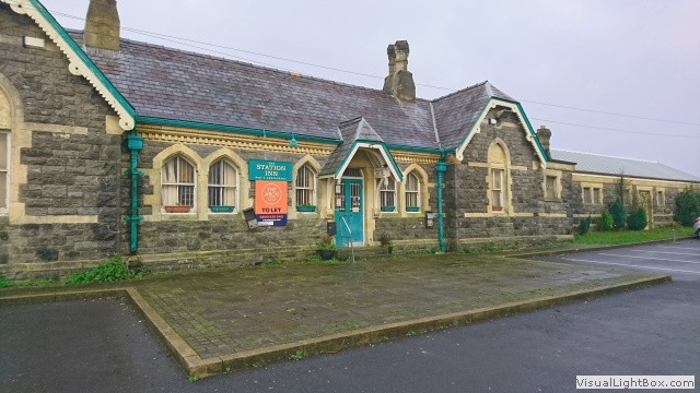 Pembroke Dock railway line opened in 1864 to serve the Royal Navy dockyard in the town, and until 1969, the line ran past the station across local streets and down to the actual dockside. Today, the mile long tracks to the dock have been removed and the main station building was converted into 'The Station Inn', but like many pubs after the pandemic- it's up for sale. We dropped the kit off at the hotel and came back out to explore the town. I headed for Hobbs Point (where warships were once fitted out) and after dipping the rear wheel into the Milford Haven (a tradition when doing a coast to coast ride), we continued to explore the town.
We rode south up Meyrick Street with its mixture of Victorian and Georgian buildings, the street hosted an unbelievable number of Public Houses, now converted into flats and houses. The street is unusually wide and was specifically designed that way by the Admiralty in order to accommodate two horse-drawn wagons coming from the barracks to trot side by side. At the top of the hill turn right into Prospect Place/ Croft Terrace and follow Presely View through its normal pensioners bungalows to 'The Defensible Barracks'. This rare example of a Bastion fort overlooks Pembroke Dock, its imposing grey stone edifice has been a landmark of Pembroke ever since it was built 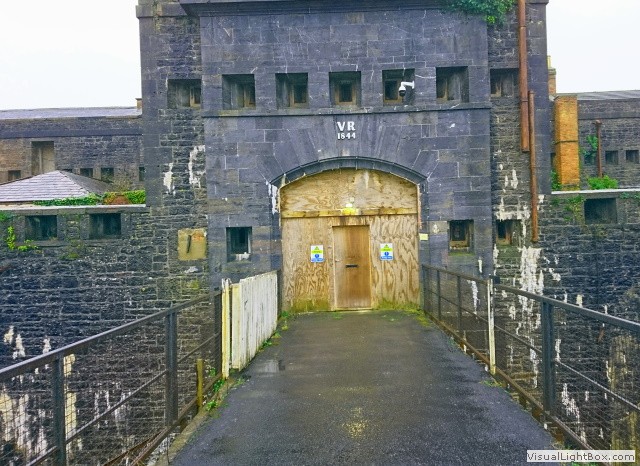 two centuries ago. We can only see the outside, but from research, the enclosed parade ground is one of the finest Georgian-style squares in Wales. Now, it's in a state of disrepair waiting for the new owner to rescue it. There's a little path west of the fort, take this and continue west on Victoria road/ St Patricks Hill/ Martello Road to West Martello Tower. Built in 1848, this was one of the last Martello Towers to be built in the United Kingdom. During the First World War it served as an observation post, and in the Second World War it was an Anti-Aircraft Battery.
To the right is the perimeter wall of the 'Royal Dockyard', we follow this east and turn left into Admiralty Way. Just stand there for a few seconds, we're at the gates of the Royal Pembroke Dock yard. Seventy years ago, we would not be permitted to just walk through, we'd be forced to stop by armed Royal Marine police. Today, no such restriction exists, all military bodies have long gone. On the left, is the house for the civilian Master of the yard, with the dockyard stables just around the back. This two hundred year old building was converted into a hotel (including the stables), but in 2006 the Grade II-listed Commodore Hotel was destroyed by fire, today its derelict. Ride on, the next building on the left is the former Captain Superintendent's Office, with the Guard  house next to it. Look right, you will see a massive building, this is one of two WW2 hangers that housed one of Britain's most discernible aircraft; the Sunderland Flying Boat. Head along Meyrick Owen Way, on the left is the iconic conning tower for the Sunderland's, it's now Pembroke Dock Heritage Centre. Head down Meyrick Owen Way and Front Street to see the North East Dockyard Tower. Intended to defend the Dockyard from landward and seaward attack, it accommodated thirty five men. The roof had the armament mounted on traversing platforms, which was removed in 1881. Pembroke Dock is a town teeming with history, too much to explore in one afternoon, so that's enough for me for today.
Day 2- Pembroke Circular (37 miles)
Head south out of Pembroke on Grove Hill Road/ Brockfield Lane, we're soon on a car free country roads. Continue heading south, the roads are relativity flat, and after two miles we can see the coast. Drop down into Cheriton and turn off the road just after St Elidyr medieval Church, the principal place of worship of the Cawdor family, and former owners of the huge Stackpole Estate which we
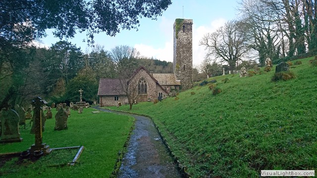 are now on. Here, the heavens opened in a biblical deluge, so we sheltered under the lychgate of St Elidyr for at least twenty minutes, though it seemed longer. When the rain abated, we rode along the now sodden woodland gravel track that goes through Cheriton Bottom. It's back on the road before crossing a bridge and onto a private road. The road goes through Lodge Park and comes out at the impressive estate stable block, next to stables is the estate dairy, which now houses a small exhibition on the history of the Stackpool (Cawdor) Estate. Stop for a coffee at Home Farm (still on the Cawdor estate), now the National Trust headquarters of the Stackpole Estate. This is where we stayed on those long winter training runs, in one of the many Trust bunkhouses and cottages.
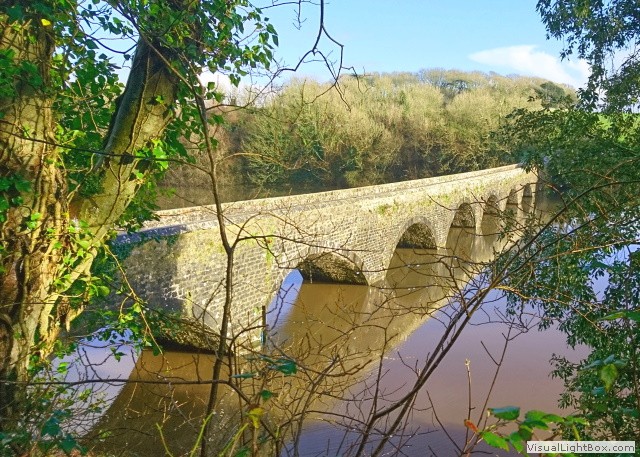 Now refreshed, follow a winding cobbled road down to the 'Eight Arch Bridge' built in 1797 to connect Stackpole Court to Stackpole Quay (Oh my word! How much money did these people have?). From here follow the footpath along the magnificent Bosherston Lily Ponds, cross over the ponds on a stone farm bridge heading south east. A narrow stretch of beach appears by the side of the stream, leading onto a beautiful expanse of golden Caribbean type sand, in the centre of the cove is Church Rock (so called because it resembles a submerged church at high tide). It's easier to walk along the waterline of Broadhaven Beach as this is the firmest sand. Sand dunes and bikes don't mix and neither does the steep steps we have to climb at the other end of the beach.
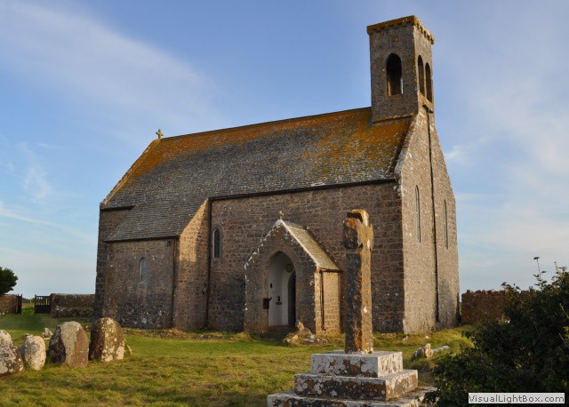
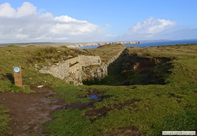 Continue on a gravel road heading towards the sea, through a couple of swing gates to Trevallen Downs Tank Range, yes a tank range! This one is WW2 and isn't used any more, but further along the coast is Castlemartin tank range and is very much active, when they're firing, we're barred from Trevallen tank range too. For access information goto .gov site (offical UK Govenment site), it will give clear dates and times when they're firing. Back to our ride; we take a little diversion south to St Govens Head, here is a rare and complete surviving example of a Second World War tank range. To move the targets, they were placed on a railway bogie that ran on subterranean railway tracks, possessing a blockhouse at either end of the railway. There was also a blockhouse related to a pop-up or swivel target adjacent to an RAF aerial bombing target. We now go back in time, sometime in the 13th or 14th century a small stone chapel was erected in a tiny gulley leading to the sea, now known as St Govans Chapel.
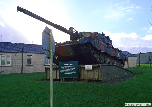
 Stick to the gravel road heading north west along the coastal cliffs. We have to turn north on Ermigate Lane now as Castlemartin tank range is a no go today. I could hear a drone somewhere, but couldn't see it, I suppose even out here someones watching. Have a peek at Filmston Chapel on the way, this abandoned medieval chapel sits in the middle of the Castlemartin Royal Armoured Corps firing range, have a look at some of the inscriptions. Head west on Merrion Cross past Castlemartin army camp, outside the camp are two tanks on show, one British and the other German. Continue to Castlemartin, From here the land to the west is all military, even on the other side of the road,
  there are loads of military hilltop observation towers, reminding me of Armagh in Northern Ireland during the troubles. Keep heading west on the B3419, Freshwater Bay opens up in front of us, what a beautiful sandy beach. There is a cafe here, but not open today. Rather than ride across the sand dunes, continue on the B3419, there's a little treat right by a War Memorial, follow a track leading to 'Gravel Bay anti-aircraft battery'. You will see remnants of a command post which lies in the centre of a clover-shaped arrangement of four octagonal gunpits each containing a holdfast (the gun mounting platform) surrounded by reinforced ammunition lockers and a blast wall. All four gunpits also contain two opposing shelters, one for gun maintenance (the limber gunner's shelter) and one for the gun detachment (the tearoom).
Continue on the B3419, then through a gate onto a farm track heading back towards the coastal path, we pass the eastern runway of one of the remotest wartime airfields in Britain; RAF Angle (it's just where the farm track splits). It opened in 1941 following Luftwaffe attacks on the oil installations at Pembroke Dock. There's not much to see today, but there's an incredible story all captured on film (click the image and watch it on YouTube). One of the WW2 Sunderland flying boats on Nazi German U-boat patrol sustained underbelly damage from enemy fire out in the Atlantic, normally this aircraft can only land on water, it was forced to land on the airfield, something that hadn't been done before.
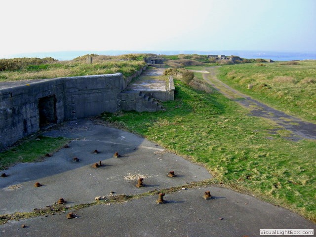 Head west, on the coastal path, I must admit some of these foot wide paths scared me a little. To the left was either a steep descent or a cliff, either way I walked besides the bike on occasions. If you can follow the path next to a fence, it's safer. We go around (what I presume) was a watchtower and there are a few styles to go through, but thankfully the fences were down next to them. When you can see Thorne island, and the East block house, look right there are some WW2 gun emplacements near Rat Island (it is on private land, but if you're quick, no-one will know you were there). Massive anti-aircraft batteries (some still with their fixing bolts still in place) and searchlight placements were built here on top of the cliff, the site includes a low level pill box near the waters edge, but I didn't go down that far so used a stock image.
The next short downhill section of coastal path is hemmed in by sharp hedgerows, it's steep and muddy, but it opens out to fields with great views. We can see Thorne island better now, the island is dominated by a coastal artillery fort built to defend the Milford Haven harbour in the mid-19th century. Head back to West Angle Beach for a cuppa in the Wavecrest Cafe. Next, we're off to Chapel Bay Fort and Museum, construction began in 1890, and was completed in 1891. Head back to the main road and through Angle village, we now skirt around Angle bay on a private road. It goes back onto the coastal path, through a few fields where you can clearly see the new Valero Refinery. Ride on the coastal path past the now defunct Angle Bay petro-chem site, and jump back 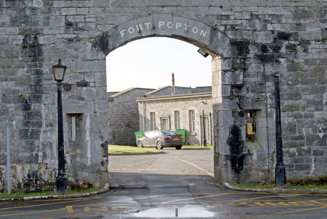 on the road just by the old control room. Head north, we're popping to see (no pun intended) Fort Popton. The fort was built in the Napoleonic era, to protect the naval dockyards at Pembroke Dock. The fort was bought in 1957 by British Petroleum, then closed to the public, it is now part of Valero's Angle Bay Refinery. I couldn't get good images of the fort and was tooted at a few times by a security car, I guess this area is highly sensitive with mammoth oil tankers a stones throw away.
Continue on the coastal path (it's a little overegrown here) under the oil terminal jetty, heading for Hundleton and onto Mill Back Road. A few miles from Pembroke the heavens opened again, we went from sunny/ overecast to having a bath. On that note, be careful you haven't timed this ride on a high spring tide as this road floods right by a big tap (a historical landmark-Why?). Continue heading towards Monkton and turn right into Church Terrace, here is Monkton Hall. The Old Hall retains a strongly medieval character and dates from 14c when it was probably a guest house of a small priory outside the walls of Pembroke. Leading onto Bridgend Terrace,
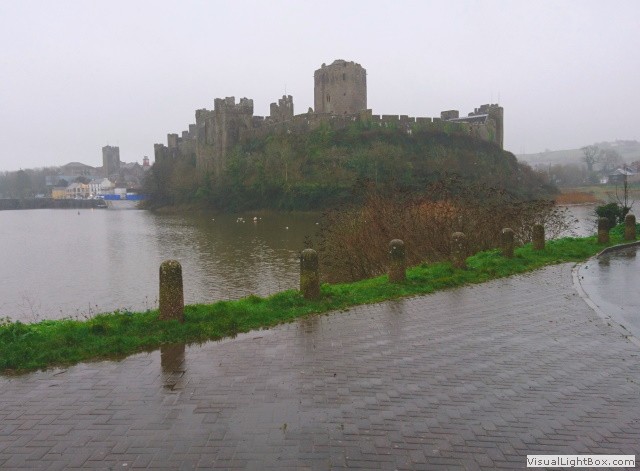 Pembroke Castle looms in front of us. Turn left just before the castle, on our right is Pembroke River, dammed by a dyke, cross over here, from this angle we have a great panoramic view of the castle. The castle was a ruin, and was virtually all restored in 1880 to give us this view today. Via 'The Grn' turn east into Woodbine Terrace, just along this road is Pembroke Workhouse. We can see very little from the main road, to see it at a better angle, go around the back. The first inmates moved in in late 1838, though the building was finally completed the following year. Now it's back to the hotel for a well earned pint.
Day 3- Pembroke to Tenby (7 miles)
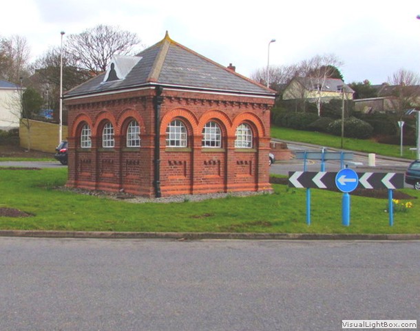 Today, we have a great line-up of things to see, this is an ancient land, but some of the things we will see today come from WW1 and WW2, the weather today promised sunny spells and heavy showers (the heavy part was right yesterday). On the way out of Pembroke there is a strange sight, in the middle of a roundabout, it's a Grade II listed late 19th century former pump house. Head out of Pembroke on the A477 and head north east at Star Cross towards Cosheston. Situated on an inlet of the Daugleddau estuary is Cosheston village where we turn right. From here, it's a bit tumpy, but it keeps us off the main road all the way to Milton, have a peak at Milton bridge, constructed in 1814. Then cross the main road into Stephen's Green Lane and left and into Paddock Lane just to have a peep at Milton Marsh pumping station.
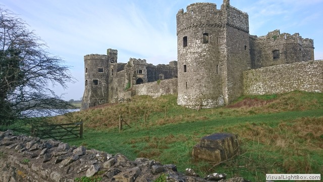 Go back to the main road and continue east, turning north to visit Carew Castle and Tidal Mill. In the late fifteenth century the Castle was improved to what we see today. The tidal mill probably dates from the early 19th century, and indeed one of the two Mill wheels carries the date 1801. It's the only restored tidal mill in Wales and one of just five in the UK. Though the Mill is no longer in operation, the machinery is still intact. It's coffee time, Carew Castle has a cafe, but it was shut, luckily, the local pub was open. The Carew Inn is not particularly old and is a mis-mash of buildings and add ons, but the log fire and hot coffee was welcome in the tiny bar. Recross the main road into Carew Cheriton, we ride past some Commonwealth graves resettled in an extension to the graveyard of St
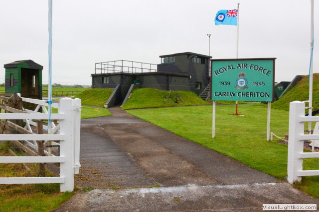 Mary's Carew. Head towards the Church past the School, opened in 1872, it remained in use until September 1940, when it was temporarily closed because of its proximity to Carew Cheriton Airfield. It was then used as a sick bay for airmen. Now for a WW2 treat, head south east to Carew Cheriton WW2 airport. Here is a unique World War II RAF control tower (Watch Office) and nearby air raid shelter; all refurbished by the community as a living memorial to those who served at Carew. Numerous squadrons were based at Carew guarding the Western Approaches. The airfield was also used in World War I by airships patrolling the Atlantic shipping lanes.
Head off east on the B4318 and turn right heading south, at a fork in the road we join the 4EV1 cycle route towards St Florence. At the centre of the village is a free-standing chimney, it was attached to a house in 1840, the house was demolished, but they left the chimney? Leave the village south east on a twisty leafy single lane past a small derelict building with a picnic bench in the middle (this is getting weird). Keep following this road to Kiln holiday Park where we pass the remains of two banks of six very large draw limekilns, set below the Northern edge of the Blackrock Limestone Quarry which they serviced to about 1860. Come out of the holiday park and follow a footpath into Tenby where we are staying tonight.
Day 4- Tenby (walking, train home)
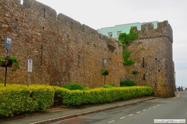 It's been a while since I came here on a stag night, as predicted I wasn't really here for the culture. Now arriving on a bike on a stormy January day, the driving rain didn't dampen my spirit. Tenby is a seaside resort, surrounded by an imposing medieval stone wall, leading to a pretty harbour lined with town-houses painted in various colours. The ruins of Tenby Castle are on a headland overlooking the harbour. Exhibits at Tenby Museum and Art Gallery include a 16th-century wrought-iron cannon.
Tenby's South Beach was identified as a potential landing site for glider-borne assault troops from Nazi forces, therefore an anti-aircraft gun was installed to protect the town from any potential invasion. Whilst Tenby avoided the damage that was inflicted upon other strategically significant locations within the region by Luftwaffe bombing raids - most notably Pembroke Dock - the beaches of Tenby were utilised as practice grounds for the allies ahead of the D-Day landings. The town is simply adorable, teeming with the archetypes of pubs and shops. Before heading for the station today, I dipped the front wheel in the cold water on Tenby's Castle beach. I couldn't believe there were surfers out in the water bobbing up and down in the dark probably glacial water. Then, I thought; I've been soaked to the skin (on occasions cold) and caked in mud over the last few days, who's the daftest? After all that was said and done, I was sorry to leave.
-
Gallery
 Why not have a look at the gallery relating to this ride. Click the image or the title.
 -
Hobbs Point Dockyard
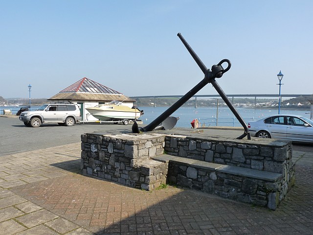 Pembroke Dock was the biggest Royal shipbuilding yard in Britain and two generations of battleships were built at the dockyard. Today, almost nothing remains of those former glories. The building slips have almost all disappeared beneath new developments. A few surviving Dockyard offices, priceless examples of the stonemason's art, are slowly crumbling- progress?
 -
The Defensible Barracks
 Built to house the Royal Marines defending the dockyard over two hundred years ago, it was recently declared one of the most
endangered buildings in the UK. It's planned to be transformed into residential apartments, a museum, a
cafe and even a wine bar. I'm okay with that- reuse it. Click the small image to see the parade ground.
 -
Pembroke Dock Heritage Centre
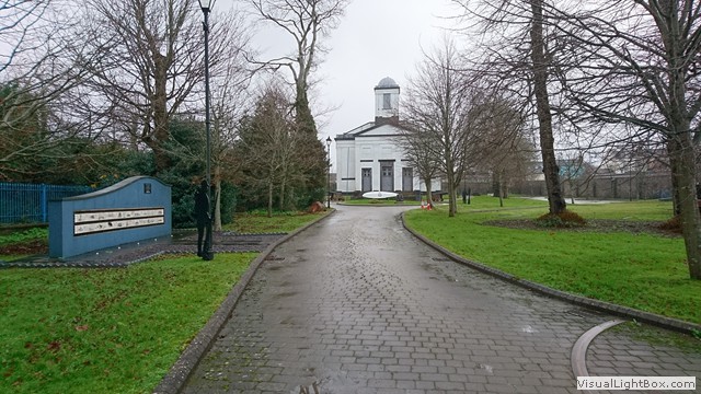 Once one of the RAF's longest serving aircraft stood outside this Heritage centre. In the seventies, the
Short Sunderland, an icon of Pembroke Dock was moved from Pembrokeshire to the Imperial War Museum
Duxford (a place I want to visit). Click the image to see that aircraft being dismantled.
 -
Cheriton Lodge a mystery
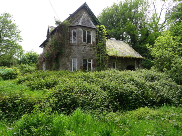 There is a derelict house on the lane near St Elidyr church. I spent a disproportionate amount of time researching Cheriton Lodge and came up with nothing. It's likely to be the rectory to St Elidyr Church, there is a sign outside the property 'this is private property and the house is not for sale'. For sure, someone knows the history? Intriguing?
 -
Stackpole Estate decline
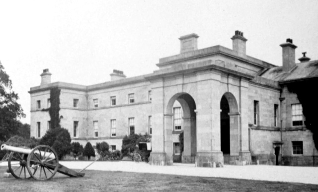 Two world wars heralded a century of decline at Stackpole. Half of the estate, around 6,000 acres, was requisitioned by the Ministry of Defence to form Castlemartin Range in 1938. Soldiers billeted in Stackpole Court caused devastating damage to the house by stripping lead from the roof, causing dry and wet rot. Sadly, the house was finally demolished in 1963. Thirteen years later, what was left of this historic estate was broken up and the farms were sold. Thankfully the coast, woods and lakes passed to the National Trust and were saved for the nation. (www.nationaltrust.org.uk). Click small image for bigger view.
 -
Trevallen Downs Aerial Target
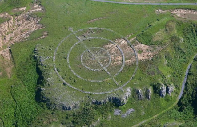 The RAF bombing target was built over the tank range impact zone, suggesting that it was constructed once the army tank range was disused.
 -
St Govan's chapel
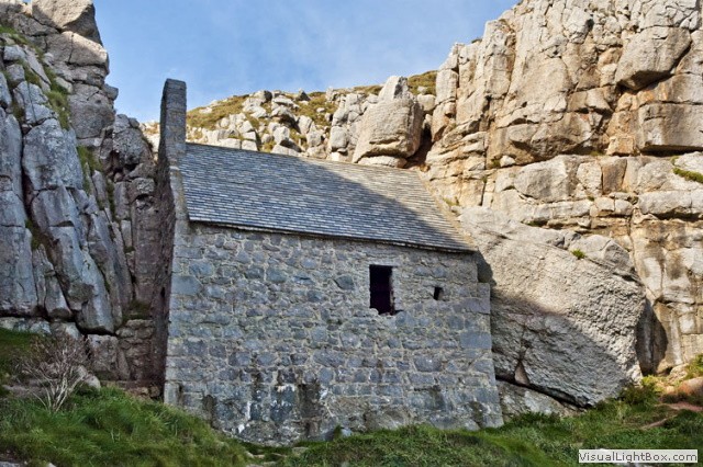 Allegedly, St Govan was walking along the Pembrokeshire coast, he was seen and pursued by a gang of bloodthirsty pirates. Miraculously as he was running away from these pirates, a cleft opened up in the cliff and he was able to tuck inside it and hide. St Govan decided to build St Govan's chapel where he was saved.
 -
Castlemartin Army Training Area
The Castlemartin Army Training Area was established in 1939 and covers 2,390 hectares of Pembrokeshire. The ranges are active for 44 weeks of the year and when in use can include a coastal exclusion zone of some twelve nautical miles of the coast, or as little as three nautical miles depending on weapons systems/ munitions being used. Click the image for a different view.
-
Angle Airfield
A succession of squadrons passed through Angle, flying Supermarine Spitfires, Westland Whirlwinds and Hawker Hurricanes on convoy protection duties and defensive patrols. For a short time in 1943 the airfield passed to the Royal Navy. Click the image for a larger view.
-
The East Blockhouse Battery
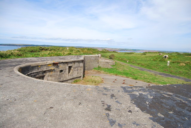 The East Blockhouse battery was constructed in the first years of the 20th century. During WW2 various large guns were mounted here until 1944. The battery was not used in anger but was used for practice. The battery's two six-inch guns were moved in 1941 to Lavernock battery, near Penarth. The East Blockhouse living quarters have been lovingly converted from a 1950s military building to provide spacious and contemporary dog friendly holiday homes. Click the small image for better a view.
 -
Chapel Bay Fort and Museum
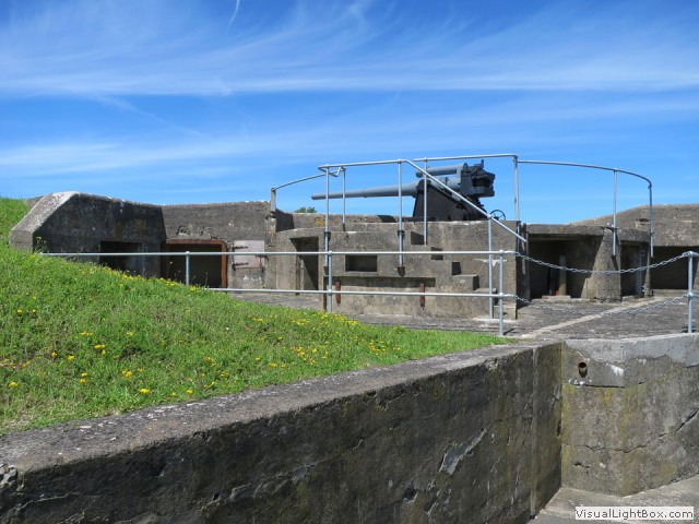 The battery was the first fortification in the area to be built of mass concrete. One of a series of forts built as part of the inner line of defence of the Haven following a Royal Commission. Originally it had three ten-inch rifled muzzle loading guns, but these were replaced in 1900 by three six-inch breech loading guns. Throughout the First World War the fort remained in military hands, but it was decommissioned in 1920.
 -
Quoits Corn Mill
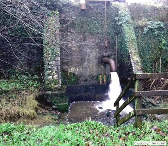 The Giant's tap is what it says and is fed from a pond above, it was the power for Quoits Corn Mill and there have been calls to turn it into hydro-power.
 -
Pembroke Workhouse
 The Union Workhouse on Woodbine road changed uses throughout its history, then the inmates included the elderly, sick, infirm, unmarried mothers, orphans, tramps and other vagrants, 'lunatics', and the able-bodied unemployed and their families. It became Woodbine House Hospital and in WW2 cared for soldiers. It also became a mental hospital and later a school, now derelict.
 -
Milton Marsh pumping station
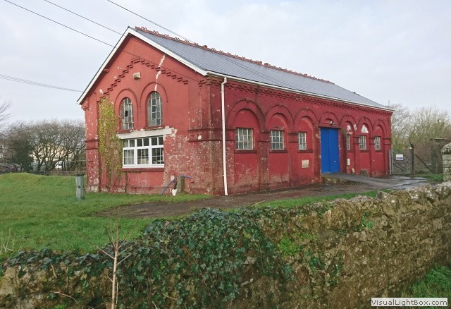 Milton Marsh pumping station is not listed, not that important any-more, it's just a pretty little post-industrial building with ornate touches, I would say built in the Edwardian period, but I can't be sure as there's no information on it.
 -
Carew Castle Ghosts
 There are thought to be several ghosts haunting Carew castle; a Celtic warrior is said to haunt the undercroft and a kitchen boy responsible for the clanking sounds of pots and pans heard coming from the kitchens.
 -
Addendum
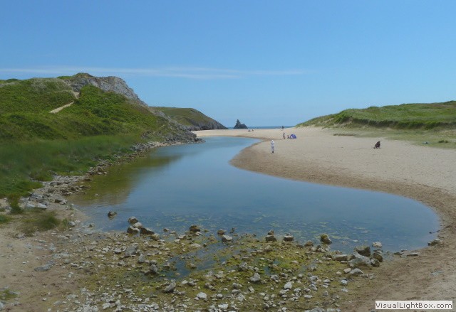 Rated by National Geographic magazine in 2010 as the second best coastline in the World. When I said it's like the Cornwall coastline, it is, and along with that comes the hills and craggy up and down coastal paths. The coastal paths are specifically for walkers, but I feel the speed I go is only slightly faster than an antique ambling shoggler (look it up). The routes need to be ridden on an MTB and be careful on the coastal paths especially in high winds. I love the history, but what I can't stand is the decimation of historic properties. There are so many buildings in need of love and of course money. Even grade listing these buildings doesn't protect them, sometimes it's a hindrance, restricting developers to the extent, the building refurbishment becomes untenable. If you want more information about Royal Navy Pembroke, visit Atlantikwall.
That said, this was a fantastic few days away, Pembrokeshire is so underrated, one of three National parks in Wales, it's crinkled coast offers endless opportunities to enjoy the outdoors. The coast has an intricate ribbon of weather-worn cliffs, dazzling beaches and secret coves, jewelled with rock pools, I'm definitely coming back. -
Download gpx route from this ride.
 Click the road icon on the right to go to download page, click the appropriate icon and start enjoying some fantastic journeys.
