Strange Times- Lydney dock to Mallards Pike (circular trip)
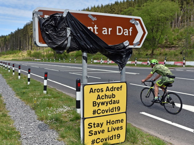 It's early spring and except for a small ride around Newport, I haven't been on the bike for four months. A combination of horrendous winter weather and a move to Lydney in the Forest of Dean taking all my time. Now with Covid-19 (have a look at our page) there's a new reason not venture out, but with the promise of a few days good weather, its time to take advantage of Borris's strict instructions of only going out to exercise. People have been fined for driving to beauty spots and then exercising, but since I now live in Lydney, this ride is from my doorstep and I feel the next government restriction is going to be 'marshal law' in a bid to halt this hideous mortiferous virus so it's crucial to get a few rides in. The World will recover, but will it ever be the same? I think not. This ride encounters three old railway companies based in the Forest of Dean. The whole route could be ridden in a day, but with many wrong turns on the first bit, the hours flew past, so I did the second leg of the trip on a mountain bike the next day.
Day 1- Lydney Dock (Step 1- 2 miles)
 From Lydney railway station I took the first right hand lane crossing the River Lyd onto the old Severn & Wye Junction railway heading towards Lydney dock. There was a pill box near to the old trackbed and although strategically placed was more likely to be used for reconnaissance than a defence post. The docks and harbour date from c1810 to 1821 and were the terminus for the Forest of Dean collieries where they transferred the coal to barges, but the approaches to Lydney were subject to very strong tidal streams and the area outside the harbour silts up and dries out at low water, so the dock had restrictions. Across the Severn you could just make out Sharpness Docks, to complete the story of the Severn railway bridge I will visit there another time. Crossing Lydney dock is the old mortuary building, little is known about this listed building. I found it was quite disappointing, no bigger than a large brick shed.
Day 1- Lydney Dock to Blakeney (Step 2- 7 miles)
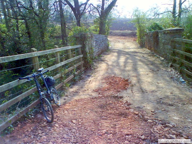 From here I trotted up some steps into a ploughed field and travelled north along the footpath, down a dip into a wooded area following the Naas cliff walk. After Naas Cliff farm the trail becomes a little more overgrown, cutting the legs with brambles protruding onto the path, but it's still ridable until I come out onto a ploughed field. Here we have to cross the main Chepstow to Gloucester railway line on a farmers bridge, I turned right on a newly formed farm track bearing fantastic views across the Severn to the decommissioned Berkeley Nuclear power station. Berkeley was the first commercial Nuclear power station in the United Kingdom to be decommissioned following its closure in 1989.
I had gone the wrong way and should've turned left after the bridge. I retraced my route and crossed another ploughed field to get to the Severn & Wye Junction railway trackbed, this was the line that led to the mammoth cast iron railway bridge that spanned the River Severn. The single trackbed was ridable and incredibly peaceful except for the singing birds (and I'll let them off). Then suddenly, I don't know who startled who first, two deer ran across my path and then nonchalantly looked back at me. The path was crossed by a few single wire electric
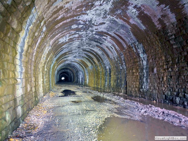 cattle fences which I easily and safely passed underneath, meant for cattle, but they'd still give a human a good belt if you touched them (so I'm told). The route became a stream, on this occasion, it was most firmest riding through the water. Then the Severn bridge railway tunnel appeared (not to be confused with the 'Severn railway tunnel' which is at Sudbrook). This 506-yard tunnel formed part of the western approach route to the Severn rail bridge. The tunnel was easy to ride through, out the other side the trackbed was eventually (and deliberately) barricaded by sleepers, and chicken wire, entwined by bracken and brambles, but it led onto a farm track. Immediately, the Severn bridge station ramp appears and though blocked by a gate which was tied with string, so easily circumnavigated. There's not much left of the station, the buildings were only ever wooden, so have long rotted away, the platforms have decayed and succumb to vandalism, and have many years of overgrowth. For me, there is a strange beauty about seeing something made by man slowly, but inexorably destroyed by the ravages of time.
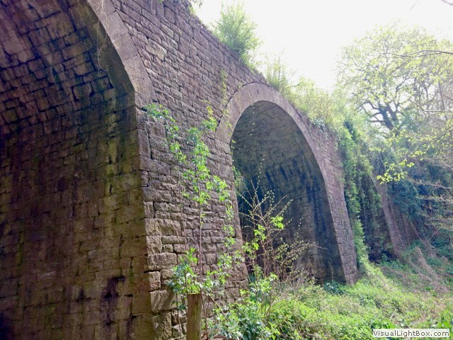 Just down from the station is the small hamlet of Purton where there was an Inn, it was here well before the Severn railway bridge. The Inn was built to support Purton ferry crossing, now the Inn is a private residence. Continuing on and heading for Blakeney we pass under Purton viaduct, prematurely built around 1832 for the proposed 'Purton Steam Carriage Road' from Purton Pill to a new colliery at Foxes Bridge. The necessary act of Parliament to allow the line was never granted, so the brand new infrastructure ended up a 'white elephant'. Now heading for 'Awre' (and just to do the anorak bit) to see a derelict single box. Here the 'Forest of Dean Central Railway' (a freight only line) joined the main Gloucester line. Retracing my steps, I jumped on this truly lost railway at a bridge abutment and rode into Blakeney. Ordinarily, you could have a coffee here in this pretty little village, but under the current restrictions, I sat on a wall, had a swig from my bottle, looked at my watch and decided to ride back to Lydney on the main road.
Day 2- Blakeney to Mallards Pike lake to Lydney (12 miles)
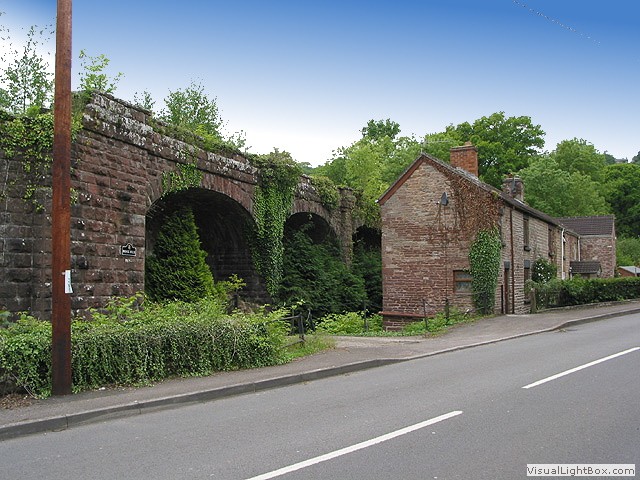 This time I'm back on the mountain bike, starting from the Royal Legion where the FDCR crossed the road on a bridge. Turning into New Road and on the junction of Clarks Lane is the beginning of a 10-span viaduct which used to cross New Road and continue another one hundred yards. Its downfall was its height, it was too low for modern lorries to pass under, so like many of the bridges on the line the viaduct across the road was doomed for destruction. Left just along Furnace Lane is a steep bridge crossing the line, but the trackbed wasn't ridable at this stage. Continue climbing up New Road (which was at this time behind road closed signs due to subsidence, though there was pedestrian access) the FDCR proceeds down to the left and at some stage I feel it must go into a tunnel, but it doesn't and crosses under the road just after Blakeney Hill Road. This line was steep and the engine would have really been chuffing here. A little way on to the right is an odd curiosity, its circular stone built pit, it can be anything from a capped mineshaft to a charcoal burning pit, but I can't find any history about it.
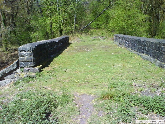 I actually join the railway trackbed just before Wenchford picnic area and continue to Blackpool bridge, the only bridge left along this line and now listed. Beyond the bridge heading north the trackbed is clearly visible, but it is criss-crossed with felled trees. I decided it was ridable in sections and clambered across (or around) the horizontal trees. Shortly afterwards the track would've crossed the road on a bridge, I had to scrabble back down to the road. A little way on, the route began rising to my left, this where I rejoined the line. It was clear not many people had trampled this part of the trackbed, through a deep cutting (something which this line was famed for) and again I dropped back onto the road where the line would've crossed. The next opportunity to ride on the line was at Mallards Pike lake, now a picnic area but it once supplied water wheels that powered the mills and iron forges around the area. The line only continues for a short distance to Howbeach Colliery now absorbed by the forest, so I head south west to jump onto the mineral loop line, started in 1870 but delays in deciding upon a standard gauge held back progress.
The cycle trail would have you veer back to the lakes, but through a little gate to the right keeps you on the trackbed if only for a short while. I left the track just before it crossed Fancy road and continued towards the 'Rising Sun Inn' (a very good pub to stop off and have a nice drink-- perhaps on a different day when the crazy stops) with the line down a little way to the left. The pub is deceptively in the middle of nowhere, but there were a lot of thirsty miners here once with four 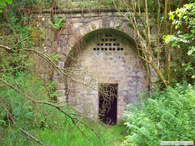 collieries within ½ a mile from the pub. Now, follow any sheep track to the left and you're on the trackbed again. I did intend to follow the line to Moseley tunnel, but with the natural debris, it was impossible or should I say impassable. I dragged the bike back up the steep embankment and tried another tack. Not long, and I could see the North portal to Moseley tunnel through the trees, I left the bike at the top and walked down, it did have an open doorway but I didn't venture in.
At the next 'T' junction, you have to cross Yorkley Road and can immediately see a tunnel vent. I began following a well trodden path to the south portal of the tunnel, I couldn't actually get down to the entrance because of new fences. Then it struck me, this tunnel is not very long at all, so why the vent halfway, considering Combe Down tunnel in Bath didn't have any vents 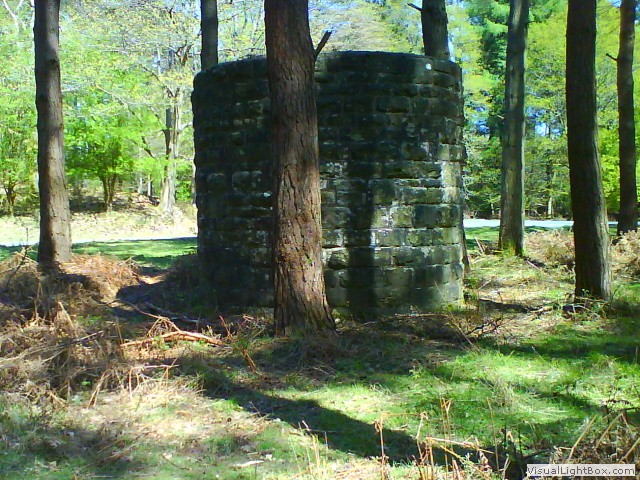 (contradicting my thought process, no vents in the Combe Down tunnel caused a massive accident, but that's another story). After a small stint on a forestry track, I managed to scamper back down to the mineral line trackbed. My trek on the old Mineral line ends at Charleswood road, Pillowell, but there's still a few miles to go back to Lydney. You can either join the main road at Whitecroft (or catch the train back to Lydney), or continue cycling off the road on forestry tracks. I choose the tracks and I'm glad I did, as no joke (or B*ll Sh***) two deer ran across my path again like the first day. I dropped down into Lydney and rode back past the boating lake dodging the geese shit, a great couple of days.
-
Gallery
 Why not have a look at the gallery relating to this ride. Click the image or the title.
 -
Pine End Works
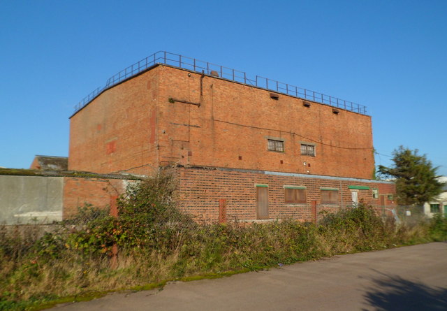 Across the Harbour Road is the former Pine End Works. The Works was established in 1940 to make plywood for aeroplanes and gliders. The 14 acre site appears to have been derelict now for several years. Click image to see an old photo.
 -
Berkeley boilers
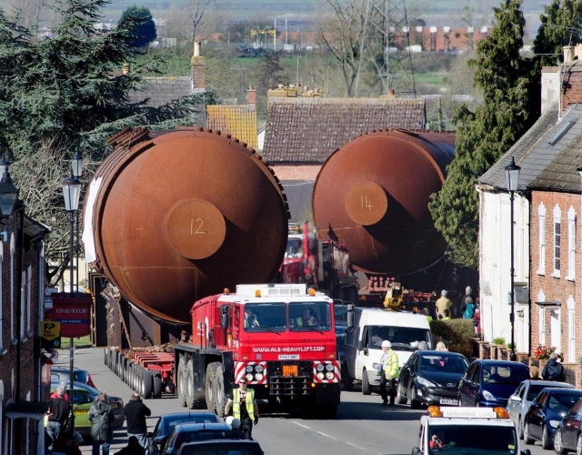 The 310 ton boilers from Berkeley Power station driven through Berkeley town in 2012, on their way to be smelted at Studsvik's specialist facility in Sweden. Click image for larger view.
 -
Roe deer of the forest Dean
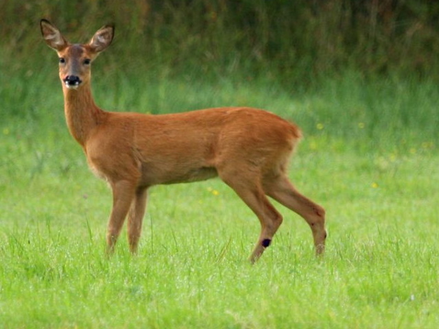 The Roe is one of the truly native deer of the British Isles. The deers coat vary in colour throughout the year, being most distinguishable in the summer when their coats are bright rusty red, in winter, their coats turn a dull, slate grey colour.
 -
Severn Bridge station
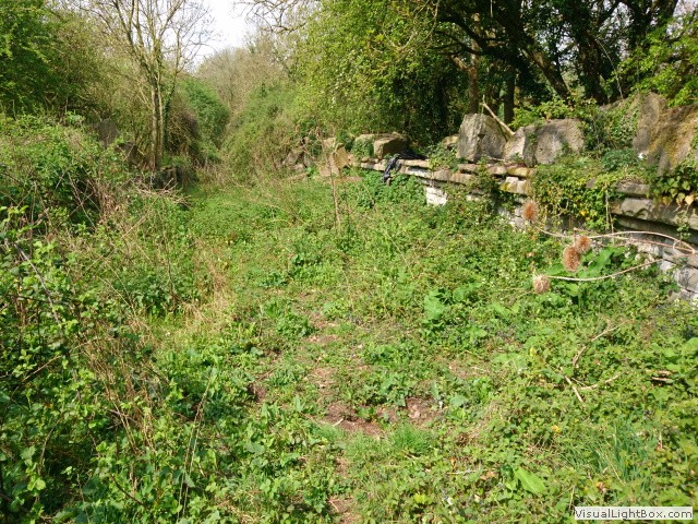 Severn Bridge station had a passing loop, small shelters on the two platforms and a signalbox. There was a short siding with a cattle pen at the end of the station nearer to the bridge, which closed in 1957. Click the image to see how it was.
 -
Awre signal box
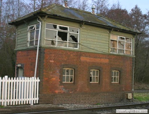 Built in the late 1800's, the box continued to be in use up to 1973, although it has considerably deteriorated Awre signal box still survives. It has now become a modellers framework to reproduce in miniature, you can actually buy the plans on line or Awre signal box as a pre-made model.
 -
Forest Dean Central Railway
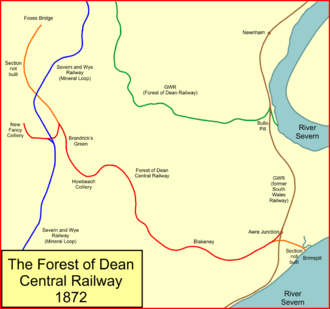 The southern end of the FDCR ran from Brims Pill on the Severn estuary, where a new dock was to be constructed to rival Lydney. It was never completed as the company ran out of money. It crossed the mainline at Awre and ran into the heart of the Forest of Dean to Howbeach Colliery (in the middle of nowhere). The colliery closed in 1895 owing to water problems, and began the decline of the FDCR, fifty years later the line fell into the annals of time.
 -
Blackpool bridge
 Blackpool brook followed the route of the FDCR and crossed it at Blackpool Bridge. The bridge is listed, but the only reference I can find why it's listed is a nearby Roman road.
 -
Addendum
 What's not to love about the Victorians? New Railways were spreading like a rash. The frenzy peaked around the mid 1800's, but it continued trickling the build of new lines well into the early 20th century. The Industrial Revolution was creating a new, increasingly affluent middle class and everybody wanted a piece of it. Though the investors didn't all make money some lost their shirt on their backs.
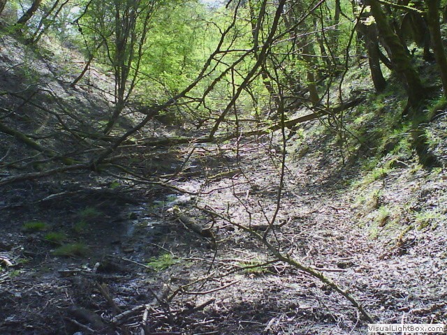 This ride we came across some magnificent structures and lines, where even a viaduct was built before they had in effect 'planning permission' and I rode (as much as I could) along a true lost railway route which began its decline after the first world war and closed all together after the second world war. Testament to the build quality, some of that infrastructure still remains. Riding old railway routes isn't every-ones cup of tea, indeed if you're not prepared to be ravaged by brambles, caked in smelly mud and go the wrong way a few times, it maybe not for you, but I loved it and cant wait for the next.
 -
Download gpx route from this ride.
 Click the road icon on the right to go to download page, click the appropriate icon and start enjoying some fantastic journeys.
