Buxton to Whaley Bridge and back to Buxton (26 miles)
 In the mid-summer of 2015, I travelled south east along the ‘High Peaks trail’ in the
Pennines. I stopped off at ‘Middleton top’ visitor centre for a well earned coffee break
in the café. There, I watched a video about the Cromford and High Peaks railway (C&HPR),
I was astounded to find out the original line approached Harpur Hill (the start of the High Peaks trail) from
a totally different route, almost bypassing Buxton. The steepness of the land presented big
problems for the railway engineers of the time, and towed inclines were a solution to
the precipitous topography, but they were incredibly dangerous and inefficient taking
a long time to travel the 33 miles to Cromford. There are five towed inclined planes on the C&HPR, but
I’m only interested in the two inclines between between Buxton and Whaley Bridge; the Bunsall
Incline and the Shallcross incline. This part of the line was
abandoned in 1892, when it was superseded by the construction of a flatter route to
Buxton. A lot of change would have happened to the land the railway line was on, but
I’m going to try and follow this old route and I don’t really know if
it’s achievable. It appears to be a long way to go just to gamble on riding 26 miles, but
I conceived this ride years before, and was just waiting for the right circumstances to cycle it. To make it
worthwhile two things needed to be in place; the weather had to be good (to go over a
mountain), and considering we were in the middle of a prolonged heat wave- it was
perfect. The accommodation had to be right; I bagged a 4☆ hotel- Bed, breakfast
and evening meals for two nights at just £110 with ‘Majestic coach holidays’ (self
drive) at the Palace Hotel.
In the mid-summer of 2015, I travelled south east along the ‘High Peaks trail’ in the
Pennines. I stopped off at ‘Middleton top’ visitor centre for a well earned coffee break
in the café. There, I watched a video about the Cromford and High Peaks railway (C&HPR),
I was astounded to find out the original line approached Harpur Hill (the start of the High Peaks trail) from
a totally different route, almost bypassing Buxton. The steepness of the land presented big
problems for the railway engineers of the time, and towed inclines were a solution to
the precipitous topography, but they were incredibly dangerous and inefficient taking
a long time to travel the 33 miles to Cromford. There are five towed inclined planes on the C&HPR, but
I’m only interested in the two inclines between between Buxton and Whaley Bridge; the Bunsall
Incline and the Shallcross incline. This part of the line was
abandoned in 1892, when it was superseded by the construction of a flatter route to
Buxton. A lot of change would have happened to the land the railway line was on, but
I’m going to try and follow this old route and I don’t really know if
it’s achievable. It appears to be a long way to go just to gamble on riding 26 miles, but
I conceived this ride years before, and was just waiting for the right circumstances to cycle it. To make it
worthwhile two things needed to be in place; the weather had to be good (to go over a
mountain), and considering we were in the middle of a prolonged heat wave- it was
perfect. The accommodation had to be right; I bagged a 4☆ hotel- Bed, breakfast
and evening meals for two nights at just £110 with ‘Majestic coach holidays’ (self
drive) at the Palace Hotel.
First leg- Buxton to Whaley Bridge (12 miles off road)
 I took the mountain bike out of the car and harrumphed at a rear wheel puncture, I must
have overinflated it at home. So it was down to the nearest
cycle shop for a spare tube, when I left the town the sky was clear and 26°C. Buxton is surrounded
by mountains and anyway you leave the town is up hill. Climbing out of Buxton on Harpur hill on the NCR68, I turned
off at ‘Hillhead Lane’ towards Hillhead quarry, here an old branch line joins the old the C&HPR.
Soon after joining the old railway route, it sweeps around the derelict ‘Far hill quarry’ now a lake,
nicknamed the ‘Blue lagoon’, the blue colour is from caustic
chemicals in the stones beneath the water (so swimming is not advised). The track has
a good shale surface which abruptly comes to an end, followed by a short section which has
I took the mountain bike out of the car and harrumphed at a rear wheel puncture, I must
have overinflated it at home. So it was down to the nearest
cycle shop for a spare tube, when I left the town the sky was clear and 26°C. Buxton is surrounded
by mountains and anyway you leave the town is up hill. Climbing out of Buxton on Harpur hill on the NCR68, I turned
off at ‘Hillhead Lane’ towards Hillhead quarry, here an old branch line joins the old the C&HPR.
Soon after joining the old railway route, it sweeps around the derelict ‘Far hill quarry’ now a lake,
nicknamed the ‘Blue lagoon’, the blue colour is from caustic
chemicals in the stones beneath the water (so swimming is not advised). The track has
a good shale surface which abruptly comes to an end, followed by a short section which has
 been rutted by off road motorcycles. We cross the road and back onto the old line. Suddenly there’s a
distressing sign under a bridge; "When the red flag is flying, you may hear explosions". We are
passing the ‘Health & Safety Executive’ laboratories, where they forensically test
everything from terrorist attacks to industrial accidents. Now it's tarmac and as with many old railway lines; the
route is absorbed by a road. The road swings right on the embankment made for the line, to the
left are many strange structures resembling the old nuclear flasks used on railways to transport
nuclear waste, but these are massive. There’s also a small railway constructed with old London
Underground Jubilee Line rolling stock, these were used to reconstruct the 7/7 London Tube
bombings.
been rutted by off road motorcycles. We cross the road and back onto the old line. Suddenly there’s a
distressing sign under a bridge; "When the red flag is flying, you may hear explosions". We are
passing the ‘Health & Safety Executive’ laboratories, where they forensically test
everything from terrorist attacks to industrial accidents. Now it's tarmac and as with many old railway lines; the
route is absorbed by a road. The road swings right on the embankment made for the line, to the
left are many strange structures resembling the old nuclear flasks used on railways to transport
nuclear waste, but these are massive. There’s also a small railway constructed with old London
Underground Jubilee Line rolling stock, these were used to reconstruct the 7/7 London Tube
bombings.
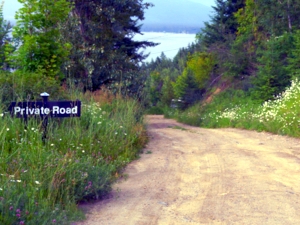
 In the opposite direction to which I’m travelling are several ‘Private
road’ signs, but there are none facing in my direction (but I suppose I can’t really use that
as an excuse).
Still on tarmac, I passed a crossroads and onto a small track, gradually curving for about a mile
until we pass a disused reservoir on the right; Stanley Moor reservoir was decommissioned some years
ago. It was built over a fault between limestone and gritstone, so it always leaked, and wasn’t the
most successful of reservoirs. At Ladmanlow I crossed the main A53 and surveyed a
gate next to Alleyn’s School field centre, it didn’t look private property, but I could see a gated
farm area ahead. This section was only 200 yards long before it was cut through by another road, so
was it easy to ride around. Heading west on the A54 to pick the route backup, my progress
was hampered again by private property signs, the frustrating part is I could see where
I wanted to go, and it was at most only a quarter of a mile long. I headed towards
In the opposite direction to which I’m travelling are several ‘Private
road’ signs, but there are none facing in my direction (but I suppose I can’t really use that
as an excuse).
Still on tarmac, I passed a crossroads and onto a small track, gradually curving for about a mile
until we pass a disused reservoir on the right; Stanley Moor reservoir was decommissioned some years
ago. It was built over a fault between limestone and gritstone, so it always leaked, and wasn’t the
most successful of reservoirs. At Ladmanlow I crossed the main A53 and surveyed a
gate next to Alleyn’s School field centre, it didn’t look private property, but I could see a gated
farm area ahead. This section was only 200 yards long before it was cut through by another road, so
was it easy to ride around. Heading west on the A54 to pick the route backup, my progress
was hampered again by private property signs, the frustrating part is I could see where
I wanted to go, and it was at most only a quarter of a mile long. I headed towards
 ‘Burbage’ and turned left onto the old Macclesfield Road, then up a massive hill to reach
the same point I could see earlier. A small bridge took the railway line under the old road, now filled in,
the line continued on a shale road towards Tunnel farm (I think this was a private road too). It’s about
a half a mile to the southern entrance to the Burbage tunnel, now sealed. I took heed of the strongly
worded warning notice sign and didn’t approach the farm. From here, I dropped downhill and headed
north up ‘Bishops Lane’ (again this has signs saying private road ‘no cycling’ but this is defiantly
a public right of way). We turned left through two stone posts and carried
the bike up steep steps through ‘Beet Wood’ and onto a footpath which
goes up over the mountain, this why I needed good weather as this bit would almost certainly be
boggy on a normal day. Some parts are ridable, but you have to be brave to ride down the hill
following a drystone wall to the Northern entrance of ‘Burbage Valley tunnel’.
‘Burbage’ and turned left onto the old Macclesfield Road, then up a massive hill to reach
the same point I could see earlier. A small bridge took the railway line under the old road, now filled in,
the line continued on a shale road towards Tunnel farm (I think this was a private road too). It’s about
a half a mile to the southern entrance to the Burbage tunnel, now sealed. I took heed of the strongly
worded warning notice sign and didn’t approach the farm. From here, I dropped downhill and headed
north up ‘Bishops Lane’ (again this has signs saying private road ‘no cycling’ but this is defiantly
a public right of way). We turned left through two stone posts and carried
the bike up steep steps through ‘Beet Wood’ and onto a footpath which
goes up over the mountain, this why I needed good weather as this bit would almost certainly be
boggy on a normal day. Some parts are ridable, but you have to be brave to ride down the hill
following a drystone wall to the Northern entrance of ‘Burbage Valley tunnel’.
 From the top of the mountain, the old C&HPR route is well trodden and easy to ride. The
views are simply incredible as the old railway track bed curves around the mountain clinging
to the contours as it gently descends. It takes me onto Goyts lane where there’s a small
lake created to fill the static steam engine used for towing the engines
up the Bunsall incline. The incline is now a road,
and I easily reached 40mph coasting downhill on the old railway line to reach the first of two reservoirs;
Errwood. I stopped just to take a photo of the larger lake’s dam, and it’s quite apparent
that we're in the midst of a heat wave as the reservoir level is very low. Then there’s another steep descent
to reach the bottom of the dam. The bumpy rough track bed now hugs the side of Fernilee reservoir
and on such a hot day the views of the shimmering lake are very inviting, with dogs shaking off the
excess water after going in for a dip. At the northern end of the reservoir, the railway
route goes down a ‘Private lane’ again and into a farm, but it’s just as easy
to ride on the road around this section and onto the A5004 for a short time before turning right into
Taxal view Lane. After a mile we turn onto Shallcross Incline, celebrated in the local news as a
sort of 'Cresta Run' after being resurfaced in 2011. Now, it's nothing more than a narrow path
dotted with horseshit.
From the top of the mountain, the old C&HPR route is well trodden and easy to ride. The
views are simply incredible as the old railway track bed curves around the mountain clinging
to the contours as it gently descends. It takes me onto Goyts lane where there’s a small
lake created to fill the static steam engine used for towing the engines
up the Bunsall incline. The incline is now a road,
and I easily reached 40mph coasting downhill on the old railway line to reach the first of two reservoirs;
Errwood. I stopped just to take a photo of the larger lake’s dam, and it’s quite apparent
that we're in the midst of a heat wave as the reservoir level is very low. Then there’s another steep descent
to reach the bottom of the dam. The bumpy rough track bed now hugs the side of Fernilee reservoir
and on such a hot day the views of the shimmering lake are very inviting, with dogs shaking off the
excess water after going in for a dip. At the northern end of the reservoir, the railway
route goes down a ‘Private lane’ again and into a farm, but it’s just as easy
to ride on the road around this section and onto the A5004 for a short time before turning right into
Taxal view Lane. After a mile we turn onto Shallcross Incline, celebrated in the local news as a
sort of 'Cresta Run' after being resurfaced in 2011. Now, it's nothing more than a narrow path
dotted with horseshit.
Second leg- Whaley Bridge to Buxton (14 miles)
 It’s under Chapel bridge (click the image and watch the train come out of the tunnel) and near the end of
the railway line, but not the end of my ride, now it's on the road
through ‘Whaley Bridge’ towards the canal basin. Here is an odd example of a transit
station where goods were transferred from the barges to rail and vice versa. The mill
owners in 'Cromford' wanted their canal to join with the ‘High Peaks canal’, but
this wasn’t feasible because of the steep terrain, so the C&HPR was born to join
the two. There's a certain irony to this story which happened when they found a better route for the railway,
making both canals and this section of the line redundant. The Peak forest canal continues north,
but we turn east and have a short ride along the canal path, over a narrow footbridge, to ‘Bugsworth
Basin’, where a pint of coke is in order at the ‘Navigation Inn’. Bugsworth Basin was once
the terminal for a horse-drawn tramway, connected to the local industries it carried
gritstone, limestone, and burnt lime to be loaded on the canal boats for onward carriage
to the North and the Midlands. It’s this ‘Peak forest Tramway Trail’ we
continue on, just after passing through a plastics company on a permissive trail, the tramway sleeper
stones are still in place. Not just one or two, but half a mile of them, making progress only possible
on a mountain bike.
It’s under Chapel bridge (click the image and watch the train come out of the tunnel) and near the end of
the railway line, but not the end of my ride, now it's on the road
through ‘Whaley Bridge’ towards the canal basin. Here is an odd example of a transit
station where goods were transferred from the barges to rail and vice versa. The mill
owners in 'Cromford' wanted their canal to join with the ‘High Peaks canal’, but
this wasn’t feasible because of the steep terrain, so the C&HPR was born to join
the two. There's a certain irony to this story which happened when they found a better route for the railway,
making both canals and this section of the line redundant. The Peak forest canal continues north,
but we turn east and have a short ride along the canal path, over a narrow footbridge, to ‘Bugsworth
Basin’, where a pint of coke is in order at the ‘Navigation Inn’. Bugsworth Basin was once
the terminal for a horse-drawn tramway, connected to the local industries it carried
gritstone, limestone, and burnt lime to be loaded on the canal boats for onward carriage
to the North and the Midlands. It’s this ‘Peak forest Tramway Trail’ we
continue on, just after passing through a plastics company on a permissive trail, the tramway sleeper
stones are still in place. Not just one or two, but half a mile of them, making progress only possible
on a mountain bike.
 Through another permissive path at Forge Mill, which has been changed its role several times
over the last century, now it's a packaging company and residential
properties. The trail goes across a well walked field and
under two towering viaducts which still carry a live railway at Chapel Milton. Sadly, from here
it’s on roads, up the high street of ‘Chapel-en-le-Frith’ (which was named after a small chapel,
built in 1225), then climbing up the ball breaking Ashbourne Lane and then Meadow Lane to ‘Doves
Holes’. The Peak forest Tramway would have terminated at the vast limestone quarries around Doves
Holes and I considered terminating my ride here too. Catching the train back to Buxton, but
the next train was in two hours time and it was only three miles to Buxton. My apprehension was about
continuing on the A6 road to Buxton, it's quite a narrow ‘A’ road strewn with heavy goods wagons making it very
dangerous to ride. My reprieve came from a narrow strip of foot path alongside the road, even with
this; the draft from the HGV’s made me wobble once or twice.
Through another permissive path at Forge Mill, which has been changed its role several times
over the last century, now it's a packaging company and residential
properties. The trail goes across a well walked field and
under two towering viaducts which still carry a live railway at Chapel Milton. Sadly, from here
it’s on roads, up the high street of ‘Chapel-en-le-Frith’ (which was named after a small chapel,
built in 1225), then climbing up the ball breaking Ashbourne Lane and then Meadow Lane to ‘Doves
Holes’. The Peak forest Tramway would have terminated at the vast limestone quarries around Doves
Holes and I considered terminating my ride here too. Catching the train back to Buxton, but
the next train was in two hours time and it was only three miles to Buxton. My apprehension was about
continuing on the A6 road to Buxton, it's quite a narrow ‘A’ road strewn with heavy goods wagons making it very
dangerous to ride. My reprieve came from a narrow strip of foot path alongside the road, even with
this; the draft from the HGV’s made me wobble once or twice.
 There were many ‘private road’ sectors or ‘private land’ sections, some I ignorantly rode along, and
some I didn’t cross respecting the landowner. I was unchallenged throughout the whole
route, but I can share the land owners concerns
especially with growing interest in the C&HPR. Other web sites report individuals and or
groups regularly showing up at tunnel farm and demanding access to the tunnel, I can imagine how
upsetting this is to the people working and living there. Many cycling routes are permissive, so arguing with
the landowners makes it difficult for Sustrans to negotiate a deal. If you’re going to do this ride; be
prepared to be challenged! That said, the well known sign; ‘trespassers will be prosecuted’ is not
strictly accurate, trespassing is not a criminal offence, and trespassers cannot usually be
prosecuted. Good job we're not
living in America where in some states the image on the left is true, though shooting the
survivor is likely to be tongue in cheek (hopefully).
There were many ‘private road’ sectors or ‘private land’ sections, some I ignorantly rode along, and
some I didn’t cross respecting the landowner. I was unchallenged throughout the whole
route, but I can share the land owners concerns
especially with growing interest in the C&HPR. Other web sites report individuals and or
groups regularly showing up at tunnel farm and demanding access to the tunnel, I can imagine how
upsetting this is to the people working and living there. Many cycling routes are permissive, so arguing with
the landowners makes it difficult for Sustrans to negotiate a deal. If you’re going to do this ride; be
prepared to be challenged! That said, the well known sign; ‘trespassers will be prosecuted’ is not
strictly accurate, trespassing is not a criminal offence, and trespassers cannot usually be
prosecuted. Good job we're not
living in America where in some states the image on the left is true, though shooting the
survivor is likely to be tongue in cheek (hopefully).
There are two extremely popular walking/ cycling routes emanating from Buxton; I think this could be the third. In 2010 there was an application put forward by John Grimshaw Associates to create a better route from Buxton to the Tissington and High Peaks trails using the existing road through the HSE site from Ladmanlow to Harpur Hill. I can't find out if this has progressed. I really do hope Sustrans pick up the ball, and I hope there can be some compromise with the landowners as some of the sections could easily be converted to walking/ cycling paths. The ride was really hard work (the hills again) and took me six hours (with stops), and as the day progressed it went overcast and I still burnt, but what a ride, OMG the views were just phenomenal, it was simply exhilarating, it took me two days to stop bouncing.
-
Gallery
 Why not have a look at the gallery relating to this ride. Click the image or the title.
 -
HSE’s Laboratory
 One of the least known secrets of Buxton is that it is home to HSE’s Laboratory. Founded
by Winston Churchill’s government to conduct research into coalmine explosions. HSE
laboratories were reportedly located in Buxton because, with quarrying already present in
the area, there was a low risk of explosive noise being associated with any coal mining
accident.
One of the least known secrets of Buxton is that it is home to HSE’s Laboratory. Founded
by Winston Churchill’s government to conduct research into coalmine explosions. HSE
laboratories were reportedly located in Buxton because, with quarrying already present in
the area, there was a low risk of explosive noise being associated with any coal mining
accident. -
Operation Smash Hit
 In July 1984 millions of people worldwide tuned in to watch a train crash on live TV. It was
a demonstration to show how safe the flasks used to carry nuclear waste by road and rail
were, by running a 239 ton train into a flask at 100mph. Once the dust and smoke cleared it
became obvious that the flask was completely intact.
In July 1984 millions of people worldwide tuned in to watch a train crash on live TV. It was
a demonstration to show how safe the flasks used to carry nuclear waste by road and rail
were, by running a 239 ton train into a flask at 100mph. Once the dust and smoke cleared it
became obvious that the flask was completely intact. -
Grinlow Tower (Click the image)
 The tower is a Victorian fortified hill marker 439 metres above sea-level (Click the image for a
better view). This tower was a favourite place to visit in the Victorian era and
continues to be a popular spot today. In the eighties, so many people were climbing the
spiral steps inside, it needed urgent repairs and was under threat of being demolished
by the very faction it overlooks; The Health & Safety boffins.
The tower is a Victorian fortified hill marker 439 metres above sea-level (Click the image for a
better view). This tower was a favourite place to visit in the Victorian era and
continues to be a popular spot today. In the eighties, so many people were climbing the
spiral steps inside, it needed urgent repairs and was under threat of being demolished
by the very faction it overlooks; The Health & Safety boffins. -
Did the RAF use Burbage tunnel?
 This part of the line closed early 1892 and Burbage tunnel and the inclines beyond Ladmanlow had
not seen a train for over a hundred years or was the line still used? It’s alleged the RAF at
Harpur Hill took over this tunnel after WW2 and used it to store surplus ordinance until
they could be disposed of safely, they stopped using the tunnel in the early 1960's. It is
unlikely they used this tunnel without the track being intact. Burbage tunnel is now bricked up at
both ends and carries a BT telephone cable through it.
This part of the line closed early 1892 and Burbage tunnel and the inclines beyond Ladmanlow had
not seen a train for over a hundred years or was the line still used? It’s alleged the RAF at
Harpur Hill took over this tunnel after WW2 and used it to store surplus ordinance until
they could be disposed of safely, they stopped using the tunnel in the early 1960's. It is
unlikely they used this tunnel without the track being intact. Burbage tunnel is now bricked up at
both ends and carries a BT telephone cable through it. -
Fernilee reservoir construction
 The first job would have been to set up housing for the navies, so a temporary village was
built for them to live in. Nothing remains of the huts today, but they would've most likely to have been
constructed on Long Hill not far from the dam. The villages were known as ‘Tin Towns’
because of the corrugated iron used in the building of the huts. Fernilee had a canteen with
an alcohol licence, to keep the men on site, so they were not roaming around the local pubs.
The first job would have been to set up housing for the navies, so a temporary village was
built for them to live in. Nothing remains of the huts today, but they would've most likely to have been
constructed on Long Hill not far from the dam. The villages were known as ‘Tin Towns’
because of the corrugated iron used in the building of the huts. Fernilee had a canteen with
an alcohol licence, to keep the men on site, so they were not roaming around the local pubs. -
Whaley Bridge Transhipment warehouse
 This warehouse provided a transhipment facility between the C&HPR and the Peak Forest
Canal. The centre arch spans the end of the canal, with railway wagons entering the building
through the two outer arches. The railway was built specifically as a connection between the
Peak Forest and Cromford canals, providing a canal-based link between the East Midlands and the
North West.
This warehouse provided a transhipment facility between the C&HPR and the Peak Forest
Canal. The centre arch spans the end of the canal, with railway wagons entering the building
through the two outer arches. The railway was built specifically as a connection between the
Peak Forest and Cromford canals, providing a canal-based link between the East Midlands and the
North West. -
The Peak Forest Tramway
 The Peak Forest Tramway was an early horse and gravity powered railway. Opened for trade on
1796, incredibly it remained in operation until the 1920’s. Its purpose was to carry limestone
from the vast quarries around Dove Holes down to Bugsworth Basin.
The Peak Forest Tramway was an early horse and gravity powered railway. Opened for trade on
1796, incredibly it remained in operation until the 1920’s. Its purpose was to carry limestone
from the vast quarries around Dove Holes down to Bugsworth Basin. -
Doves Holes award
 Despite its location in the beautiful High Peak countryside, a satirical Radio 5
survey put Doves Holes on the map for all the wrong reasons. Doves Holes was branded the
ugliest village in Britain in a National poll in 2002.
Despite its location in the beautiful High Peak countryside, a satirical Radio 5
survey put Doves Holes on the map for all the wrong reasons. Doves Holes was branded the
ugliest village in Britain in a National poll in 2002. -
Private or un-adopted roads
 There are apparently an estimated 4,000 miles of un-adopted roads in England and Wales, but
what is an un-adopted road? These private roads are thoroughfares where the Local
Authority doesn’t have an agreement to maintain them at public expense. Owning land doesn’t mean they can
prevent you using the route for lawful purposes; such as deliveries or entrée to open access
land (under the right to roam), but if you trespass on someone’s property- you may be asked to
leave (and that would be a reasonable request), and you must leave (and that would be a
reasonable action).
There are apparently an estimated 4,000 miles of un-adopted roads in England and Wales, but
what is an un-adopted road? These private roads are thoroughfares where the Local
Authority doesn’t have an agreement to maintain them at public expense. Owning land doesn’t mean they can
prevent you using the route for lawful purposes; such as deliveries or entrée to open access
land (under the right to roam), but if you trespass on someone’s property- you may be asked to
leave (and that would be a reasonable request), and you must leave (and that would be a
reasonable action).

 One of the least known secrets of Buxton is that it is home to HSE’s Laboratory. Founded
by Winston Churchill’s government to conduct research into coalmine explosions. HSE
laboratories were reportedly located in Buxton because, with quarrying already present in
the area, there was a low risk of explosive noise being associated with any coal mining
accident.
One of the least known secrets of Buxton is that it is home to HSE’s Laboratory. Founded
by Winston Churchill’s government to conduct research into coalmine explosions. HSE
laboratories were reportedly located in Buxton because, with quarrying already present in
the area, there was a low risk of explosive noise being associated with any coal mining
accident. In July 1984 millions of people worldwide tuned in to watch a train crash on live TV. It was
a demonstration to show how safe the flasks used to carry nuclear waste by road and rail
were, by running a 239 ton train into a flask at 100mph. Once the dust and smoke cleared it
became obvious that the flask was completely intact.
In July 1984 millions of people worldwide tuned in to watch a train crash on live TV. It was
a demonstration to show how safe the flasks used to carry nuclear waste by road and rail
were, by running a 239 ton train into a flask at 100mph. Once the dust and smoke cleared it
became obvious that the flask was completely intact.
 This part of the line closed early 1892 and Burbage tunnel and the inclines beyond Ladmanlow had
not seen a train for over a hundred years or was the line still used? It’s alleged the RAF at
Harpur Hill took over this tunnel after WW2 and used it to store surplus ordinance until
they could be disposed of safely, they stopped using the tunnel in the early 1960's. It is
unlikely they used this tunnel without the track being intact. Burbage tunnel is now bricked up at
both ends and carries a BT telephone cable through it.
This part of the line closed early 1892 and Burbage tunnel and the inclines beyond Ladmanlow had
not seen a train for over a hundred years or was the line still used? It’s alleged the RAF at
Harpur Hill took over this tunnel after WW2 and used it to store surplus ordinance until
they could be disposed of safely, they stopped using the tunnel in the early 1960's. It is
unlikely they used this tunnel without the track being intact. Burbage tunnel is now bricked up at
both ends and carries a BT telephone cable through it. The first job would have been to set up housing for the navies, so a temporary village was
built for them to live in. Nothing remains of the huts today, but they would've most likely to have been
constructed on Long Hill not far from the dam. The villages were known as ‘Tin Towns’
because of the corrugated iron used in the building of the huts. Fernilee had a canteen with
an alcohol licence, to keep the men on site, so they were not roaming around the local pubs.
The first job would have been to set up housing for the navies, so a temporary village was
built for them to live in. Nothing remains of the huts today, but they would've most likely to have been
constructed on Long Hill not far from the dam. The villages were known as ‘Tin Towns’
because of the corrugated iron used in the building of the huts. Fernilee had a canteen with
an alcohol licence, to keep the men on site, so they were not roaming around the local pubs.  This warehouse provided a transhipment facility between the C&HPR and the Peak Forest
Canal. The centre arch spans the end of the canal, with railway wagons entering the building
through the two outer arches. The railway was built specifically as a connection between the
Peak Forest and Cromford canals, providing a canal-based link between the East Midlands and the
North West.
This warehouse provided a transhipment facility between the C&HPR and the Peak Forest
Canal. The centre arch spans the end of the canal, with railway wagons entering the building
through the two outer arches. The railway was built specifically as a connection between the
Peak Forest and Cromford canals, providing a canal-based link between the East Midlands and the
North West.  The Peak Forest Tramway was an early horse and gravity powered railway. Opened for trade on
1796, incredibly it remained in operation until the 1920’s. Its purpose was to carry limestone
from the vast quarries around Dove Holes down to Bugsworth Basin.
The Peak Forest Tramway was an early horse and gravity powered railway. Opened for trade on
1796, incredibly it remained in operation until the 1920’s. Its purpose was to carry limestone
from the vast quarries around Dove Holes down to Bugsworth Basin. Despite its location in the beautiful High Peak countryside, a satirical Radio 5
survey put Doves Holes on the map for all the wrong reasons. Doves Holes was branded the
ugliest village in Britain in a National poll in 2002.
Despite its location in the beautiful High Peak countryside, a satirical Radio 5
survey put Doves Holes on the map for all the wrong reasons. Doves Holes was branded the
ugliest village in Britain in a National poll in 2002. There are apparently an estimated 4,000 miles of un-adopted roads in England and Wales, but
what is an un-adopted road? These private roads are thoroughfares where the Local
Authority doesn’t have an agreement to maintain them at public expense. Owning land doesn’t mean they can
prevent you using the route for lawful purposes; such as deliveries or entrée to open access
land (under the right to roam), but if you trespass on someone’s property- you may be asked to
leave (and that would be a reasonable request), and you must leave (and that would be a
reasonable action).
There are apparently an estimated 4,000 miles of un-adopted roads in England and Wales, but
what is an un-adopted road? These private roads are thoroughfares where the Local
Authority doesn’t have an agreement to maintain them at public expense. Owning land doesn’t mean they can
prevent you using the route for lawful purposes; such as deliveries or entrée to open access
land (under the right to roam), but if you trespass on someone’s property- you may be asked to
leave (and that would be a reasonable request), and you must leave (and that would be a
reasonable action).